What is the appropriate way to tag a oneway exit from a highway that leads to another highway classification?
I noticed that in the example below, the highlighted segment was changed to highway=secondary_link, but I thought it should be highway=unclassified (unclassified_link unfortunately does not exist).
This is a good scheme for real on-ramps at grade-separated interchanges.
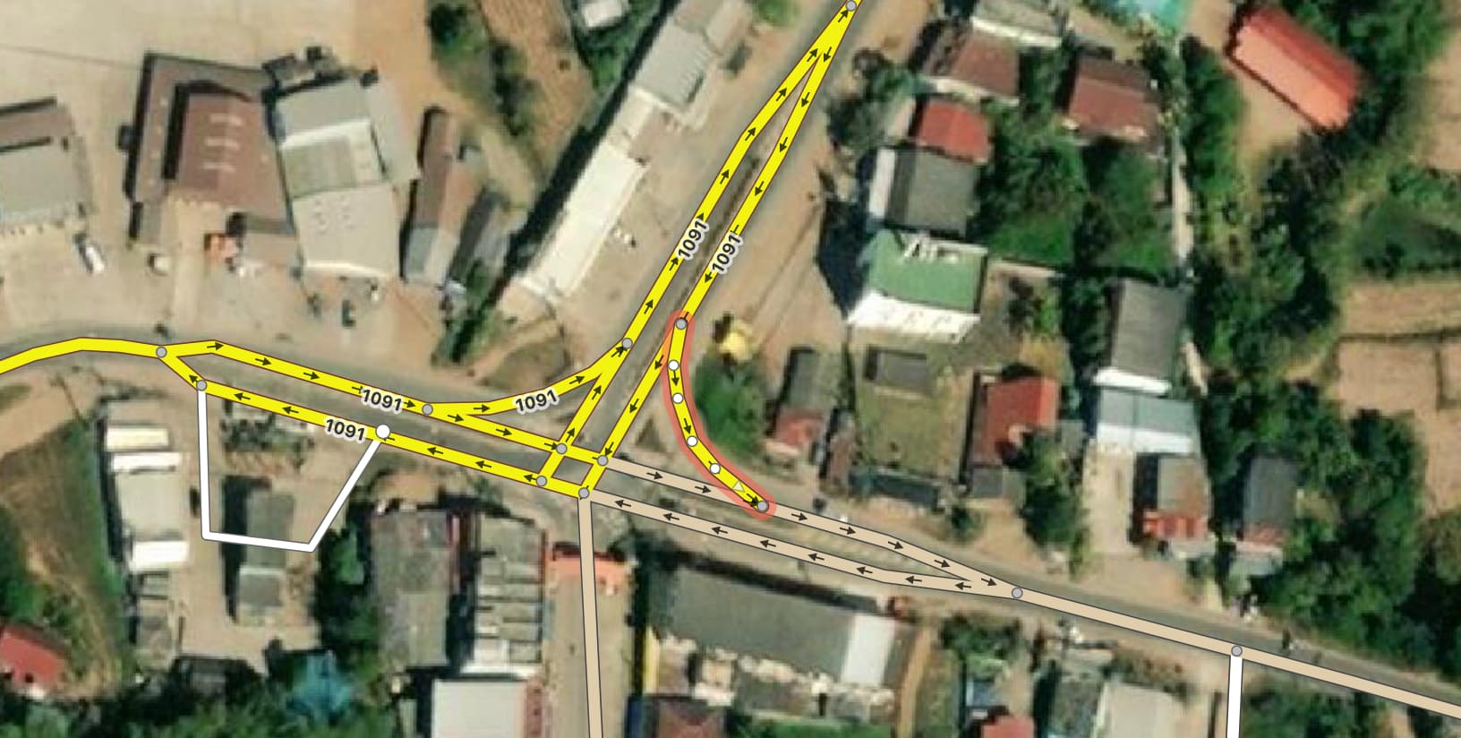
For at-grade intersections this is under discussion, especially for the most common type of _link cuts the corner at an intersection (triangular island).
we tag highway-classification by importance and a _link that connects roads of higher classification with roads of lower classification can only have the importance of the lower road classification. But note the exceptions for motorway and trunk!
The rendering corresponds more to the usual map appearance of printed maps. No map I know of, except OSM-based ones, renders such separated turn lanes in the higher road classification.
By the way, in traffic engineering parlance, this is called a slip lane or turn channel. The triangular island formed by it is called a pork chop island.
American maps traditionally render every link road as a faint line, which would mostly work around this issue. However, it can still be tricky to filter out link roads without creating discontinuities:
Because the higher-classification approach is so widespread nowadays, routers similarly can’t depend on the highway tag to characterize the link way as an on- or off-ramp versus a mere slip lane. This affects the assumed speed (in the absence of legal speed limits for ramps in some countries) as well as guidance instructions (“Take the ramp” versus “Turn right”). The ambiguity is especially pronounced around expressways. As a workaround, OSRM makes a sometimes inaccurate assumption based on the link way’s length, while Valhalla goes through the trouble of walking the routing graph.