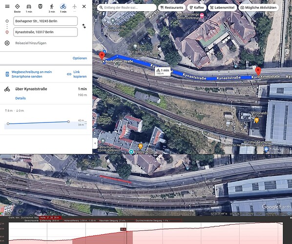
In my city (Berlin, Germany) there is a bridge across some railways (Kynastbrücke near Ostkreutz). For bicycling it is rather step, but not marked as such on any maps I could find.
Links to location and segments in comments.
- Using OSM Web routing with bicycle (GraphHopper) shows 4 meters downhill
- Using gpx.studio which showed it as 4 meters downhill
- Komoot showed it as 1 meter downhill.
Looking at Google Maps we can see a different picture which matches reality:
8 meters uphill.
Taking a more detailed look via Google Earth:
Here we can see the steepest part (highlighted) is nearly 10% slope. As the overall bridge elevation is around 6 meters.
I found that one can indicate that with [incline](https://wiki.openstreetmap.org/wiki/Key:incline) but that would probably not fix the hight profile of those apps, but might effect the routing positivly.
What options do I have to improve this?
