Hello,
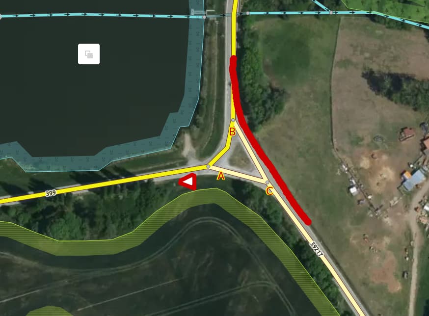
I have a problem with how to tag the give way sign in the following triangular intersection. The main road is the red line (partly road 399 then continuing as tertiary road 39217).
Is it sufficient to place the give way sign where it actually is and tag it with directions as described in the wiki here? Tag:highway=give_way - OpenStreetMap Wiki
Or should I do something more?
Because in reality, when you are coming from 399 from the way where the sign is and continuing the same road to the left, then you have to give way on the points A and B as well.
