How to map this observation platform?

Basically it’s an observation platform that you can access via some climbing. Should I tag it as a bridge=boardwalk?

I was thinking along the lines of the following tags:

area=yes
bridge=broadwalk
highway=footway
man_made=bridge
material=wood
surface=wood
tourism=viewpoint

But then again, isn’t boardwalk supposed to be a Line, not an Area?

Thanks


1 Like

I would mark that specific part of the way as:

highway=footway
bridge=broadwalk
material=wood
surface=wood

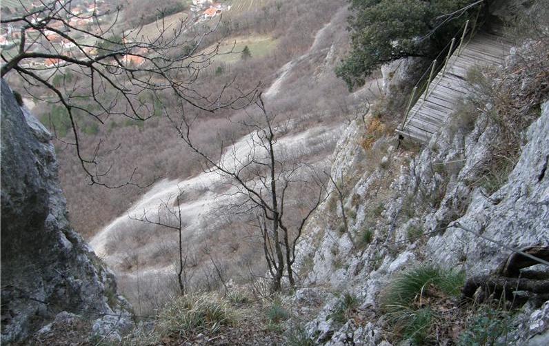
The rest of the ways on both sides of that bridge (i.e. leading to the bridge and from the bridge) seems to be highway=via_ferrata, if I’m seeing that cables/supports correctly, so I’d mark that accordingly.

Then I’d add a point on (or very near) that bridge as tourism=viewpoint, with supplemental tags as noted there (description / direction / ele / …)

(You can also add man_made=bridge and its associated tags if you really feel the need to mark the area occupied by it, but especially for such small structures I do not think it is very useful use of your time, unless you have important information to add in, e.g. bridge:support / bridge:structure / architect…)

3 Likes

In general I agree here with @Matija_Nalis

if you would really want, you could map area:highway=footway area (but usefulness of this kind of micromapping is dubious, especially in this case)

Thanks guys. I guess I’ll go with Matija’s suggestion.

2 Likes