Here the editor has painstakingly added many tags, alas not the vital one needed to get this massive antenna on the Map, as you see. What did he miss? Thanks.
For the avoidance of doubt, which map are you referring to?
I’m guessing you’re talking about the general purpose (and fairly slow moving) “OSM Carto” layer that can be seen via OSM.org. Have you tried asking them whether they think features such as this are a good fit for their map?
1 Like
Correct:
the Map, as you see.
I was thinking of using some of their existing framework.
Then it could be rendered in a jiffy.
I’ll leave any more complex proposals to people with aviation experience.
Maybe because beacon:type=VOR;DME has a semicolon. And it’s not VORTAC. This is not standard, but widely used. See taginfo on https://wiki.openstreetmap.org/wiki/Key:beacon:type
Otherwise the tagging seems sane.
VOR is rendered. Seems to be a renderer value resolution problem.
As a workaround you could map it as area/building/man-made antenna.
Even better the rendering should be fixed, and VORTAC added to the list after proper consultation in Tagging Mailinglist and Community Forum.
Just found out that man_made=beacon is currently not rendered at all on Carto style 
2 Likes
That’s why I asked the question that I did at the top of the thread ![]()
Essentially, everyone needs to stop expecting the “OSM Carto” style to show this sort of thing. It’s a bit like trying to teach your cat to make you a cup of tea - you can try as much as you like, and it might be a shame that it can’t do it, but you’d be wasting your time because it’s simply not within its nature to do that.
I don’t think that there are any styles available from osm.org that would show it, but there may be others hosted elsewhere. This style would, but that map only covers UK/IE. I’m sure that there are others though - someone must have done an “air/flight-focused” one.
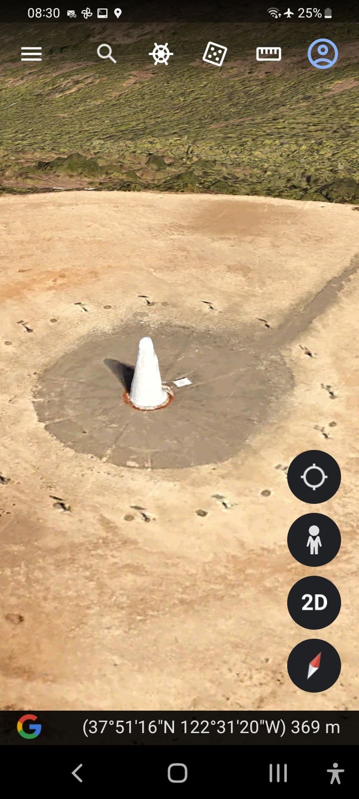
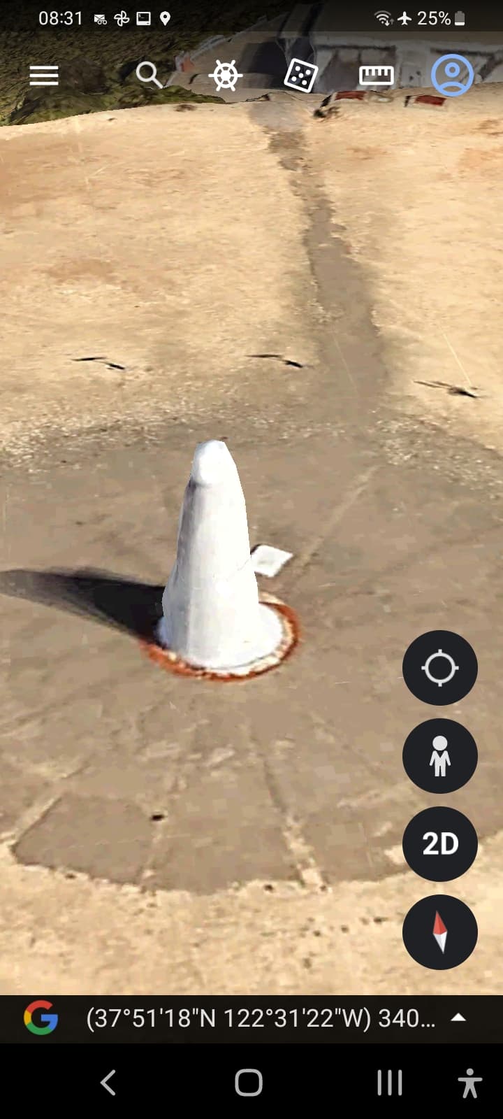
PS: The actual feature here is marked “airmark=beacon” and “man_made=antenna”. There are lots already mapped.
1 Like
Just in case you’re not aware, you didn’t link to a map. You linked to a feature on the https://www.openstreetmap.org website. There are 6 different maps available there - which map people will see when they click on your link will depend on which of those 6 maps they were looking at last.
Layer URL parameter - OpenStreetMap Wiki says they will get Mapnik if no parameter is given.

Well “Mapnik” hasn’t really been a tile layer since Barack Obama’s first term as president ![]()
It dates from when there were two tile layers, one using some software called “Mapnik” and dating from before 2012. In 2012 the “Standard” style on osm.org changed to use “OSM Carto” stylesheets that are much easier to edit - compare this with this.
I’ve changed the wiki page to reflect what actually happens - in a new browser page or new empty tab you’ll get the “Standard” style, but otherwise you’ll get whatever style you were last looking at.
3 Likes
There’s no letter to force Carto,
only letters to force the other styles?!
The letter M is used to force the default/carto style - the choice of letter is a hangover from when that layer was referred to as the mapnik style. It wasn’t changed when we renamed the style in order to avoid breaking existing links.
2 Likes
@SomeoneElse, Tom says ‘M’ still works. Perhaps you could note it on that wiki page. Thanks.
It’s a wiki - you could have a go at changing it yourself? Initially perhaps just change “No Suffix” to “No suffix or M”?
1 Like
Done! Thanks.
1 Like