So I am trying to convert this into simple vector file in Adobe Illustrator. However, when I export the map from website, the file itself is so big that my computer laggs. I tried to edit map in Illustrator on multiple computers but same result.
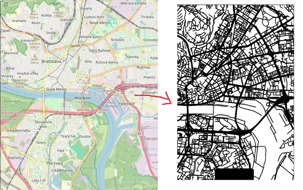
How would you guys go about getting this desired result? (Image on right was made by using Snazzy maps - but the the result is not so good and as there are many differences).
Or is there any software that would help me to extract roads for cars ONLY into vector file?
How would I do this - I would install a PostGIS database and Mapnik on my Linux machine and then modify the map style so that only the road network is shown. This would yield a much simpler map that would be easier to process, or maybe I could tweak the map style so that post-processing isn’t even needed.
Other options include using the (free-of-charge but not open-source) software “Maperitive” (see maperitive.net) which allows you to do something similar (modify map style, then export SVG) but it runs with ease on Windows or Mac, and has a dedicated Illustrator SVG output mode, or you could also load the shape file for the region (from download.geofabrik.de) into QGIS (free and open source) and style it there.
there are many solutions for your problem, one is creating an svg in QGIS via the layout → print dialogue, others would be rendering vectors with mapnik (or another rendering program). There are also services that render a map for you like maposmatic or others, have a look at the wiki, “osm on paper”. Generally, if the area is not too big, exporting as vectors from OSM (via the export tab) and using a suitable vector editing program, should also work.
Thank you all for a great insights and time you put in order to help me out. Really appreciate it!
I downloaded Maperitive but to me as a beginner it looks soo difficult. Is there any place where I could pay to someone who would teach me how to do it? I tried looking at youtube if there is some tutorial but nothing relevant to my need.
You see, I only want to leave the roads there and somehow style it so I can just work with SVG of it. You know, getting rid of all labels, markers, and other things such as land.
how big is the area that you want to cover? Do you want to do this one time, or repeatedly? If you are a beginner, installing and configuring postgis seems a bit overkill just to get a map, but if you are needing this frequently it would be suitable and fast.
(Please don’t ask the same question in several places without at least telling others you’ve cross-posted - it’s a waste of people’s time to answer a question that might already have been answered somewhere else.)