I’ve been trying to increase sidewalk mapping coverage in my city, and have noticed that in many cases there are pseudo-sidewalks (especially in bridges) that can technically work as sidewalks but are usually rather narrow, and not always connected to the sidewalks network. I believe that these (along with the footpaths inside tunnels) are meant for maintenance (and potentially emergency) access.
What is the proper way to map these? Wikipedia refers to this kind of infrastructure as “catwalks”, but I couldn’t find anything in the OSM wiki using this term. Taginfo shows a few instances of sidewalk=catwalk, footway=catwalk, and similar, but usage is very sparse.
Would something like highway=footway + footway=catwalk be an acceptable way to tag these ATYL-style? Or are there already existing tags that would fit this purpose better? Some examples of tags I dug up that have a bit more usage:
footway=service — but this this seems too generic and vague.
So my current inclination is to go with highway=footway + footway=service + usage=maintenance. Does that seem reasonable, or should we embrace footway=catwalk and document it explicitly? I confess that as a non-native speaker of English, the latter feels inadequate, but I guess with proper documentation it’s no more awkward than e.g. idiosyncrasies like the broad definition of “highway” that we use.
Are you referring to something like the footpath past this sign? Physically it’s still a sidewalk, even if it’s closed under normal circumstances. I’d use access restriction tags to set it off-limits.
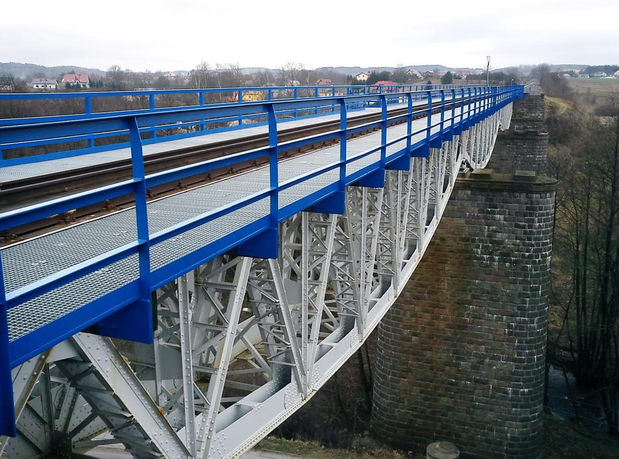
A catwalk can also refer to something like this, recalling a cat’s love of climbing:
But by referring to the sidewalk beside the roadway as a catwalk, you are communicating its narrow quality and service orientation:
“Catwalk” can refer to the actual parts of sidewalks closest to the roadway for accessing kerbside vehicles across verges, confusingly either in contrast or synonymous to “carriage-walk”. Another term is “landing steps”. https://www.chicago.gov/content/dam/city/depts/cdot/sdwlk/general/SCSP_FAQ_2014-05-19.pdf footway=service seems confusing in the end. The cover photo is a walkway next to a road, which may be seen as a =sidewalk independent of whether it’s inside a carpark. File:Walkway - geograph.org.uk - 509930.jpg - OpenStreetMap Wiki
Problem of footway= is conflicting with =sidewalk for sidewalks only used for maintenance or secondarily emergencies, as replied. So solutions other than footway= needs to be considered.
Thank you all for your insight and perspective. Yes, those examples roughly reflect what I had in mind (except paths climbing a bridge’s suspension cable ).
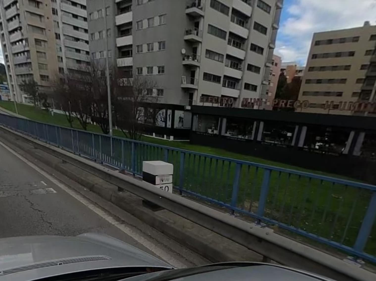
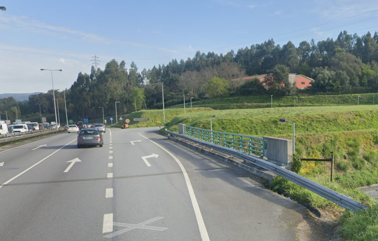
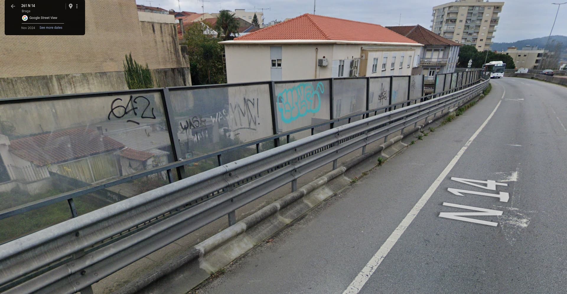
I guess I should have provided some concrete examples to help. My city is quite car-centric so there are such not-quite-sidewalks in many places. Sometimes it’s clear that access=no is adequate, like here for example:
(Notice those large white blocks, which occupy a sizeable chunk of the transition space, but don’t completely block it.)
I hesitate to tag these as access=no, but on the other hand they are very much not regular sidewalks; they seem to have been build like the inacessible ones above, and connected to the sidewalk network as kind of a workaround to provide real walkable paths. So I would not want to restrict their access, yet I think they should be identified as the service/maintenance paths that they were built as. I think tagging them as footway=sidewalk might be misleading.
I think they should be routable for pedestrians in the absence of alternatives (i.e. I’d rather not designate them as being exclusive to maintenance/emergency use), but without classifying them as sidewalks. That’s why I thought something generic like footway=service could work, with additional tags to clarify the meaning. (I suppose I’ll abandon the “catwalk” option, which I wasn’t much of a fan of to begin with, due to the potential for ambiguity — besides being a somewhat obscure term.)
I’d appreciate your tagging suggestions given this additional context!
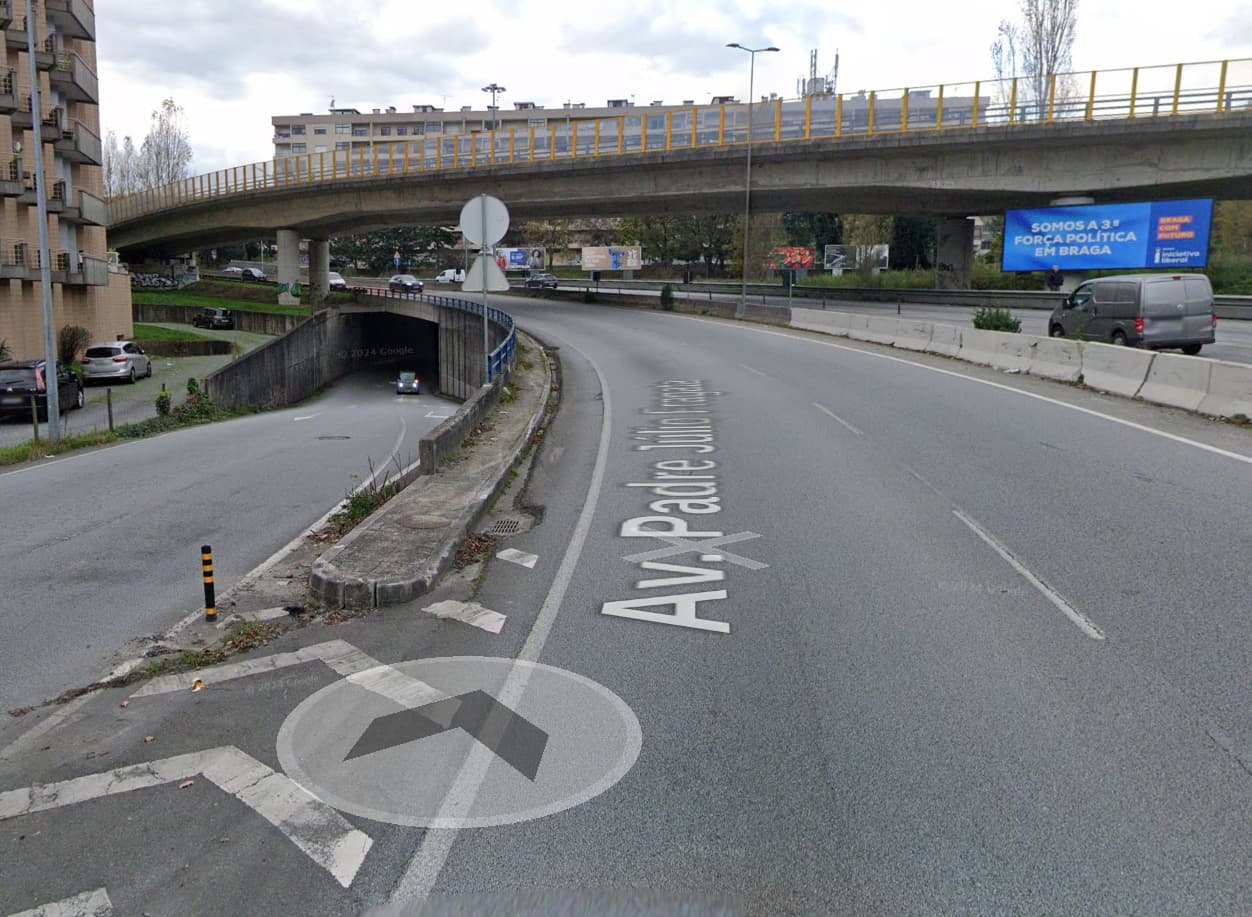
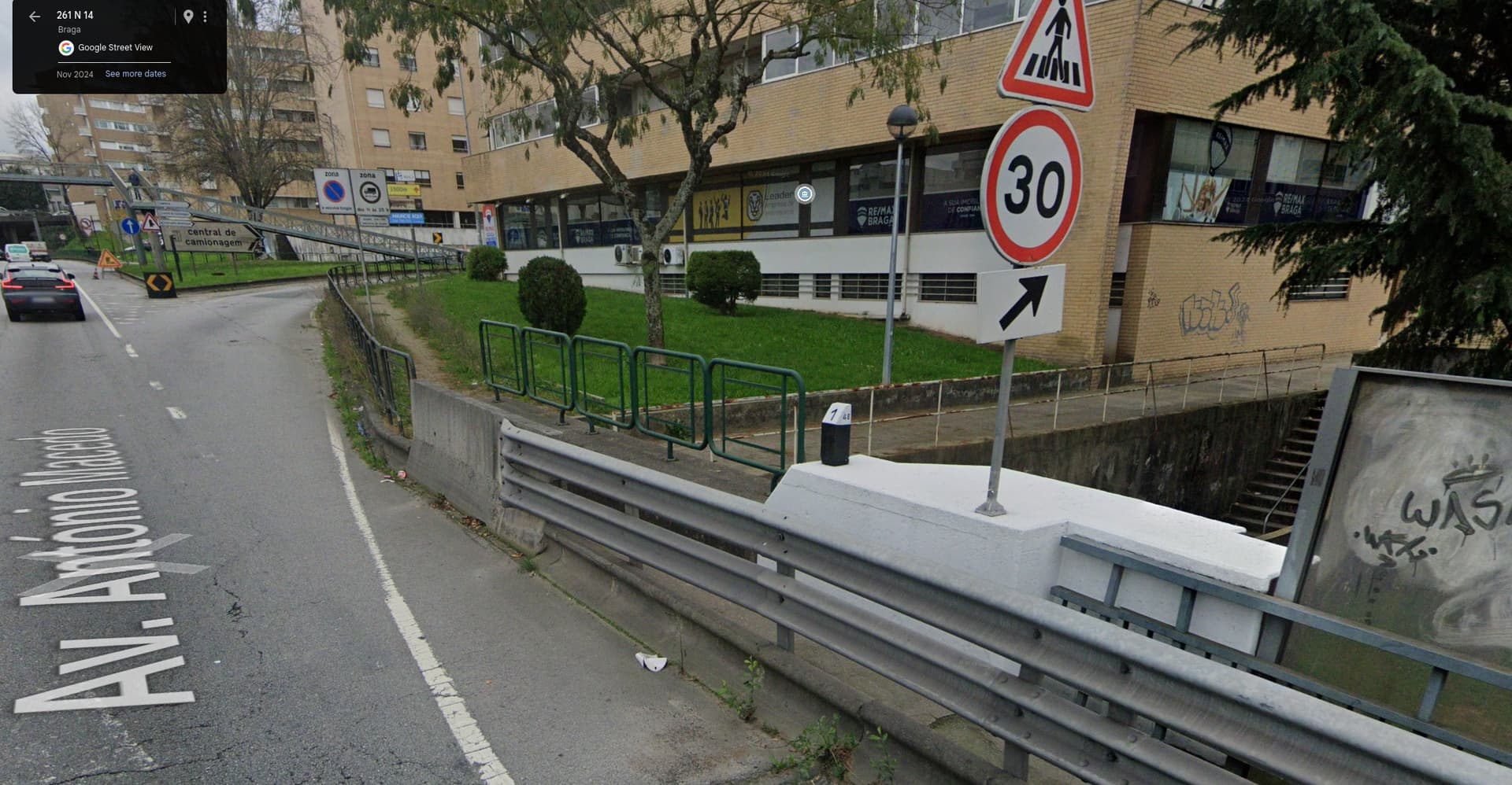
By the way, for comparison, here’s an additional location (in a different city) that gives off similar vibes, but is better integrated into the sidewalk network and thus I wouldn’t take issue if it was tagged with footway=sidewalk:
Some of these examples might not even qualify as pedestrian infrastructure. Sometimes a road has a raised traffic island in the median or a raised curb on the outer side; it may be purely for safety purposes, or to catch runoff in the gutter. Eventually, due to increasing safety standards, they may build a guardrail on top of that. In other cases, there might be a real sidewalk even if it has gotten cut off from the pedestrian network. Sometimes knowing the history of the road can give us some clues; otherwise, the best we can do is guess and add access=no or access=emergency in case we’re wrong.
generally, it is not our decision to restrict access, we just record the legal situation. If there are no signs (or other circumstances) that forbid the access to pedestrians, we will not tag the access as „no“, but there is the softer „discouraged“, which can be used if you really feel that a sign is missing
If the “footway” happens to be in a gray area where we aren’t even sure it’s a footway, an access=no doesn’t seem as far-fetched. The “other circumstances” might need to include some common sense.
That said, I’ve often mapped sidewalks just like the ones along the Lamar Boulevard Bridge, but without tagging access restrictions since there are no signs. There’s no risk of a router leading pedestrians astray, since the sidewalk doesn’t physically connect to any sidewalk before or after the bridge anyways. I just assume they built sidewalks into the bridge ahead of time in case the overall road would need sidewalks later on. It’s much more expensive to add sidewalks to a bridge after the fact.
it depends on the jurisdiction. If walking on the road is generally permitted, a sign is required. The other circumstances were referring to other law that could be applicable, e.g. nature protection (not in the concrete highway example).


