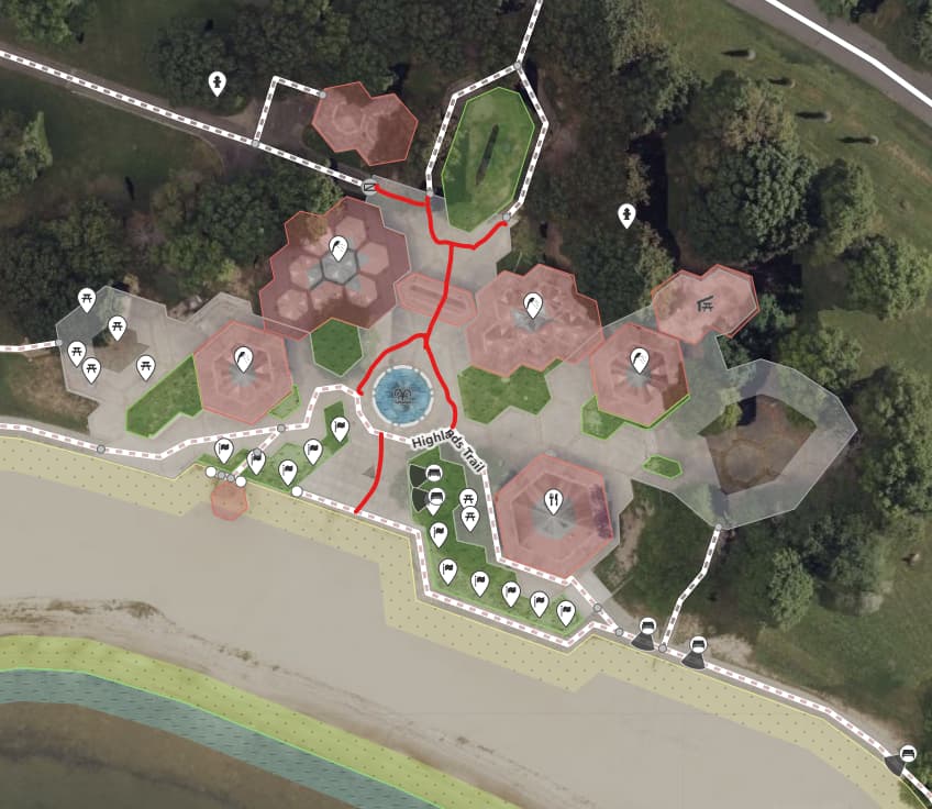
I started creating pathways and then I thought one big pedestrian area would be better? What would be the proper way to draw this area?
you may use both: the main paths for navigation purposes and the area for large scale visualization.
What would be the proper way to draw this area?
Based on aerial: area:highway=footway in addition to highway=footway lines.
Though lines would be sufficient.
(note, that this case seems borderline: still, this is rather bunch of footways than pedestrian square)
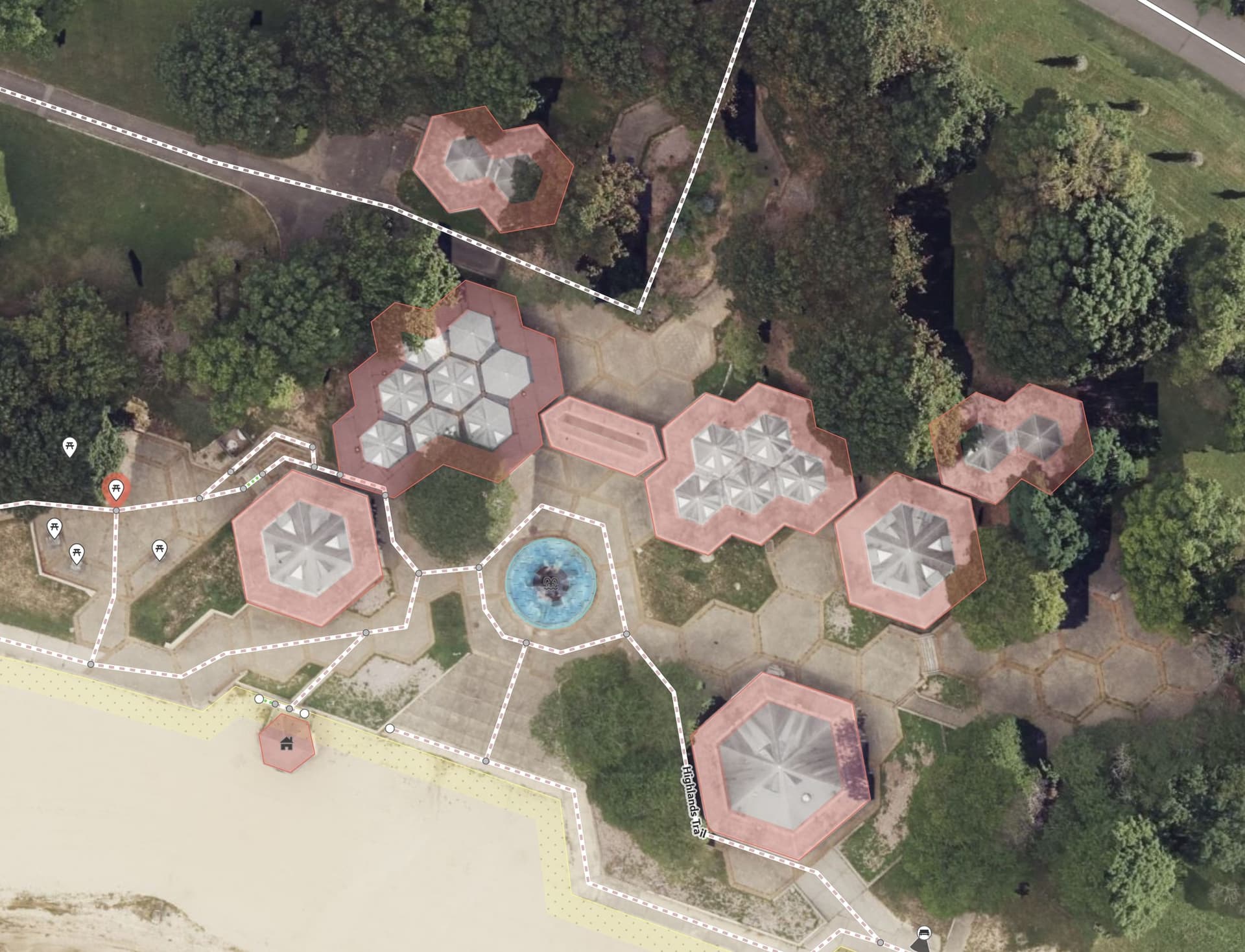
It is possible to draw the actual geometry of pedestrian/footway areas (especially if they are irregular) by simply adding an area: prefix to the highway tag added to these areas. In this case the result would be area:highway=pedestrian. Such areas are not used for routing, so the centerlines need to be drawn additionally to allow routers to calculate paths inside the area.
However, In cases like these, where there’s no standard/predefined paths across the area, it’s awkward to draw the entire network of possible paths, since that is simultaneously too dense and too sparse. In other words, with a network like what you have in the screenshot above, you would get awkward routes with unnatural, sharp turns; but the more you try to draw the natural paths that people could take through the area, the more you’d end up with a messy, noisy graph.
So instead, in cases like this it’s more appropriate to tag the area using the regular highway tags with an extra area=yes tag. So you would do highway=pedestrian+area=yes. These areas are routable (by routing software that supports areas) so the linear paths can be removed, resulting in a cleaner, leaner map that also better represents what exists in the ground.
2 Likes
Would somoene please tell me if I am mapping this correctly? I am still working on the shape of the pedestrian area.