How should I tag a shop that occupies two adjacent buildings with two addresses?

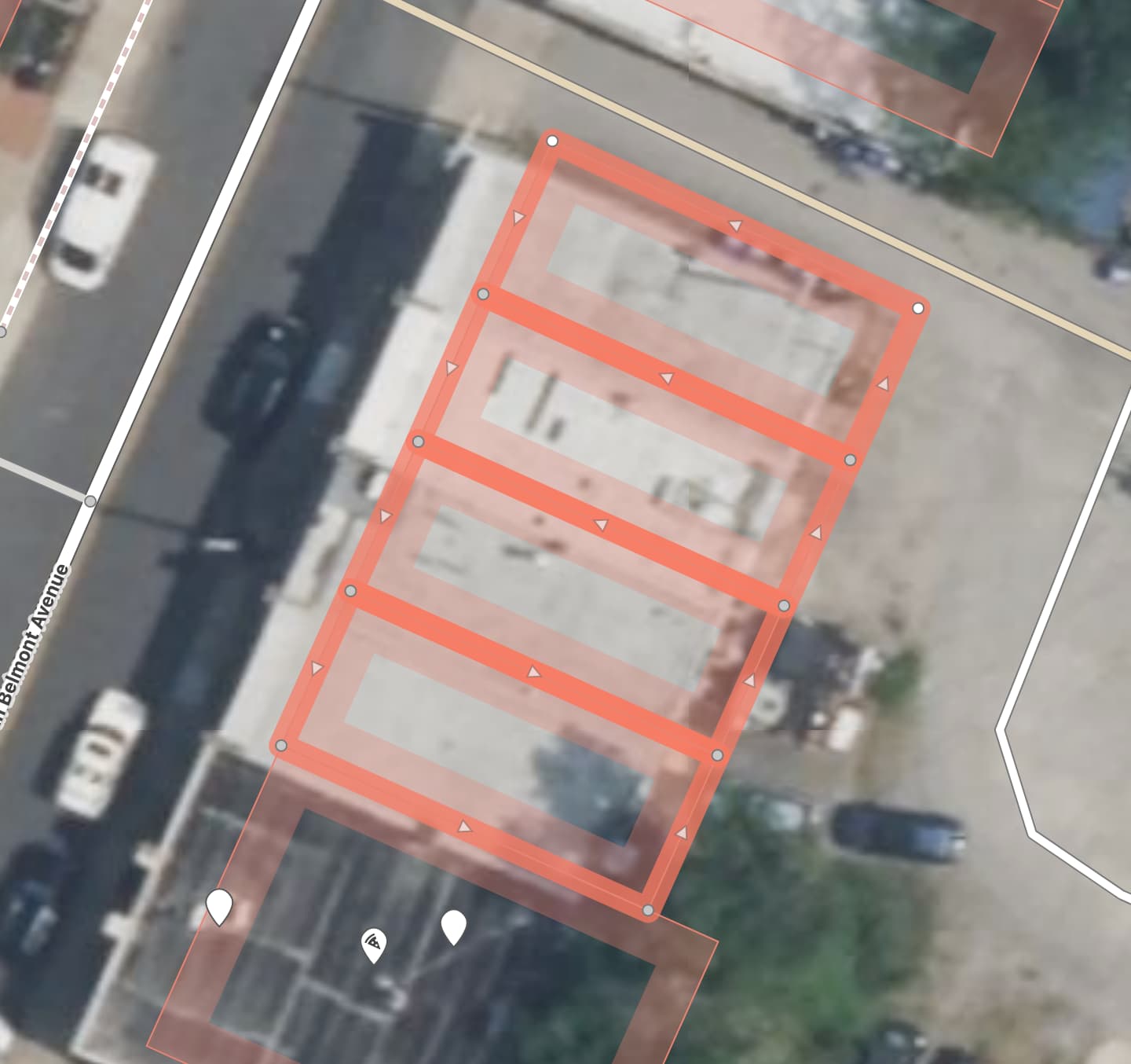
The situation: In my city (Richmond, VA, USA), I’ve found two examples of shops that occupy adjacent buildings with a shared wall between them and some way for their occupants to move freely from one half of the shop to the other without going outside (through an internal door in the shared wall). Each “half” of the shop has its own street entrance with its own address, but in both cases only one of the entrances is actually used - the other is blocked off from the inside with a table or a shelf or something.

What the wiki says: While browsing the wiki and other community posts, I’ve found guidance around buildings with multiple addresses (draw the building as an area and add multiple address nodes) or multiple buildings for one house number, but how should I tag this situation where it’s technically two buildings occupied by the same shop and operating as one?

How I see it, I have two options:

  • Combine the two buildings into one (delete the way that represents the shared wall) and add two address nodes.
  • Keep the two buildings separate, add the shop’s tags to the main entrance, and then link the other building to it… somehow? Is this where relations come in handy? I’ve read the wiki pages on Relations and Types of Relations. The Types of Relations page links to a discussion about Clusters, but I’m just not able to wrap my head around it. (I’m still newish to OSM but have learned a lot in the last couple weeks, but haven’t dabbled with relations yet)

Examples:

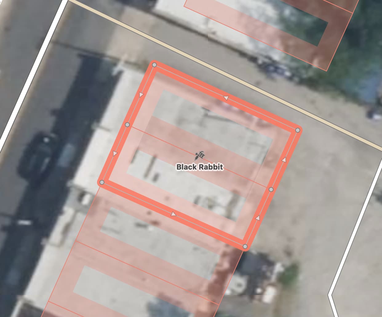
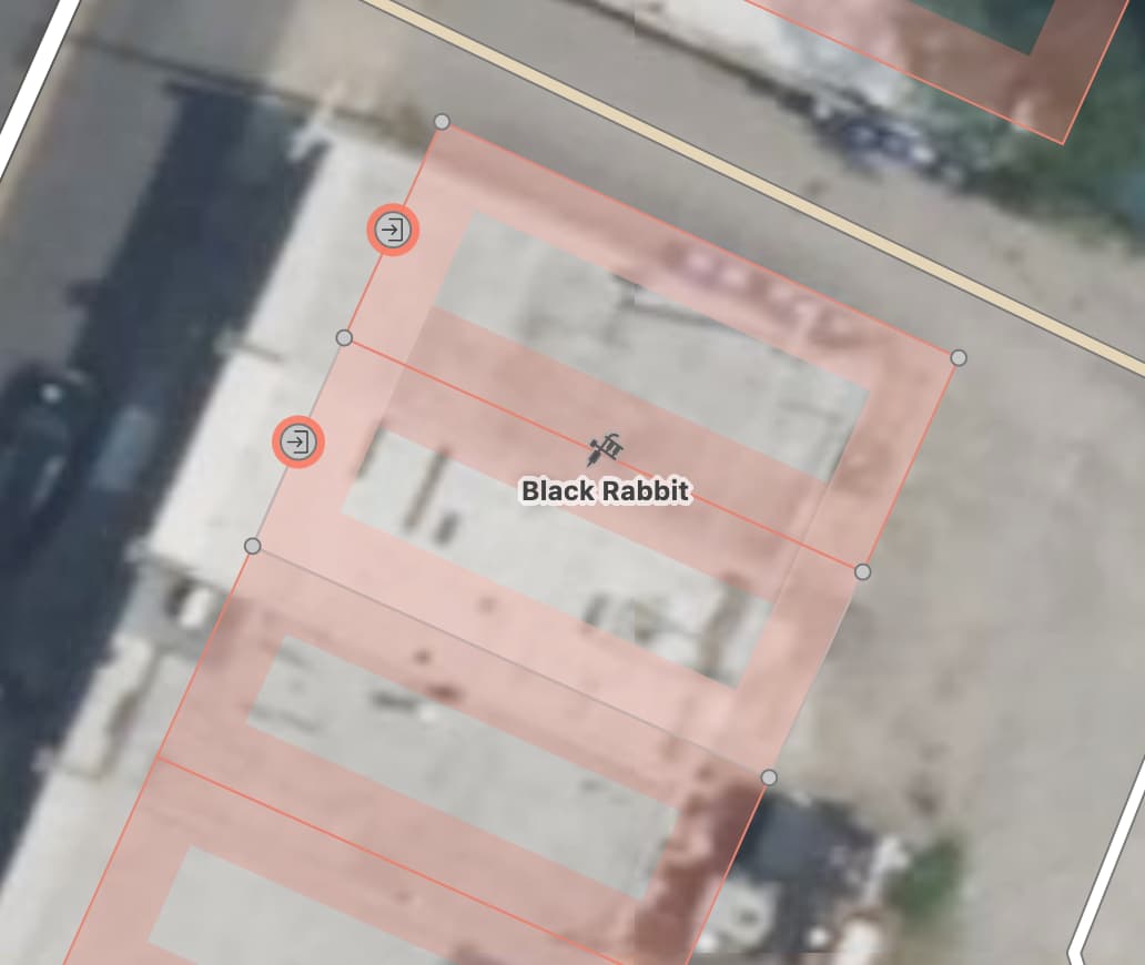
  • Black Rabbit Tattoo - main entrance is #17 (/way/538126477), and the adjoining building is #19 (/way/538126476). (sorry, I can’t post more than three links since I’m still new to this forum)
  • Belmont Food Shop - main entrance is #27 (/way/538126472), and the adjoining building is #25 (/way/538126473).

Survey photo:

Thanks in advance for your help.

First of all, looking at aerial imagery, I would’ve figured that there’s just one building instead of four identical buildings in a row. But your interpretation may be better informed. It’s convenient because you can simply tag each building area with its address instead of thinking about separate address points.

In this case, I would keep the buildings as is but map the shop as an area that encompasses the two buildings, sharing all the buildings’ nodes:

Note that when you choose the Tattoo Parlor preset in iD, it adds the building=yes tag by default. But you don’t want to imply that this area is also the building, so clear the Building field.

Even though the tattoo parlor occupies both buildings and both buildings have addresses, a geocoder can’t confidently infer the tattoo parlor’s address from just that information. The owner may give either 17–19 Belmont or just 17 Belmont as its address, so set the Address field accordingly (17;19 or 17, North Belmont Avenue, etc.).

Finally, to clarify the entrance situation, add Entrance nodes corresponding to both doors. Each node should be connected to both the shop area and the building area, but one will probably have a Type of Service (entrance=service) and an Allowed Access or Private (access=private), while the other would be a Main Entrance (entrance=main).

You can tag both entrances with the address too. This means the same address will appear on multiple features, but I think it’s fine. The address is secondary information, not saying that there are multiple 17 Belmonts. Otherwise, I don’t think there would be a single right answer as to which one should be 17 Belmont, since it really depends on whether the user is looking up a building, door, or shop.

Granted, this answer is how you’d micromap the situation pedantically. It’s perfectly OK to just map the tattoo parlor as a point and put it somewhere around the middle of the combined retail space.

In my opinion, if two adjacent buildings are connected internally, they should be mapped as one building, in other words one building should be the footprint of all the internal connected spaces.

In question about the addresses, if a poi uses two address nodes you generally pick the one with the highest house number.