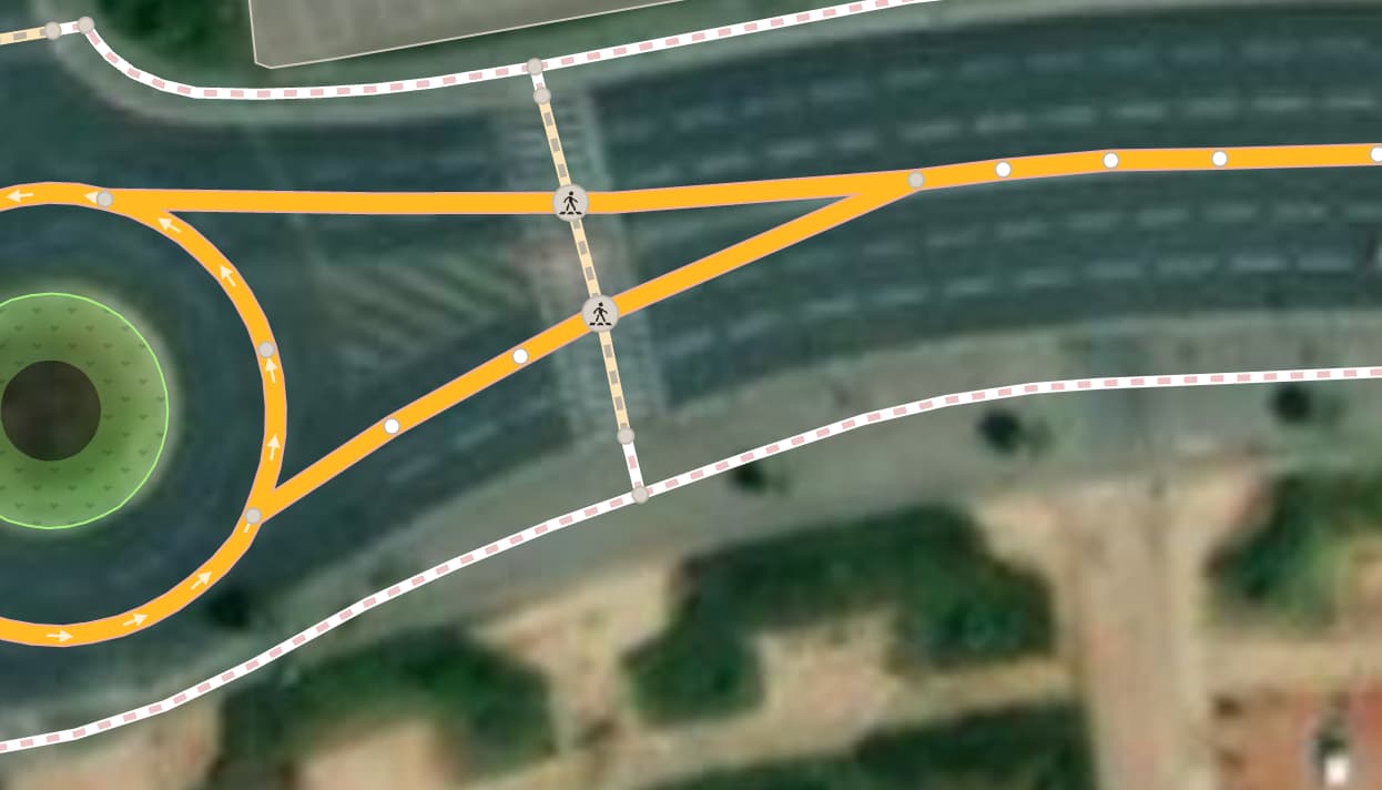
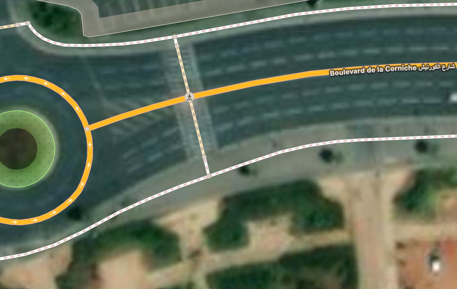
What is the best practice to map this type of intersection with a roundabout, where the road is split by paint:
Should I map it with a single line that goes through the paint
Or split it in 2 lines?
What is the best practice to map this type of intersection with a roundabout, where the road is split by paint:
Should I map it with a single line that goes through the paint
Or split it in 2 lines?
I’d personally be inclined to do the latter, though I’d mark the link roads as oneway=yes and move where they join together to the start of the split (about 3 dashed lane lines west, assuming north is up, where the actual split starts). The former is also acceptable given the context.
Of course! I forgot to add them before taking the screenshot. I was just looking for people’s opinions. Thank you for giving yours.
Related to this layout with 2 crossing nodes and a crossing way… crossing_island? and do we repeat the tags of the crossing nodes on the crossing way or does highway=footway + footway=crossing suffice?
I really just want to know whether to map it a single line or as 2 lines. I’ll worry about the crossings later.
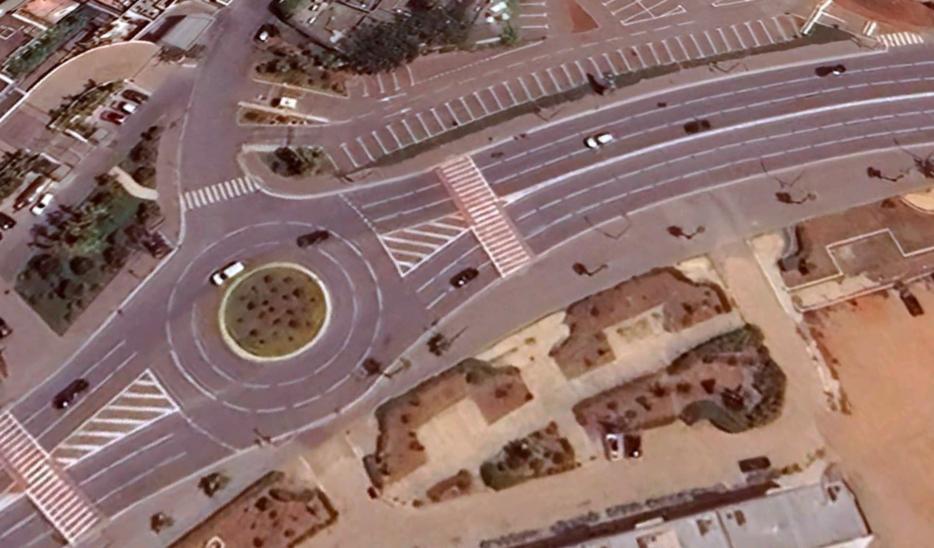
The layout with split ways on/off oneway is fine, general conventional mapping method even though that split area is just painted i.e. no true kerb enhanced physical separation.
I think I would map this as a single lane, since there’s no physical separation between one direction and the other. However, if I were to find a similar situation with two separate oneways I would leave it be (mainly because the separation is quite long, would it be shorter maybe I would “correct” it with a single way).
But this is an additional disadvantage that should be considered here. Creating 2 =crossing on the oneway=yes pair each side causes a false impression that there are refuge islands protecting the pedestrians.
It should be discussed by collapsing the the tip of the triangle to the crosswalk, leaving 1 =crossing only. Then the relative gain from this offset has to be weighted.
That would make the split on the map after it occurs on the ground. Also that space appears to be a flush median, so for all practical purposes, it’s a median.
Since it’s just paint, I would map it as a single line.
Yo lo pondría separado.
Para el caso del cruce de peatones, agregaría “crossing:island=no” para identificar a los peatones que ese cruce no esta protegido y tengan precaución.
I don’t know the traffic laws of the area and if a refuge island is even necessary, but it seems the spirit of the refuge island is met in the pictured junction.
Refuge Islands allow pedestrians to stop in the centre of the road, so they can split the crossing into two stages for each direction of traffic.
Pedestrian refuge islands are raised median islands that provide a location for pedestrians to safely wait for a gap in the traffic so they can finish crossing…
For pedestrians to safely cross a roadway, they must estimate vehicle speeds, determine acceptable gaps in traffic based on their walking speed, and predict vehicle paths. Installing a median or pedestrian refuge island can help improve safety by allowing pedestrians to cross one direction of traffic at a time.
Yep, that tweak makes sense! No point in letting the link roads feel undecided—oneway it is!
I map them meself, and add an implicit=yes in absence of a solid_line divider, but I dare say that such roundabout flare turn restrictions are useless. Which navigator is fast enough you turning off on an exit too early and is able to tell you are going the wrong way and routes a quasi u-turn? None! In practice no router plans that move, unless you’re on an address at the ‘off’ flare (and those that do exist here have a dotted line at the driveway divider to allow a left turn directly to the roundabout, the newest roundabouts with physical raised traffic islands even have a gap build in with stop spot signage to tell you’ve got no right of way at all. My car navigator is actually set to not plan u-turns at all. It’s outright dangerous with the poor behavior of drivers, particularly those on mofa, moped, scooter and motorcycle… the two wheeled motorized vehicles, regardless if you put your indicator out or not. Suicidal /OT.
The turn restriction relation captures the actual and verifiable restriction: you’re not allowed to make a left-turn (u-turn) there, because of the solid line, while the OSM way layout suggests you can.
hmmm, you saw that too ;o). Seeing more than a few in your country with the implicit=yes.
True. Also, we have many roundabouts/junctions with raised or painted flare islands with and without the splits. Or splits in the most important way and no splits in the less important way. The trend is to add more and more details, so I expect all will be split in the near future.
Of course, we also have an incredible amount of turbo roundabouts, you can’t get it more detailed than that.