Hey all,
I am sometimes mapping Agrivoltaic facilities, which have some kind of agriculture and some kind of photovoltaic on it. Globally, these systems become more and more, so I am wondering, how to map these correctly.
It would be nice to be able to capture all characteristics you can usually map with pv and with agri sites. Here are some examples of existing sites:
Any ideas on how to correctly map this?
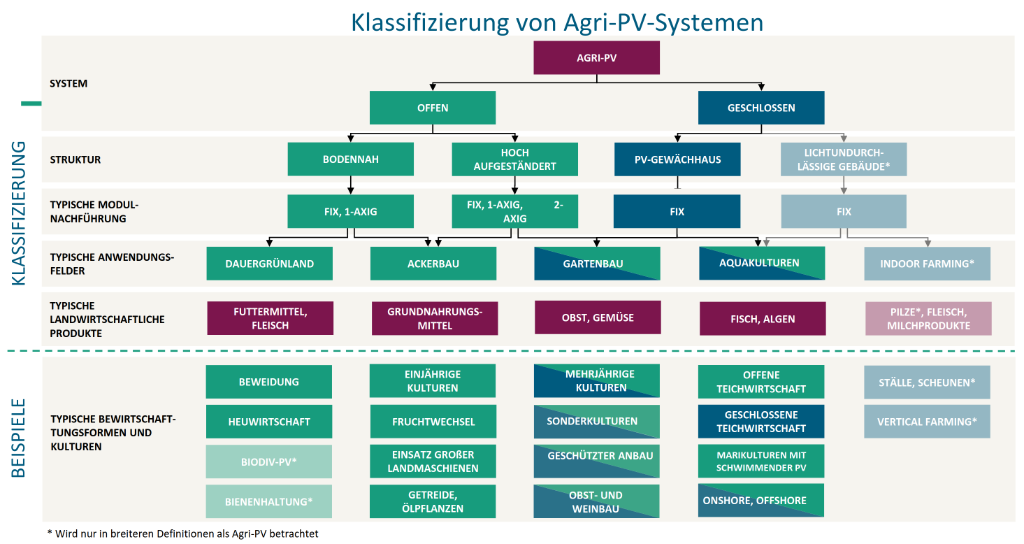
Edit: I thought I might share some more information on Agrivoltaics gathered. For the agricultural part it is usually about greenland, Arable farming, Viticulture or Fruit and vegetable growing. Generally, a distinction can be made between open and closed systems.The latter are used in PV greenhouses. Open agrivoltaic systems are divided into highly elevated (management UNDER modules) and ground-level systems (management BETWEEN modules). The modules can be mounted vertically or horizontally and can be tracked or fixed.
Here I found a calssification diagram in German:
In Germany there is DIN SPEC 91434 defining what exactly qualifies as Agrivoltaics.