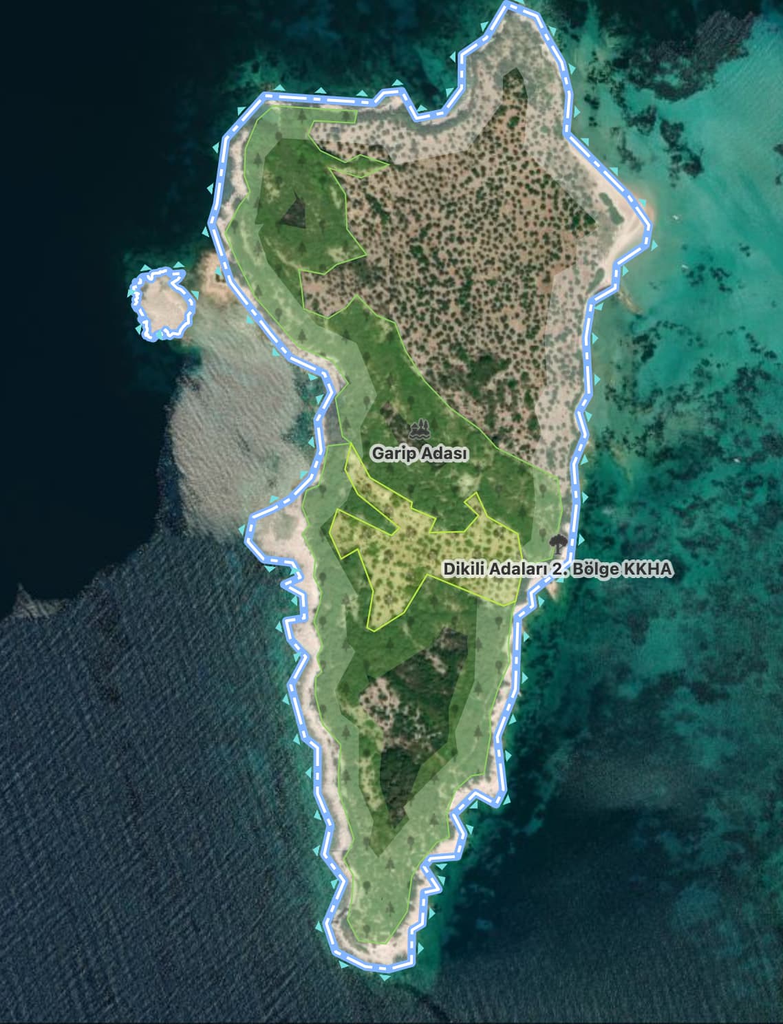
I am trying to improve the edits on Garip Island in Turkey.
The island actually consists of two islands - one very small island, and another larger island.
(I visited the islands and did GPX traces recently).
On OpenStreetMap it appears as a single landmass.
On commercial mapping services it is correctly identified as two separate land masses.
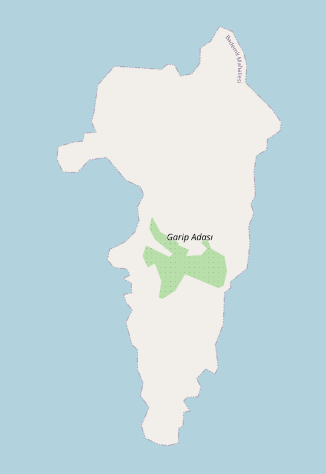
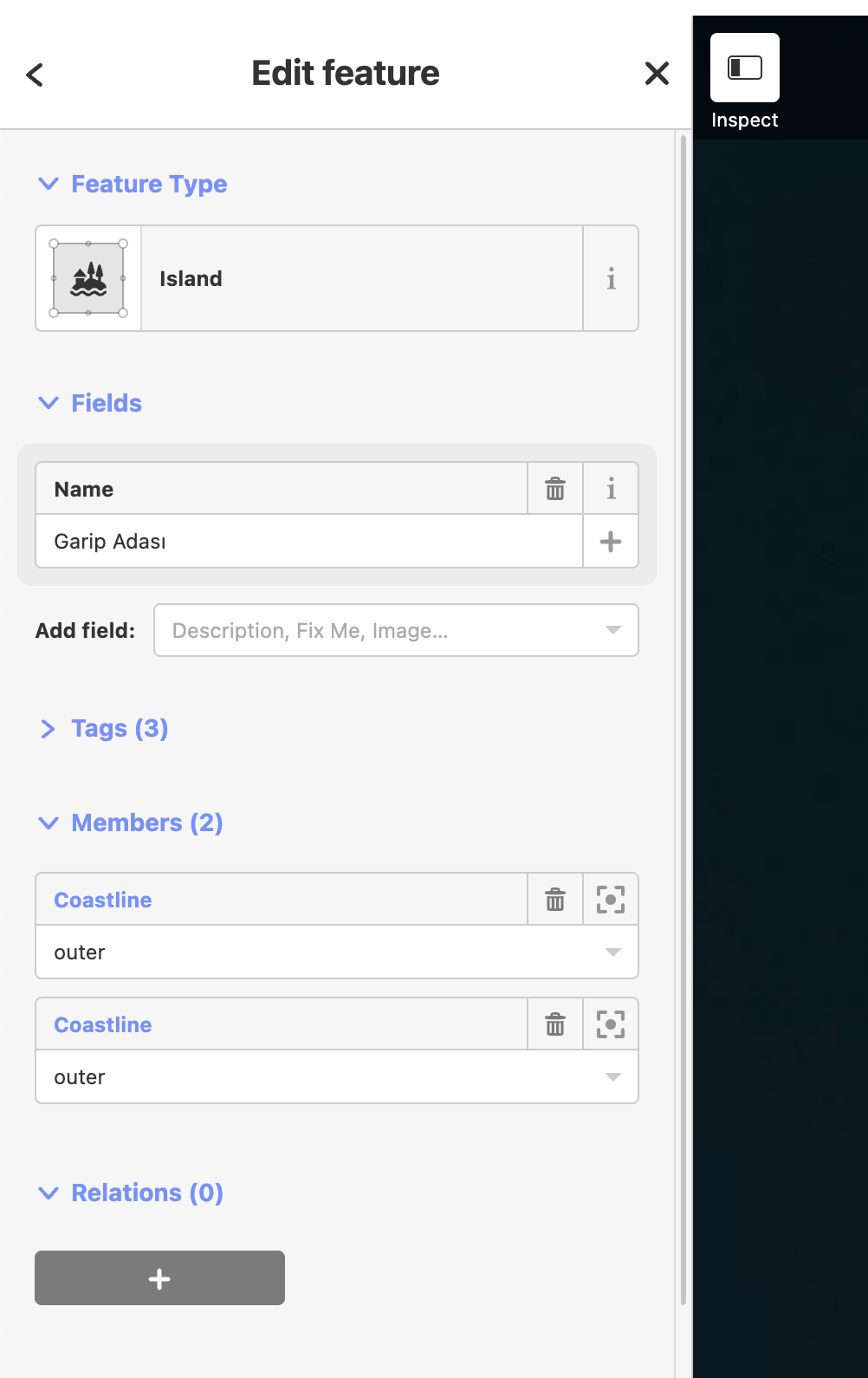
I have tried to split it into two using the web editor, as shown here:
Rendering the sea coast is a complicated task because it’s by far the biggest single element in the World, so changes on the coast are updated rarely. I’d say every several weeks or something like that.
Good to know - so I have modified the right shapes? I was thinking maybe I changed the municipal outlines, but not the coastline or something. Many thanks
If both islands have the same name, I would add the small island to the multipolygon of the large island as an outer.
When the name is searched, the relation showing both parts of the island name would display.
Is that ok or am I not understanding correctly?
Also seems nonsensical to have a single way forming a polygon and making tagging as a multipolygon - let’s try to keep it real guys.
I thought so as well at start, but it doesn’t feel right to tag two islands as one island. I think the guy writing the wiki article just didn’t feel like making a new article for the little island. But to local people, they are definitely two islands, and they probably have a name for the little island. How else would they reference it when they, for example, go fishing there? Do they say “Lets go to that part of Garip Adası island that is separated by sea”? Probably not.
I agree, I would delete the multipolygon and put the tags on the way. But there is some logic to keeping the relation, because sometimes people divide the coast to tag a part of the coast with some tags. And then, having a multipolygon would save you from splitting the island into two islands.
I have a very similar problem here (Trehörningen).
I also split an island into a big and a small one, connecting them by a bridge.
At first I kept both parts in the island-relation.
But the next day I discovered both islands have ‘sunk’ to ‘Atlantis’ as result.
I don’t see anything wrong.
Since then, I have removed the small one from the relation, and hoped that solves the problem.
But currently, I still have not seen any change.
OSM-Inspector just shows NO coastline around both islands.
I know coastlines are special.
But just waiting and ‘praying’ isn’t an efficient option.
Did you find any solution & clarification for this problem?