Hello fellow mappers,
I recently started mapping with JOSM after gaining a bit of experience with iD for a few weeks. Uploaded my first two GPS traces to OSM last night but they showed up as little dots that are difficult to follow when zooming in and it can be hard to see where the points lead to, in some cases).
My traces are circled in orange and I don’t understand why they don’t appear like the ones circled in yellow:
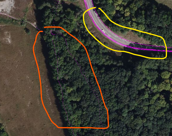
I recorded both of my traces with OSMTracker on Android and uploaded them using my phone. Is there something I need to do on the app or in JOSM to make the traces appear as solid lines?
I thought checking the box “Force lines if no segments imported” might connect the points but that just seems to mess up the traces circled in yellow in my attached image.
Thank you all in advance!