Hi, so I have a problem with making a query that will show me boundaries of Baltic Sea as a polygon/multiplygon, all I could find is a node with some info about Baltic.
This isn’t available, because there are many definitions for it. Then the maintenance of such large areas is a nightmare, and low performance.
You find the definition you want separately. Eg IHO Limits of Oceans and Seas. International Hydrographic Organization, IHO; Sieger, R (2012): Limits of oceans and seas in digitized, machine readable form (has a DOI which you may like if academic)
3 Likes
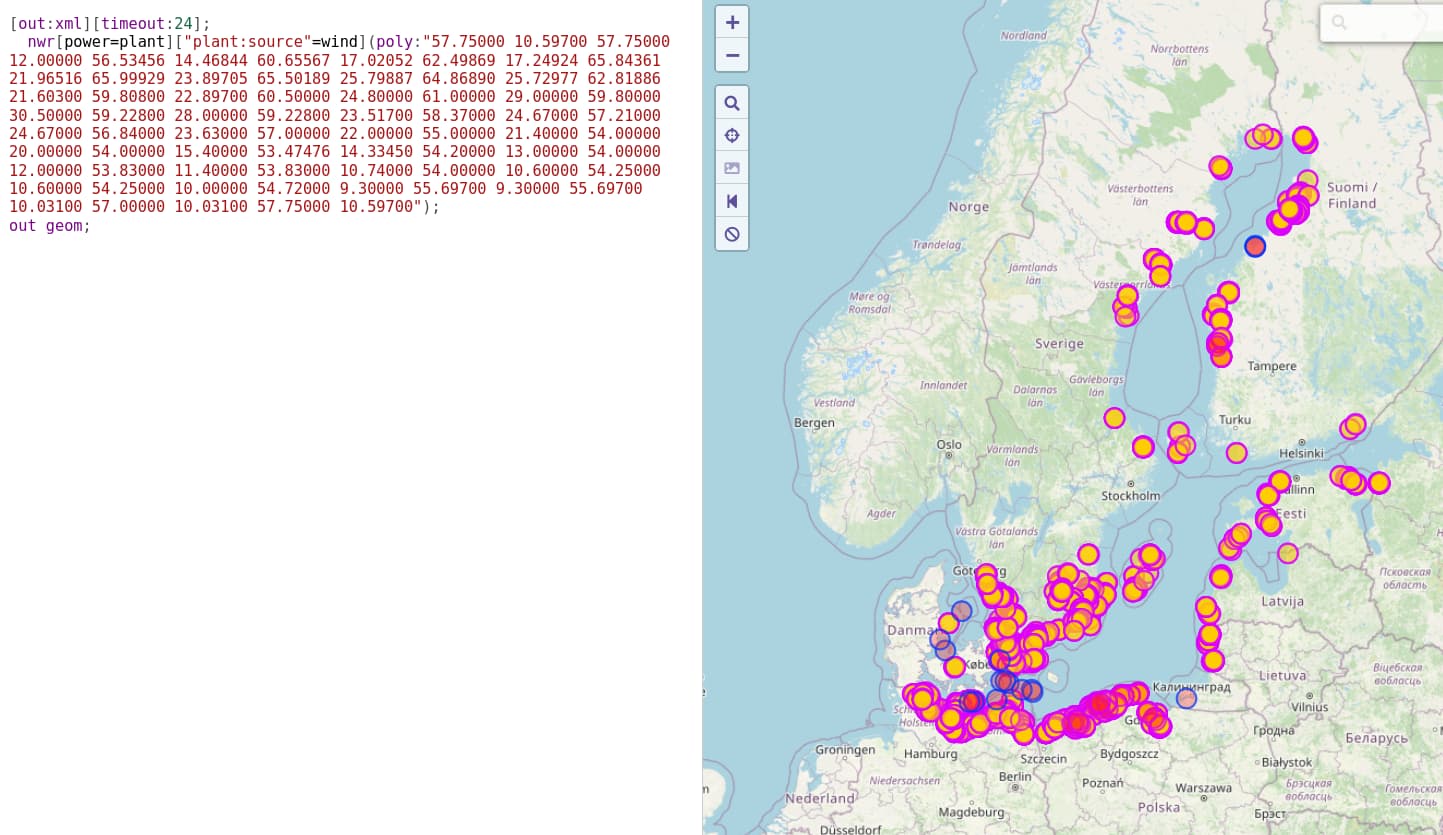
Okay so what do I do If I want to get data about positions of all wind farms on the Baltic sea ? do I have put approximate coordinates or what ?
perhaps “drawing” with JOSM the area & with the overpass poly option? just as a quick manual no tested example with the data suggested by @Kovoschiz
[out:xml][timeout:24];
  nwr[power=plant]["plant:source"=wind](poly:"57.75000 10.59700 57.75000 12.00000 56.53456 14.46844 60.65567 17.02052 62.49869 17.24924 65.84361 21.96516 65.99929 23.89705 65.50189 25.79887 64.86890 25.72977 62.81886 21.60300 59.80800 22.89700 60.50000 24.80000 61.00000 29.00000 59.80000 30.50000 59.22800 28.00000 59.22800 23.51700 58.37000 24.67000 57.21000 24.67000 56.84000 23.63000 57.00000 22.00000 55.00000 21.40000 54.00000 20.00000 54.00000 15.40000 53.47476 14.33450 54.20000 13.00000 54.00000 12.00000 53.83000 11.40000 53.83000 10.74000 54.00000 10.60000 54.25000 10.60000 54.25000 10.00000 54.72000 9.30000 55.69700 9.30000 55.69700 10.03100 57.00000 10.03100 57.75000 10.59700");
out geom;
1 Like