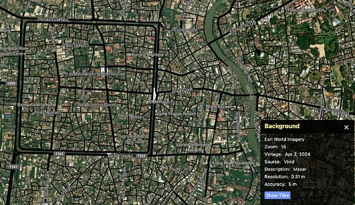
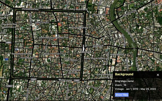
I’ve noticed that ESRI and Bing alot more “stitched up” than I thought, there’s little holes in ESRI imagery that are just older Bing imagery, and some areas where Bing is newer than ESRI.
It’s annoying to have to switch between the two to check which one is the most up to date in what I think is a pretty small area, it’d be so much better if the entire country could depend on one unified latest imagery.
Welcome Sooup!
Bing tiles include some rough “vintage” dates in their HTTP headers, but I couldn’t find any online resources showing them right now. I built a demo a while back, and from my experience, Bing imagery in Thailand tends to average around 5 years old. Unfortunately, I don’t think ESRI does much better.
Without access to Maxar or authorization to use Google, it looks like we’re stuck with only a handful of older sources in Thailand ![]() .
.
I assume you are mapping in that area using local knowledge, then the Strava Heatmap extensions can be a great alternative for improving or adding missing road geometries.
Assuming that “Vintage” is the date of the imagery, it is shown for Bing and ESRI in ID-editor / Background / Show Background Panel. Some ESRI images are only 1 year old.

