Complete newbie question. I’ve exported from OSM in PNG format and then imported that into QGIS. I want it then to be georeferenced, I’ve checked the projection as WGS84 (EPSG 4326). I’ve gone through manual georeferencing in QGIS, entering points from the original OSM page to match points on the exported PNG. Well it sort of works, but I get a very distorted image at the end - mostly stretched lengthways.
So, I’m wondering, firstly why is that happening? Secondly, is there a much better way to export from OSM and get it properly georeferenced in QGIS? I feel like I’m probably missing the correct way to go about it.
Thanks for any advice.
You can just add the OSM tiles as an “XYZ Layer”
Layer → Add Layer → Add XYZ Layer
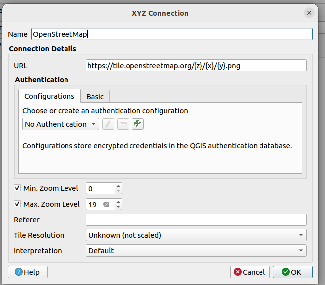
If OpenStreetMap is not one of the choices, you can add it:
Great! Thanks a lot! I knew I was probably missing something much better ![]()