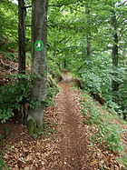
Lots of them are in the woods. Cycling there generally is not allowed. So even if tagged for the wrong reason, result will be right ![]()
Your analysis is supported by these statements on the general rules on cycling on paths in the forests as summarised here
In a nutshell: Mountain biking is forbidden in Austrian forests unless it is explicitly permitted.
Which is based on a reference to §33 of the Austrian Forest Act which reads
C. Use of the forest for recreational purposes
types of use
§ 33.(1) Notwithstanding the provisions of paragraphs 2 and 3 and Article 34, anyone may enter and remain in the forest for recreational purposes.
[…]
(3) Use that goes beyond paragraph 1, such as camping in the dark, camping, driving or horseback riding, is only permitted with the consent of the forest owner, with regard to forest roads with the consent of the person who is responsible for maintaining the forest road. […]
These are two things - the value itself and the trust level of the value. But also an explicit value may be wrong.
1 Like
I think that is a fair assesment.
That correlation could also (partially) be explained / supported by the fact that in some areas there are regulations where the “bikeability” is a factor that determines whether a path is or is not legally accessible (and if access is legally enshrined or not).
Two examples:
Nordrhein-Westfalen official state website ( Radfahren im Wald → Rechtslage)
What is meant by “fixed trails” was clarified by the Administrative Court of Cologne in a ruling (14 K 5008/07) on 02.12.2008: “Fixed trails” according to § 2 para. 2 of the NRW State Forestry Act are not only artificially paved trails, but also trails with a naturally solid subsoil, which are also suitable for bicycle traffic in the forest due to their width. Typical “single trails” outside woodland trails , which are popular with mountain bikers, are not fixed paths in the sense of the jurisdiction and the law. Their use is therefore not permitted.
[…]
The suitability of trails for cycling is judged not only by the acquisition of the surface, but also by whether cycling can lead to the disturbance of other recreationists. Therefore, narrow paths and trails that do not provide sufficient space for cyclists to meet other forest visitors may not be used by bicycle.
Dutch roads act
(not to be confused with the road traffic law)
The existence of a restriction in the use, other than by virtue of a legal provision regulating traffic, may also be assumed on the basis of the condition of the road and of the use which is customarily made of the road.
4 Likes
Perhaps part of the problem is that the wiki currently only shows well-behaved examples. If both casual mappers and data consumers were aware of the fact that both of the following paths:
 |
 |
| could be tagged like this (without necessarily violating the wiki): |
highway=path
foot=yes
bicycle=yes
surface=ground
mappers might become more inclined to also add smoothness tags and data consumers might become more careful when evaluating the access tags.
Yes and for example in Bavaria this ruleset changed less than 2 years ago and the wall of text describing it contains things like:
If there is a risk that travel on the path will loosen the soil surface, increasing the risk of soil loss and soil erotion on the path, the path is regularly unsuitable for travel by bicycles or other non-powered vehicles.
Width, gradient, curves and clarity are to be considered, also in connection with the frequentation of the path by other nature users.
The suitability of a path may also be limited to the time of day or certain periods of a day for reasons of community compatibility.
…
This applies, for example, to unpaved paths that lead across alpine pastures where there are animals. Particularly during the nighttime (between sunset and sunrise), entering these paths can trigger panic reactions in grazing animals, leading to injuries and damage.
In my opinion we should not even try to boil stuff like this down into foot=yes/no or bicycle=yes/no, because the correct answer in such cases will always be foot=maybe and bicycle=maybe, no matter how much we do not like it.
8 Likes
I think it is time update those “default access tables” that were linked above. If a tag on a stretch of path is that much difficult to tag, no way there can be country wide defaults. In doubt though, I rather trust local knowledge will get tagged with enough consideration to be much more true to the ground than defaults from the heavens.
1 Like
Some data consumers will do nothing if they can get away with it. Sometimes (as here) attention needs to be drawn to grossly inappropriate routing. No-one says it’s easy (in GB you need different rules in Scotland and England+Wales) but working out whether it is legal to send a cyclist somewhere is literally the least you have to do.
Things like the above (“OSM-based router sends cyclists in error through the Royal Parks”) reflect badly on everyone else in OSM.
2 Likes
Yes, I agree that if the legal texts you quoted :
are indeed the actual rules in Bavaria that define on which paths are /are not allowed to ride your bike then it is so hard to verify that the lesser evil would be something like “bicycle=unknown” with a note explaining why that value was chosen.
However -IANAB (I am not a Bavarian ![]() )- the link you posted also contains texts that -together with articles below from cycling associations- might suggest that access for bicycle=* may have become more clear and verifiable with those changes instead of less clear. Perhaps something along the lines of :
)- the link you posted also contains texts that -together with articles below from cycling associations- might suggest that access for bicycle=* may have become more clear and verifiable with those changes instead of less clear. Perhaps something along the lines of :
“access is allowed for cycling, unless there is a barrier or sign that says that is is not, and the landowner is free to place those, some conditions in hindsight” :
Which may roughly be seen in OSM as bicycle=permissive on highway=path
I am interested in your view on this.
For those interested, see the sources below.
Vollzug des Bayerischen Naturschutzgesetzes
Blocking by the landowner or other authorized persons, Art. 27 Para. 3, Art. 33 BayNatSchG
2.6.1 General
1.The right of access may not be exercised if the property owner or other authorized person has prohibited access to his or her property – whether permissible or not (Art. 27 Para. 3 Sentence 2 BayNatSchG).2. The prerequisite is that the prohibition has been imposed by means of clear blocks applicable to the general public.
[…]
9. If the property owner or other authorized person blocks his property with signs, these must refer to a legal reason that justifies a restriction of the right of access (Art. 27 Para. 3 Clause 3 BayNatSchG), for example “forestry work”, […]
10. If such a reason is not given, such blocking signs for those seeking recreation are irrelevant.
11.This applies, for example, to signs with the inscription “Private property – Trespassing prohibited”.
And here is the actual Bayerisches Naturschutzgesetz – BayNatSchG itself to which the above mentioned “Volzug” refers. (The Volzug if I understand correctly is a service instruction to the authorities on how the law -here: BayNatSchG- is to be implemented? )
The cycling association DIMB (who -although from non-neutral perspective of course - have a extensive legal database), seem to interpret the notions on suitable ways in BayNatSchG here, and here as when a way would be deemed not suitable for bicycles, it is not bicycle=no, but that the property owners are not liable for damages or obliged to maintain paths for cycling.
And with the new Volzug it is argued that the cycling bans have become more clear with signs and presumably more frequent (see also the second half of the link in the quote " wave of signs…"):
When the new administrative regulation for the Bavarian Nature Conservation Act came into force in December 2020, cycling associations such as the DIMB feared a wave of signs prohibiting mountain bikers . Because the new regulation is intended to create an “objective determination of drivability”. In practice, this means that authorities and landowners can more easily enforce road closures. If MTB trails are closed, this must be indicated with appropriate signs.
The crux: Not only the lower and higher nature conservation authorities are allowed to put up prohibition signs, the landowners themselves are also authorized.
1 Like
The tl;dr of the “Agreement of the Bavarian State Government with the General German Bicycle Club” is found in chapter 4 on page 3:
Thus, unless the property owner puts up a prohibition sign (which in itself could be unlawful), the legal position is by definition unclear.
In such cases, as a mapper, I would add bicycle=no if there is a sign prohibiting cycling, bicycle=permissive if there is a sign suggesting cycling is permitted, and add nothing in all other cases.
Strictly speaking, it is not even possible to conclusively determine whether bicycle=permissive or bicycle=yes is correct, since we cannot know whether the property owner can legally prohibit access at all (see: Art. 33 Admissibility of bans).
My approach would be to map what is visible on the ground and use common sense otherwise.
It might me helpful to mention on the page that highway=path was introduced with access=designated, and appears to be the most
popular way to tag ways with several designated uses.
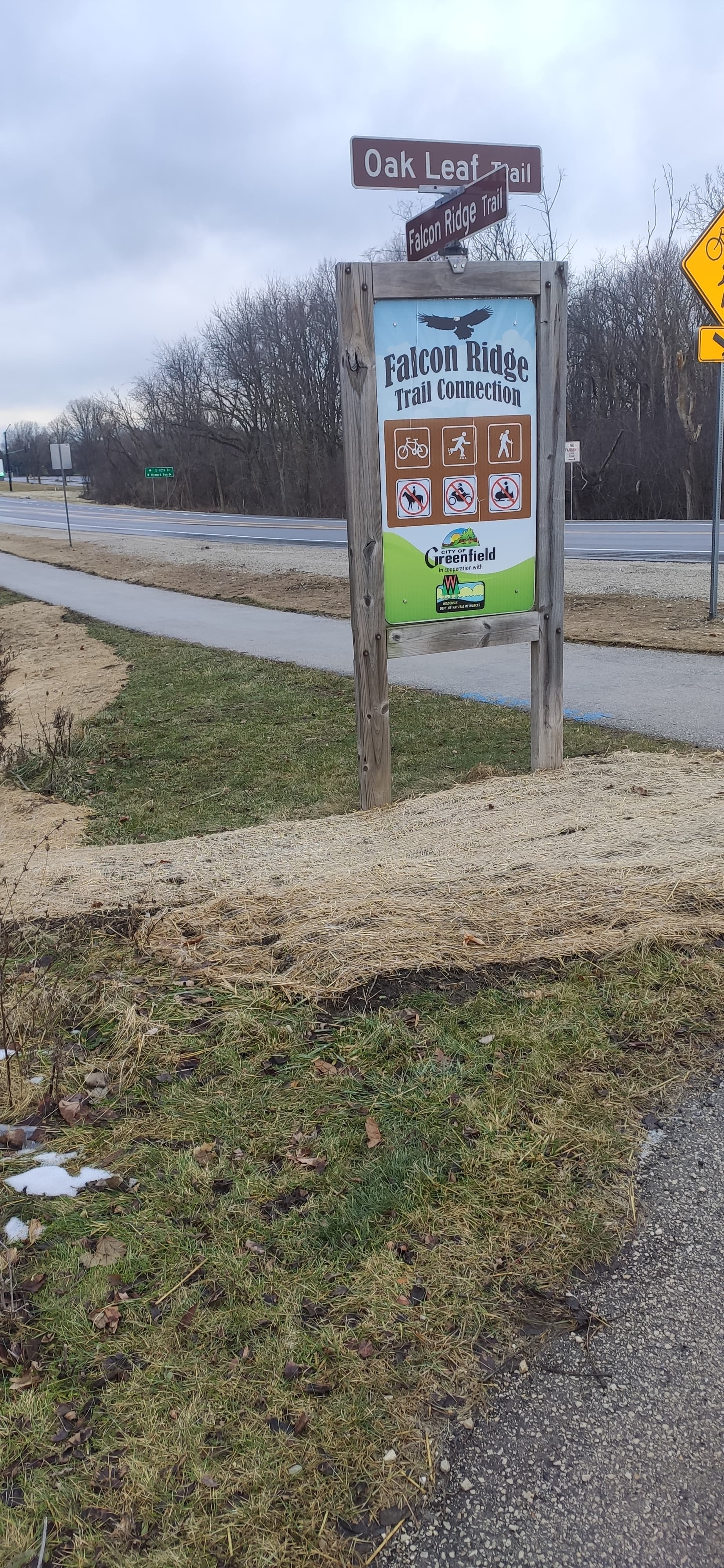
For example, several recreational pathways in the United States will be designated for a wide array of uses, including cycling, walking, horse riding, skiing, and even snowmobiling. Here is a suburban path as an example:
1 Like
Do note that access=designated is bad tagging according to its wiki:
NOTE! The exact key/value combination access=designated should never appear on an object. The value *=designated must be used with a specific mode of transport. Examples: bicycle=designated or foot=designated.
Be aware that “add nothing” is work-multiplicator, i.e. next person that comes after you will have to survey the same thing, and if they don’t map anything too, the next person will check it again, etc.
4 Likes
That’s not a good global suggestion. In my country if bikes are prohibited then it’s almost always signed as such. I local mapper will know to what is the correct access. bicycle=yes is appropriate, even if no sign. I don’t see the use case for permissive.
It seems like this thread has gone into the weeds with specifics about one or a few countries.
I would argue that bicycle=unknown would attract even more attention and that we should not add data that is not verifiable by others either.
I agree, but it was not a global suggestion, it was the answer to post #41.
Permissive only ever makes sense if the permission can be revoked at any time.
feel free to improve wiki! I think that this kind of example would be helpful
-
If bicycle=* is left blank by mapper A after seeing a path with no sign (because he thinks the rules in this area are too vague to determine bike-access in such cases where no signs are present that explicitly allow cycling), then:
-
mapper B might very well think “this path hasn’t been evaluated yet for the presence or absence of signs about cycling, and if there is no sign prohibiting it, cycling is actually allowed” , so I will go and have a look there in the near future so I can add bicycle=*
-
while mapper C might very well think “bicycle=yes” is regarded as a default-value for highway=path in Germany in the wiki and that sounds reasonable to apply, since I heard about legal right to roam in Germany and assumes that cycling most probably will be allowed if bicycle=* is not tagged
In any case fellow mappers and data users will be helped by making access-tags as explicit as we can -within the limits of verifiability, even if that means tagging bicycle=unknown.
If a mapper thinks the regulations are too vague to make a verifiable assessment, bicycle=unknown together with a note:bicycle= or source:bicycle= explaining the source for that conclusion, will help us forward more than by leaving bicycle=* blank,
because we can then try to make sense of the relation between the regulations and OSM-tags together and publish the results in a wiki so that the outcome hopefully will be more clear for other mappers as well.
2 Likes
I’ve also used “unknown” where even after survey it’s really not obvious what the access rules are - somewhere between private and permissive, but it’s not very clear.
2 Likes
To be honest, I think the work-multiplicator argument, while true in theory, is completely irrelevant in practice.
- The wiki says of
bicycle=unkown: “If you know places with this tag, verify if it could be tagged with another tag.” - The combination of
highway=pathandbicycle=unkownis basically non existent (probably because 1.) - The percentage of mappers who seriously think about such things is likely to be vanishingly small, and everyone else will just tag it as it pleases them, ignoring both the wiki and reality.
Therefore, I do not think it makes sense to actively encourage people to tag something that cannot be decided beyond a reasonable doubt, as this will only further increase the amount of incorrect data.
The presence of bicycle=unkown would certainly encourage rather than hinder mappers B and C to add what they see fit.
I doubt that, especially if -as suggested- bicycle=unknown is accompanied by a source:bicycle=* that explains why you think the regulations are too vague too ensure -even after survey- if cycling is allowed or not.
For any reasonably acting mapper that explanation should discourage just adding bicycle=yes/no without discussing it rather than encourage it (if I don’t know why the previous mapper has left bicycle blank, I can not take those reasons into account).
Another explanation might be that areas (and ways within those areas) where the regulations actually are that vague that even after survey legal access for bicycles can not be determined reasonably are rather rare ( since this could be considered a violation of the “no penalty without well-defined law” principle ).
For instance, in the discussed example of Bavaria, the documents that were referred to argue that access cannot reasonably be determined were from before the changes in the ruleset from 2020. And just like the cycling association quoted earlier I read those 2020 texts to give more clarity (and more access-signs) : “If MTB trails are closed, this must be indicated with appropriate signs.”.
And those questions are exactly the ones mappers can discuss (in another, more country-specific forum-part ![]() ) as a response to a tagged bicycle=unknown together with a explanation for that choice.
) as a response to a tagged bicycle=unknown together with a explanation for that choice.
2 Likes
actually in Germany you can walk everywhere, not just on paths but also on meadows, in forests, etc. no path required. For cycling, you have to stay on ways, and in Baden-Württemberg (only) there is the requirement for minwidth of 2m in forests
2 Likes
I doubt that. Trampling through grass does damage to the crop, even if merely grass.