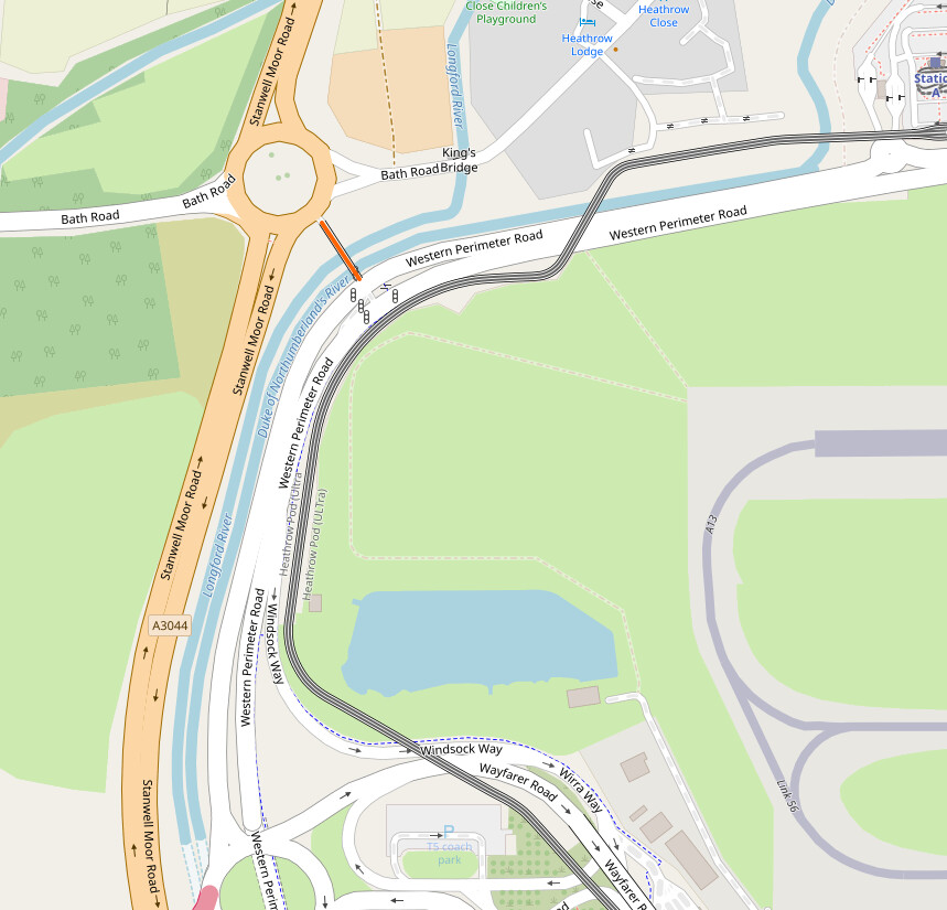
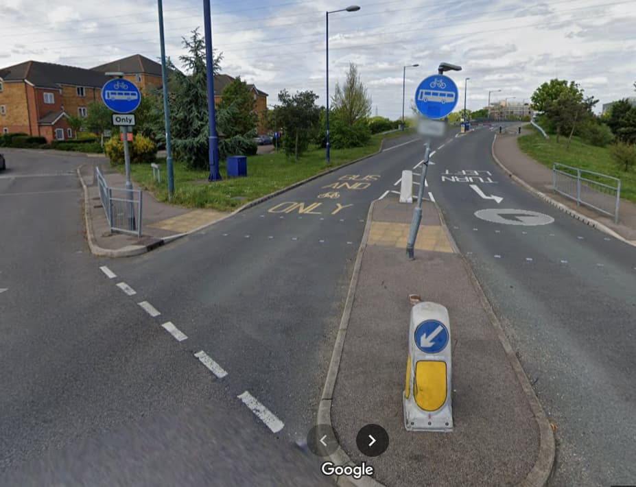
Given the existing definitions on highway=busway, it’s not entirely clear to me whether a bus shortcut road should be tagged as highway=busway or as something else. Here is an example of what I mean:
I’m not really sure what the highway=busway tag is meant for in the first place, to be perfectly honest. Tag:highway=busway - OpenStreetMap Wiki says that the tag shouldn’t be used on “physically-separated bus bypass lanes”, defined as “… short stretches of bus-only roadway at intersections that allow buses priority through an intersection before re-entering general traffic”. That’s precisely what the way in question seems to be for, so it seems clear to me that highway=busway therefore shouldn’t be used in this case.
The wiki defines lot of scenarios where the tag is inappropriate, but I’m not really sure where it is appropriate for use. It seems like it’s meant for roads that are only accessible to buses, but I’m not sure what purpose the tag serves that isn’t fulfilled by highway=service, access=no, bus=designated.
highway=busway is for dedicated bus rapid transit roads of a higher importance, not for little shortcuts like this. While common in some places, they are rare to non-existent in others.
Originally busway was meant to be used only on BRT systems, but this quickly started to be problematic since it is not always easy to define what is and is not an BRT.
Some BRT systems only have very small sections of bus only road, and some have a whole network. Where left now with a situation where if a bus station connects to a pace of busway the stations will also be tagged as busway:
But if only the road around the bus station is a bus only road, then it does not get tagged as a busway:
I think that this is quite inconsistent, and I would be much more content if all bus only roads are tagged as busway. Since that is more verifiable and is how we do it with all highway types. We don’t tag small cycleways as unclassified + bicycle=designated for example:
I thought the example of Eindhoven on the wiki page was rather odd, given that I thought that roads at bus stations are highway=service: Way: Eindhoven Centraal Station (305610793) | OpenStreetMap
However the station does have direct connections to true busways.
Perhaps here is the clearest example of a “true busway”
from looking at wikipedia, in OpenStreetMap terms this is a route, which also travels on regular roads (“ using dedicated bus lanes for almost the entire length of the route”), so the distinction seems to boil down to the length of the dedicated bus roads.
I don’t understand why a short busway (road dedicated for buses) shouldn’t be a busway. The length is already implicit in the geometry.
Is this a highway=busway with tag cycleway=yes or cycleway=shared_lane or cycleway=shared_busway to or something else ? I would like to make sure cycle routing works in apps like komoot and cyclestreets which currently send cyclists on detours instead trough the bus dedicated route shared with bikes. It is also a part of National Cycle Network 125