Did you mean “Gulf of America”, or were you suggesting that name=* should be in Spanish? In general, the language of name=* for high seas is still an unsettled topic without great options, but there seems to be significant support for standardizing on English based on nautical conventions. (For the Gulf, it’s currently in Spanish, which… might honestly be the best compromise given the circumstances.)
Jurisdiction isn’t the sole determining factor for the scope of a toponym. After all, the waterbody that separates Baja California from the rest of Mexico currently has name:en=* set to “Gulf of California” as preferred by the U.S. government, not “Sea of Cortéz” as preferred by the Mexican government, even though none of it falls under U.S. jurisdiction. In this case, “Gulf of California” is more common among English speakers, regardless of dialect but particularly in American English. In light of our project’s policy favoring on-the-ground verifiability, that usage matters more than any territorial considerations.
If it becomes clear that “Gulf of America” is only intended to apply to the portion within U.S. jurisdiction, then we can model it as a separate feature, but for now that’s just speculation. Remember also that creating a separate feature makes the name much more prominent, not less.
The Gulf’s node is tagged with both gnis:feature_id=* for the entry in GNIS, which covers names of domestic features, and as of yesterday, GNS:id=* for the entry in GNS, which covers names of international and foreign features. Neither database has been updated since the executive order.
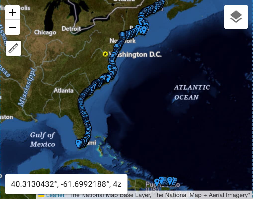
GNIS geography can be quite imprecise for non-point features. For example, it tends to represent a waterway as a pair of coordinate pairs at either end, sometimes with additional coordinate pairs at arbitrary points along the waterway at county lines. Some lakes are modeled as a series of coordinate pairs forming a grid. The modeling of the Gulf along the Gulf Coast is consistent with the modeling of the Atlantic Ocean along the Atlantic Seaboard and the northern coast of Puerto Rico:
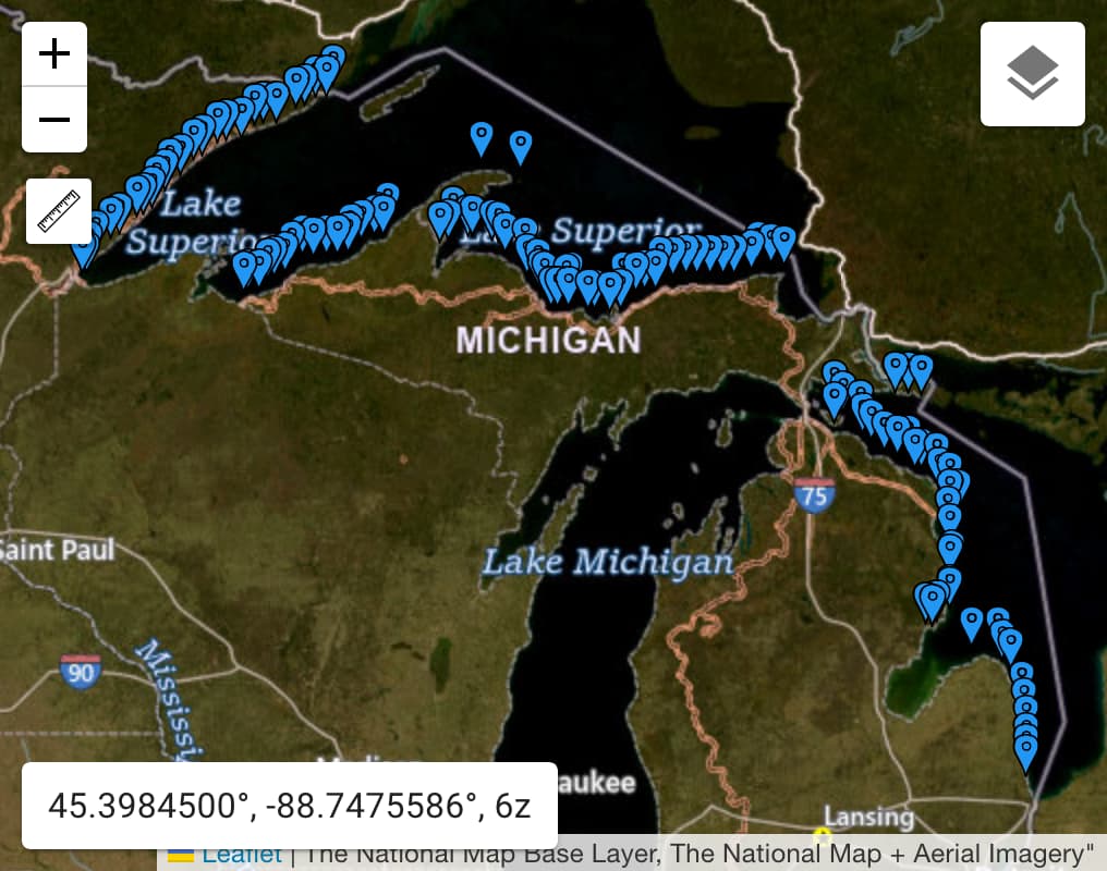
Whereas the record for the Great Lakes omits Lakes Erie, Michigan, and Ontario, which are indisputably part of the Great Lakes:
I wouldn’t read too much into the placement of these coordinate pairs. They’re only really there to give a general sense of the feature’s extent. As you can see from these screenshots, The National Map labels these waterbodies at their true centroids regardless of GNIS.
Anyways, I’d consider GNS to be a better source for the federal government’s position about the name of the Gulf as a whole. It also places the Gulf at the centroid:
![A map of the Gulf of Mexico annotated with a single point at the centroid. A popup identifies the point feature as the Gulf of Mexico, with alternative names Golfo de Méjico and Golfo de Mexico [sic]. (Public domain as a work of the U.S. federal government.)](https://community-cdn.openstreetmap.org/uploads/default/original/3X/7/e/7eb152e28100f03967fa77c9aea7bf6c3f976cf7.jpeg)
I expect this RSS feed to be updated as soon as any change occurs to any feature that GNS classifies as an “ocean” belonging to no country, including the Gulf. I don’t know of a similar feed for GNIS.
Most U.S. federal government agencies routinely put out materials in languages other than English. So far, we have no idea if the order will be interpreted as requiring, say, the Justice Department or the Voice of America to start translating “Gulf of America” into other languages such as Spanish. Would it be Golfo de América (Latin America says hi), or Golfo de América del Norte (Canada says hi), or for simplicity, back to what Hernán Cortés called it, Golfo del Norte? Then again, we have no idea to what extent these translation programs will be impacted by the administration’s anti-diversity orders. ![]()