This thread has been covered in the news by Wired author Paresh Dave:
16 Likes
… with rather more understanding of what’s actually going on the some of the DWG’s correspondents, actually ![]()
1 Like

A general argument not specific to this topic: The meaning of nat_*:en-US= with country code is quite redundant. name:en-US= already means it’s for the US nationally. nat_name= is used generically, before and without country codes.
If anyone wants to discuss this, we have a long thread for nat_ref:*= Talk:Tag:aeroway=aerodrome - OpenStreetMap Wiki
What about official_name:en-US-u-sd-usak=Denali + official_name:en-US=Mount McKinley ?
I’d say that Minh’s proposal has the advantage of reducing this question to standard OSM practices: “does this reference system gain any traction” is not very different from “does this tag gain any traction”
2 Likes
Ah, I had forgotten about the regional subdivision syntax from BCP 47 and the Unicode standard. The name:en-US-NC=* and name:en-US-VA=* I had previously used turn out to be invalid locale codes, so I changed them to name:en-u-sd-usnc=* and name:en-u-sd-usva=*, respectively. In theory, these extensions should be recognized by any software that correctly parses BCP 47 syntax, but most software relies on much more primitive regular expressions that will reject extensions.
Some languages like Gallo have no choice but to use an extension code, but for more common languages, a renderer is less likely to label places according to such a slight locale variant. While official_name:en-US-u-sd-usak=* is more precise than reg_name=* or reg_name:en=*, this is the kind of detail that normally belongs in a dictionary or gazetteer rather than a map. Unlike the gulf, the mountain only really pertains to a single region, making the national/regional tagging scheme more attractive. I suppose we could set reg_name:wikidata=* to a lexeme ID if you feel that reduces ambiguity.
If you’re referring to the name:US:BGN=* key I floated earlier, this approach would allow us to be very specific about who uses which name, but it would be pretty much only for the edification of fellow mappers, so uptake by data consumers is kind of beside the point. It would be a different story if we have a whole set of features whose names are strongly tied to a particular naming authority. For example, there are multiple schemes for abbreviating the names of U.S. states and territories, so in theory I could’ve tagged short_name:US:AP=* instead of short_name=* plus source:short_name=Associated Press. Let’s save that thought for if he issues an executive order systematically nicknaming each of the countries he deals with like he nicknames his political rivals.
1 Like
Another point of uncertainty has been whether the entire gulf should be renamed. The president’s order addressed “the U.S. Continental Shelf area bounded on the northeast, north, and northwest by the States of Texas, Louisiana, Mississippi, Alabama and Florida and extending to the seaward boundary with Mexico and Cuba.”
I think this provides a simple way to conclude this discussion. The part of the gulf that can be tagged name=Gulf of America is the part along the coast that falls under US jurisdiction. The area outside of that (the vast majority of the gulf) is outside US jurisdiction, so it is not directly affected by the executive order, so it should be named according to what is broadly the most common name. It takes a long time for a new name to be adopted by various sources (cartographic and non-cartographic), so there is little point in considering changing that name at the moment.
An alternative approach based on the Associated Press:
The Associated Press will refer to it by its original name while acknowledging the new name Trump has chosen. As a global news agency that disseminates news around the world, the AP must ensure that place names and geography are easily recognizable to all audiences.
In OSM, this might translate to name=Gulf of Mexico / Gulf of America (“Gulf of America” is displayed, although with less importance), or name=Gulf of Mexico + alt_name=Gulf of America (“Gulf of America” is searchable, but not displayed by default).
President Trump also signed an executive order to revert the name of North America’s tallest peak, Denali in Alaska, to Mount McKinley. Former President Barack Obama changed the official name to Denali in 2015 to reflect the traditions of Alaska Natives as well as the preference of many Alaska residents. Trump said in his executive order that he wanted to “restore the name of a great president, William McKinley, to Mount McKinley.” The Associated Press will use the official name change to Mount McKinley. The area lies solely in the United States and as president, Trump has the authority to change federal geographical names within the country.
Same logic as before. If the changed feature falls entirely under one country’s jurisdiction, the change on the map should be immediate. If it is a feature shared by multiple countries, then prefer a common name and avoid recentism until sufficient consensus emerges.
1 Like
… and for defusing burning itches to “at long last update OSM with the new name”, yes.
But it does not hurt to prepare for the next step and, in my case, to support an idea that elegantly addresses some issues I have encountered in other parts of OSM.
This is just more blustering by a person who has no sense of propriety and no sense of history whatsoever. His pronouncements should be ignored by OSM until such time as a recognized, official body decides to change the name.
4 Likes
The Gulf of Mexico node has a GNIS:id value, but the USGS has the nodes placed along the US coastline. Isn’t that the correct location for gnis nodes in OSM?
Certainly, I would have reg_name= to guarantee some compatibility. I mainly doubt whether nat_name= should refer to the “national” government only. It better consider the common usage and acceptance nationally, as reg_name= and loc_name= would regionally and locally.
As a side note, what I disliked more is seeing the some dozens to hundreds of unscalable constructs as official_short_name*= , short_official_name*= , alt_short_name*= , short_alt_name*= (aside from old_*_name*= and *_old_name*= )
The OSM approach will be similar. name and name:en will certainly remain “Gulf of Mexico”. The only way this would change is if real world usage of this common name drops off dramatically in favor of the proposed alternative. This seems an unlikely outcome to me. What we will record in the OSM database is the fact that the federal government of the United States has designated Gulf of America as the official name. We will add the official name once it has been added to the Geographic Names Information System (GNIS). This will be the point that the name is in fact official. Google is also waiting for this change and so far it has not yet happened:
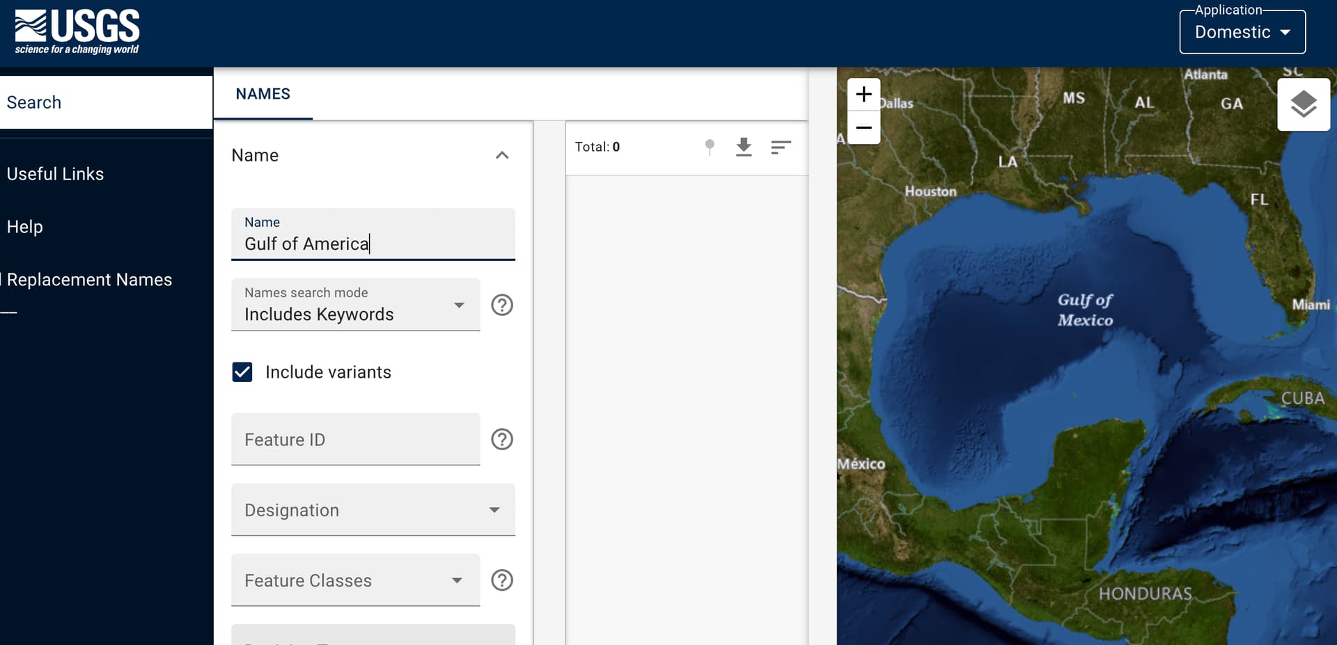
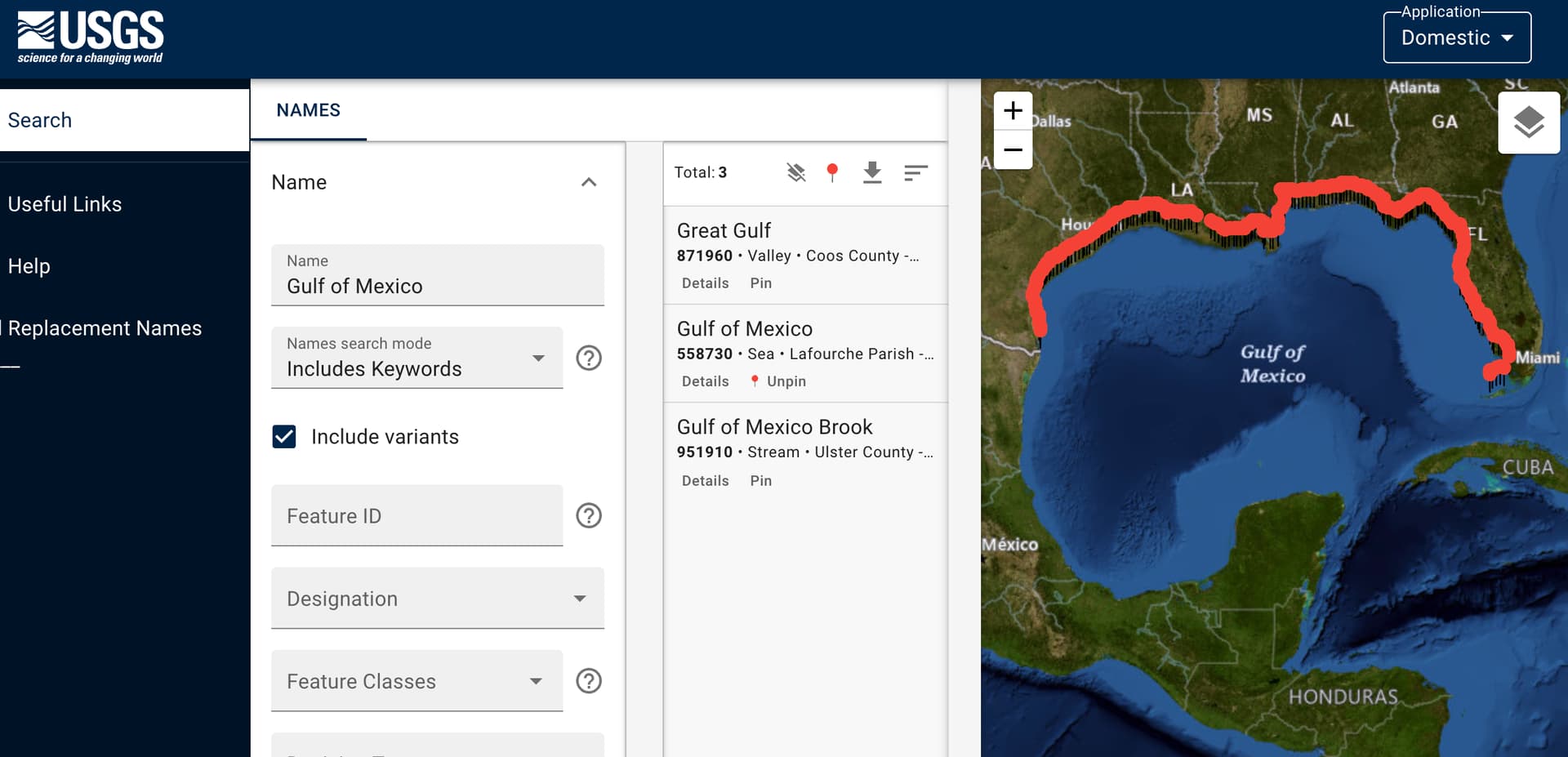
Until the new name shows up in GNIS, there is nothing to be done in OSM.
When a GNIS change does happen, the only question is which key we will use. As noted above, it won’t be name or name:en.
If the Gulf of Mexico were fully within the borders of the US, nat_name or official_name could be a good fit, meaning “the nationally recognized or official name used by the containing country”. A significant portion of the gulf is beyond the US border so these keys are not appropriate. I’m not aware of a key schema that means “the official name as recognized by a specific national government” for objects outside the boundaries of the country in question.
We do have well established language specific sub keys and their national variants. official_name:en won’t work because it would would imply that all English speaking nations agree on the official name. The more specific official_name:en-US means “the official name in United States English”. This gets us much closer. Although there is some slight nuance between this meaning and “the official name designated by the US federal government”, I think this should be close enough for the time being.
If the slight inaccuracy is troubling, perhaps we’ll further extend the name key prefix or suffix system to account for national name variations that aren’t tied to specific languages. This would be a longer term project though.
4 Likes
This might be a good incentive for them to implement proper parsing
1 Like
Looked up the exact definition of country codes in the standard now. “It can also be used to indicate that content is expressed in a way that is appropriate for use throughout a region, for instance, Spanish content tailored to be useful throughout Latin America.”, with example ““es-419” represents Spanish (‘es’) appropriate to the UN-defined Latin America and Caribbean region (‘419’).”. So in fact, it’s not limited to dialects as American English (or the English used in US), but can simply be English content suitable for USA. https://www.ietf.org/rfc/bcp/bcp47.txt
Did you mean “Gulf of America”, or were you suggesting that name=* should be in Spanish? In general, the language of name=* for high seas is still an unsettled topic without great options, but there seems to be significant support for standardizing on English based on nautical conventions. (For the Gulf, it’s currently in Spanish, which… might honestly be the best compromise given the circumstances.)
Jurisdiction isn’t the sole determining factor for the scope of a toponym. After all, the waterbody that separates Baja California from the rest of Mexico currently has name:en=* set to “Gulf of California” as preferred by the U.S. government, not “Sea of Cortéz” as preferred by the Mexican government, even though none of it falls under U.S. jurisdiction. In this case, “Gulf of California” is more common among English speakers, regardless of dialect but particularly in American English. In light of our project’s policy favoring on-the-ground verifiability, that usage matters more than any territorial considerations.
If it becomes clear that “Gulf of America” is only intended to apply to the portion within U.S. jurisdiction, then we can model it as a separate feature, but for now that’s just speculation. Remember also that creating a separate feature makes the name much more prominent, not less.
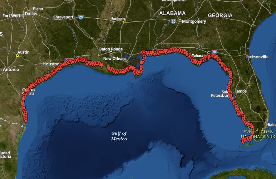
The Gulf’s node is tagged with both gnis:feature_id=* for the entry in GNIS, which covers names of domestic features, and as of yesterday, GNS:id=* for the entry in GNS, which covers names of international and foreign features. Neither database has been updated since the executive order.
GNIS geography can be quite imprecise for non-point features. For example, it tends to represent a waterway as a pair of coordinate pairs at either end, sometimes with additional coordinate pairs at arbitrary points along the waterway at county lines. Some lakes are modeled as a series of coordinate pairs forming a grid. The modeling of the Gulf along the Gulf Coast is consistent with the modeling of the Atlantic Ocean along the Atlantic Seaboard and the northern coast of Puerto Rico:
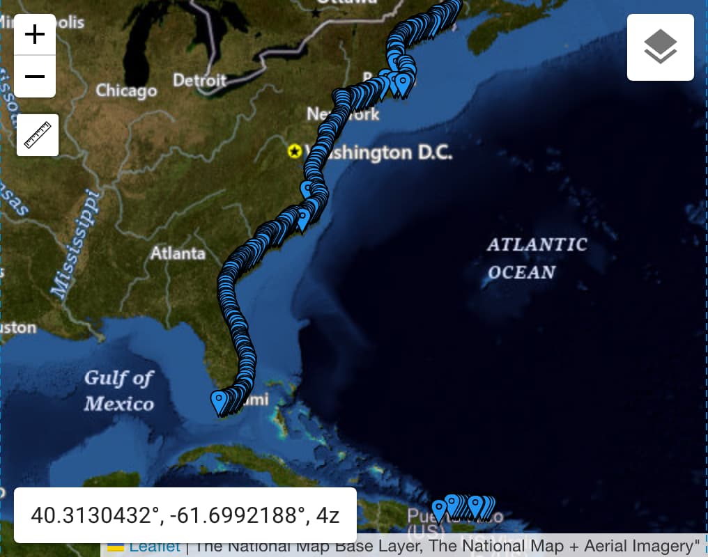
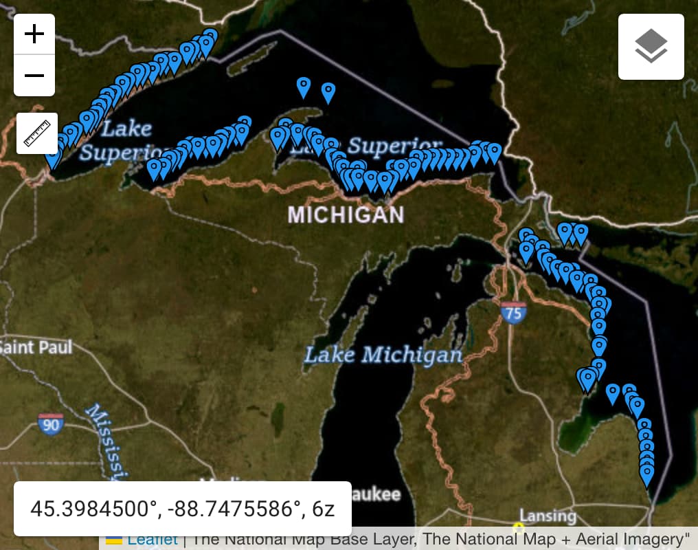
Whereas the record for the Great Lakes omits Lakes Erie, Michigan, and Ontario, which are indisputably part of the Great Lakes:
I wouldn’t read too much into the placement of these coordinate pairs. They’re only really there to give a general sense of the feature’s extent. As you can see from these screenshots, The National Map labels these waterbodies at their true centroids regardless of GNIS.
Anyways, I’d consider GNS to be a better source for the federal government’s position about the name of the Gulf as a whole. It also places the Gulf at the centroid:
![A map of the Gulf of Mexico annotated with a single point at the centroid. A popup identifies the point feature as the Gulf of Mexico, with alternative names Golfo de Méjico and Golfo de Mexico [sic]. (Public domain as a work of the U.S. federal government.)](https://community-cdn.openstreetmap.org/uploads/default/original/3X/7/e/7eb152e28100f03967fa77c9aea7bf6c3f976cf7.jpeg)
I expect this RSS feed to be updated as soon as any change occurs to any feature that GNS classifies as an “ocean” belonging to no country, including the Gulf. I don’t know of a similar feed for GNIS.
Most U.S. federal government agencies routinely put out materials in languages other than English. So far, we have no idea if the order will be interpreted as requiring, say, the Justice Department or the Voice of America to start translating “Gulf of America” into other languages such as Spanish. Would it be Golfo de América (Latin America says hi), or Golfo de América del Norte (Canada says hi), or for simplicity, back to what Hernán Cortés called it, Golfo del Norte? Then again, we have no idea to what extent these translation programs will be impacted by the administration’s anti-diversity orders. ![]()
2 Likes
I’m sorry, which part of:
take all appropriate actions to rename as the “Gulf of America” the U.S. Continental Shelf area bounded on the northeast, north, and northwest by the States of Texas, Louisiana, Mississippi, Alabama and Florida and extending to the seaward boundary with Mexico and Cuba in the area formerly named as the Gulf of Mexico
is speculation?
1 Like
I was responding to suggestions that we should carve out a new feature to apply the name, “along the coast”, presumably only extending out to the territorial sea limit 12 nautical miles offshore. That’s nowhere near any “boundary with Mexico and Cuba”. Or does the order refer to some other seaward boundary that delimits U.S. jurisdiction? If so, which one? The contiguous zone (24 nmi), EEZ (200 nmi), or continental shelf? In some places, the continental shelf extends beyond U.S. jurisdiction. Or does the order only define the Gulf in this way to eliminate any ambiguity about which body of water it refers to? This is not uncommon in regulatory text. Until we’re sure about what the order actually refers to, any separate feature’s position or shape is speculative.
It’s an awkwardly worded, internally inconsistent clause, probably intended to skate as close as possible to the limits of presidential authority without somehow overstepping. Most of all, picking a bounds at this point is speculative because the feature has not been renamed yet. The Interior Department has been tasked with defining exactly what has been renamed, but we haven’t seen the result of that yet.
2 Likes
The contiguous zone doesn’t reach Mexico, the continental shelf is not a boundary with Mexico, therefore by a process of elimination it is the remaining option.