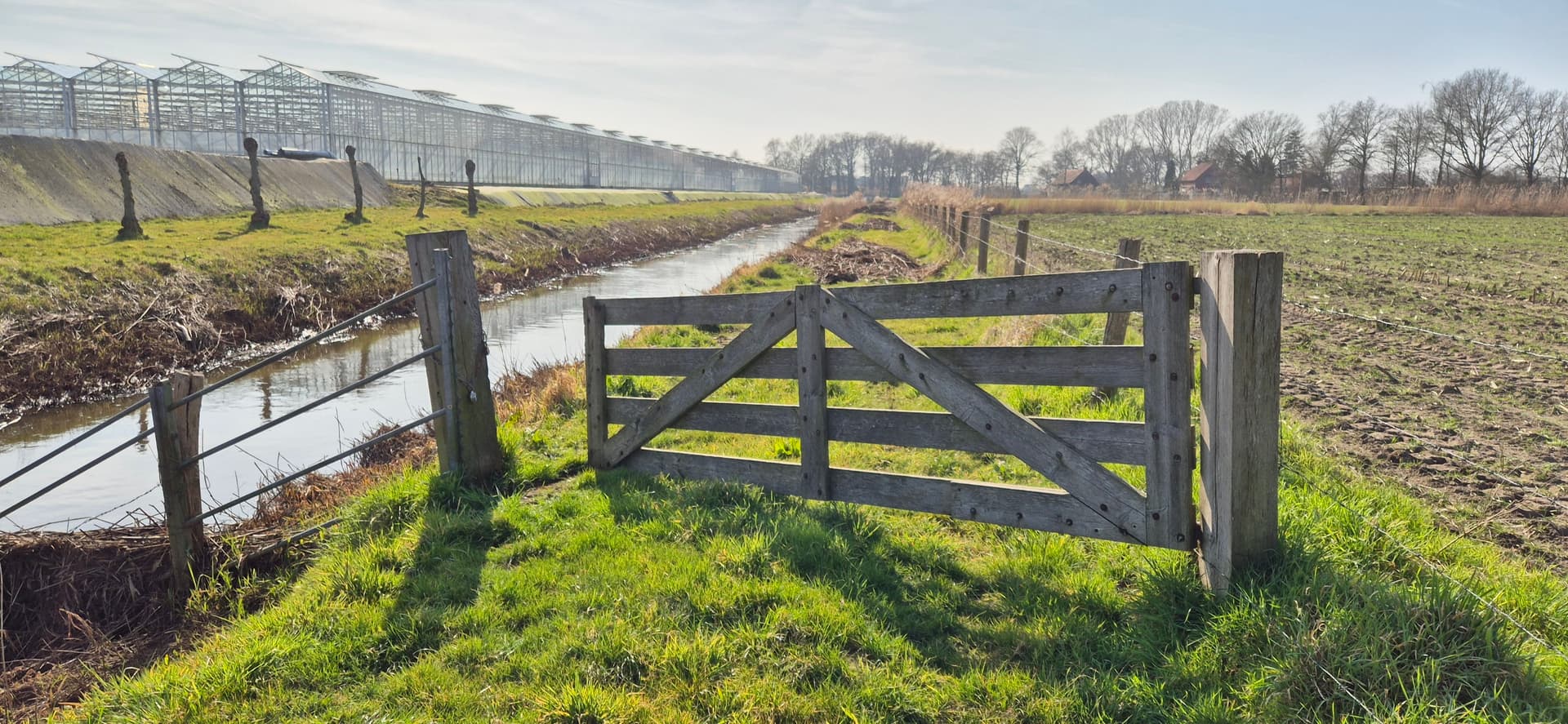
I’ve been exploring next to a stream. At the start, I could access the area through a small wooden gate for hikers. It has the message “keep closed, grazing animals.” I finished most of the unknown trail and came across a large wooden gate at the end (see image). I was lucky to be able to push this gate open, but had a lock and chains to close it up if desired.
As far as I’ve seen, this is the only exit point on the other side, except for a small gate in between to a farm yard which would be private (I e-mailed the farm business for further info on that).
Now comes the problem. This path has not been added yet, and I will, but I’m not sure how to tag this gate. Because there is no other exit point so far, and I don’t want other hikers to be stuck at the end and have to walk back 1.2km.
If I’d found this gate locked (on my way out the fenced area) and had to decide, whether to walk the extra mile back and some unknown extra miles more, I’d just jump the gate.
I guess I said that before: Openstreetmap in desperate need of “gate_scale” a difficulty rating of gates.
PS: Note that sac_scale not able to fill the void, as sac_scale implies foot=yes, and likely not all pedestrians comfortable with any of the hurdles gates can present.
I use Locked=yes often on privated area’s or gates that are obviously ment to keep the public out.
The gate in question is one that belongs to the Ministry of Infrastructure and Water Management, and the path is one they use to manage the nature and gives acces to the grazers. They allow you to travel on these paths unless the gate is locked or there’s a sign that prohibits it.
The problem also lies in routing apps. If i knew which months or a specific time It think it would work. Otherwise it’s always a yes or no option. If i remember correctly I’ve seen that my routing app closes a path a certain time of day, for example across a fenced business area.
I never understood access or lock tags with gates. For example, there’s technically a gate at my local park. At one point I think it was automatic. There’s a sign that saids gate open dawn-dusk but in reality it is open 24/7/365 rain or shine (or hurricane). So it’s as if there is no gate in reality but there’s 2 signs that say otherwise and theoretically could be closed (and I assume locked) by the parks department even if they never do so. FWIW I mapped this as gate and nothing more because I noticed when I did any more routers started not taking me into the park for trails or parking which is of course accessible to the public.
I got in touch with the local buisness today and they can’t confim the path actually being there. Allthough it’s clearly accesible from one side. Otherwise the Ministry of Infrastructure and Water Management would’t maken an accesible gate there with a sign on it to close it after entering .
And the small gate to their farm is indeed private. They also told me they would’t prefer the path being there behind their yard in case of disturbing them and the nature. So maybe making the path as a dead end would be the best in this case?
If there’s a path behind the ‘hungerburg highjump’ gate then we’re obliged to map it too. It’s one of those where ‘permissive’ might apply but then you have to specify what can and what not as e.g. Osmose will tell you it’s too broad, horses, hazmat, 50 ton 18 wheelers and what not, so then access=no, foot=permissive with 173K use, livestock A OK (just kidding).
This section of path next to the stream also belongs to the Ministry of Infrastructure and Water Management. They use these paths to maintain the nature and mow the grass. These paths are passively accesible to the public unless theres a sign or a locked gate.