The main motivation is that legally speaking, tramways in Germany are either street-level (i.e. embedded on the carriageway), exclusive (physically separated from the street) or independent (built more like a railway, also includes grade separated tracks). There are other rules such as legal access (e.g. cars have no lega laccess on such tracks, though busses can) and signalling (exclusive tracks need at least a Saltire for crossings, at least for highways) but for OSM, the interaction with the highway is the most relevant one.
One example I’m the most familiar is Mainzer Landstraße in Frankfurt which between Galluswarte and Mönchhofstraße is only separated by paint (which usually is considered not enough to warrant a separations on OSM) and on top of that, the only warning signs I found were some tram images on pedestrian lights but none on highway crossings — they only appeared further west. Relatedly, Heidelberger Landstraße in Darmstadt also is tagged as a dual carriageway even though some disagree with that idea and in the same city, I mapped this piece of street separately from the actual dual carriageway even though it has no physical separation up until the stop in part because of my uncertainty regarding the tram/bus lane.
Lastly, embedded_rails also need to be updated to reflect the use of that as while it mentions legal access, it also refers to exclusive trackbeds instead of exclusive tram lanes and doesn’t cover the latter case.
Wäre es nicht einfacher, diese Diskussion auf Deutsch im deutschen Forum zu führen?
Im Allgemeinen denke ich, dass das Wiki nicht mit dem zunehmenden Detaillierungsgrad Schritt gehalten hat. Wo hochauflösende Luftbilder vorliegen reicht es nicht mehr, die Straßenbahnstrecke als einen way zusammen mit dem highway abzubilden, sondern inzwischen mappt man jedes Gleis separat. Es kommt zwangsläufig zu Konflikten mit der Straßengeometrie. Irgendeinen Kompromiss muss man dann eingehen.
Eigentlich nicht, dass die Beispiele hier hauptsächlich in Deutschland sind, liegt nur darin, dass es sich um meine Hauptbearbeitungsgebiete handeln bzw. dass ich die drei Gleiskörper der BOStrab aufgezählt habe, habe ich nur gemacht, um den Unterschied zwischen den Teil einer Fahrbahn und getrennter Fahrbahn zu verdeutlichen. Allerdings ist es letzten endes ein internationales Problem und z.B. der Fragesteller im verlinkten Thread kommt aus Russland.
I’ve wondered about the same question. Specifically, should exclusive (tram only) lanes that are separated from normal traffic lanes only by a white line be included in the road highway, using :lanes tagging (e.g. embedded_rails:lanes, access:lanes)? (In addition to being drawn separately as railway=tram) And, maybe a separate question, do they “count” for the lanes=* tag? I went looking for the answer on those two wiki pages and don’t have anything to say about it.
Is there a consensus? If so, it would be great if it could be documented on those pages.
To revive my question, I’ve changed the Bismarckstraße to reduce the duplicate way so that question has been solved but there still are others I’m in the dark.
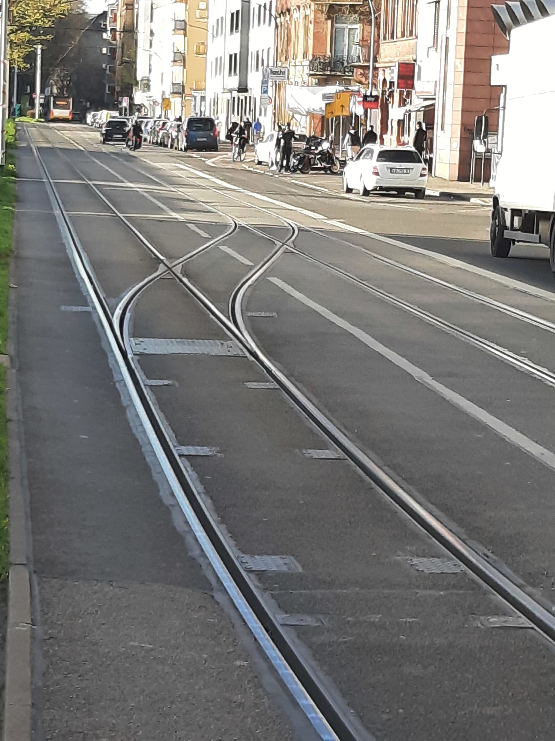
Here is another example of a tramway which is part of the carriageway of a public RoW (albeit also used by busses) and not protected by barriers:
For context, this this is how the way is currently mapped, the bus-/tramlanes being separate from where cars drive which only applies further north the road.
And for completion, here is a Mapillary link to Mainzer Landstraße in Frankfurt (the exclusive but unprotected tram lanes) to show what I really mean.