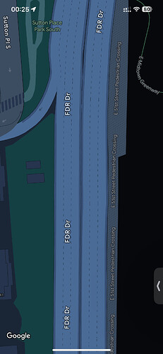
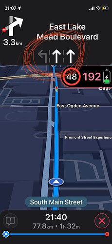
I have identified a crucial feature that is missing in the current road options. Currently, when we select primary or secondary roads with multiple lanes—whether they have 2, 4, 6, or even more lanes—OpenStreetMap displays just a single line representing both directions of traffic. This approach can be quite limiting and does not accurately convey the structure of multi-lane roads.
To enhance the usability and accuracy of OpenStreetMap, it would be highly beneficial to incorporate lane lines in the middle of the roads. By clearly delineating individual lanes, we can provide a more precise representation of the road layout. This improvement would make it easier for users to identify the number of lanes and their respective directions, significantly aiding in navigation and route planning.
Furthermore, incorporating lane lines would provide substantial benefits for third-party mapping applications that rely on OpenStreetMap data. These applications, which often include advanced navigation features, could utilize detailed lane information to offer more accurate lane guidance and turning instructions. This enhancement would not only improve the user experience for drivers but also support the development of more sophisticated navigation tools.
In summary, adding lane lines to represent multi-lane roads in OpenStreetMap is a much-needed feature that would enhance the map’s accuracy, usability, and functionality. It would provide clearer visual information and support better navigation features for third-party applications that use OpenStreetMap data.

