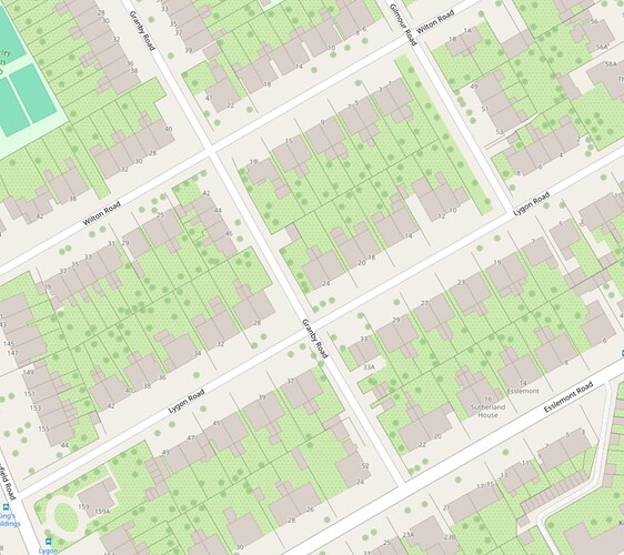
Edinburgh is very well mapped, however I’m not sure about the buildings…
Is there a reason that conservatories & porches etc are mapped as a whole separate building? Does the Edinburgh community do this deliberately? Or is it something we should work on fixing (converting to building:part). It seems to be the case for a majority of buildings.
Perhaps if you explained what it was you’re “not sure about” then people might be able to comment…
Do you mean the extensions that have been drawn as separate buildings? I doubt anyone would object if you wanted to change them and the outline of the original houses to building:part and add an outline for the whole building.
If you mean terraced houses and semis being mapped as separate buildings I think that’s standard isn’t it?
If you’re in Edinburgh, you’re welcome to join the monthly pub meetup, you could ask there.
Also if you leave a note, more local mappers will see it than on here
Sorry, I thought it was clear enough from the title, I mean the way the conservatories & porches etc are mapped as separate buildings attached to the main building, instead of using building:part.
i’m just trying to understand if there’s an actual reason it was done this way.
