I’m a bit confused by the documentation on ASLs. Does anybody have any good examples of intersections in OpenStreetMap that contain both an ASL, a pedestrian crossing, and traffic lights at an intersection?
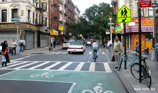
Here is what I’m trying to map, except it’s a larger intersection with traffic lights in each lane, and crosswalk signals crossing each road. It includes the stripes on the crosswalks and the ASL as shown in this example:
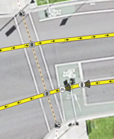
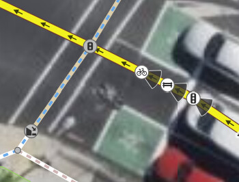
Sounds about right, mapped a few here done by that principle and motor vehicle drivers hate them. They’re’ sitting there behind you and counting and hoot just before turning green to get out of their ‘i’m always in a rush’ important way.