Tervist!
Ever since @dgmapping shared a nice Maa-amet WMS link to trace and verify buildings in Tool for finding missing buildings: OpenStreetMap vs Maa-amet - #17 by dgmapping, I’ve been thinking that it would be nice if we included this kind of choice as one or multiple default background layer(s) in iD, maybe also JOSM.
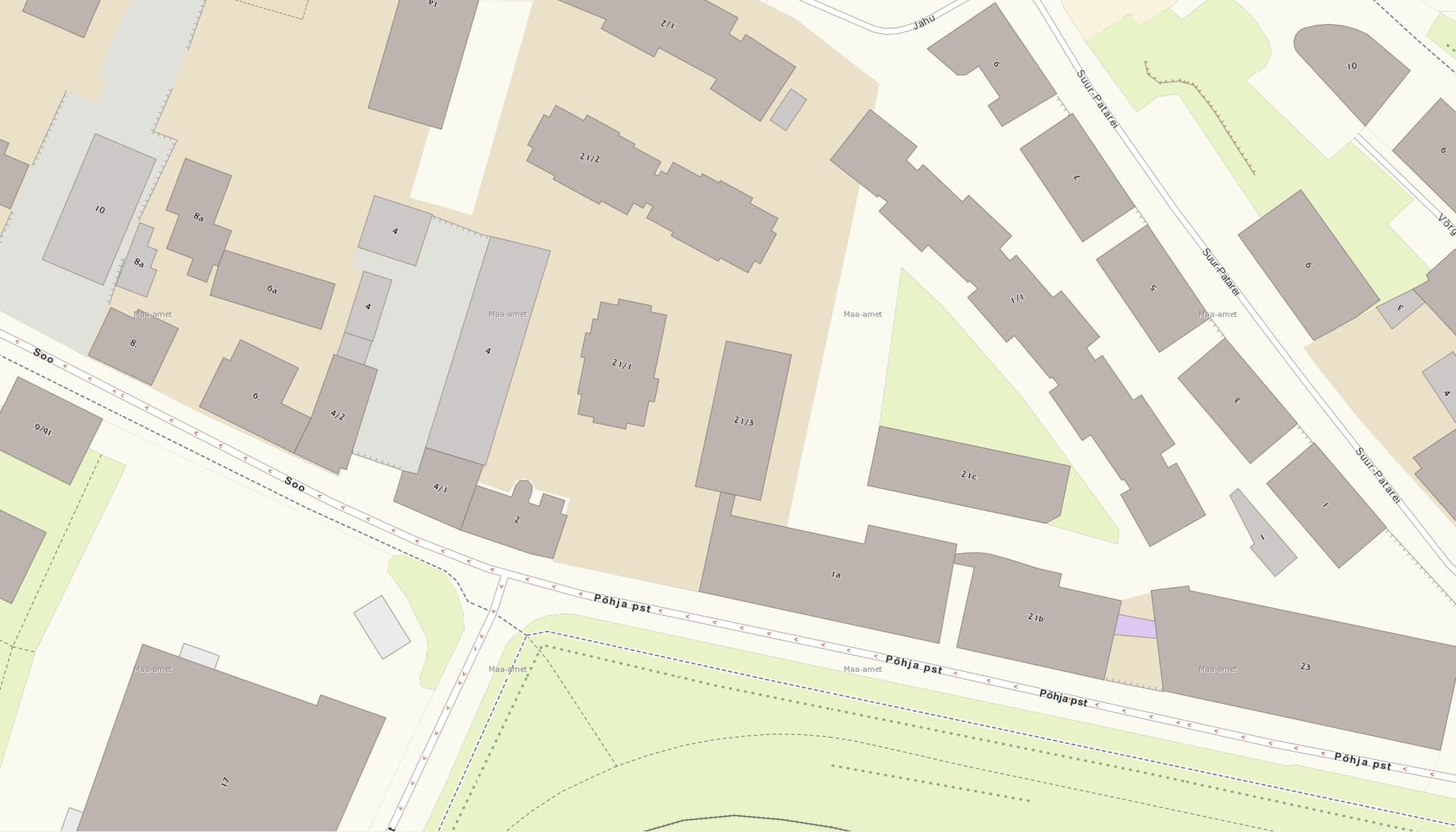
The question is: what do we want to include or do, if anything? ![]() Those vector tiles seem to be a net improvement over the Maa-amet raster basemap, and according to @dgmapping are also updated daily, versus yearly for the raster basemap. They shine especially on high zoom levels and get rid of a lot of uncertainty when drawing building outlines.
Those vector tiles seem to be a net improvement over the Maa-amet raster basemap, and according to @dgmapping are also updated daily, versus yearly for the raster basemap. They shine especially on high zoom levels and get rid of a lot of uncertainty when drawing building outlines.
I was thinking myself of replacing two default layers (existing imagery appears first, “new” imagery follows, WMS link included for you to try it out yourself):
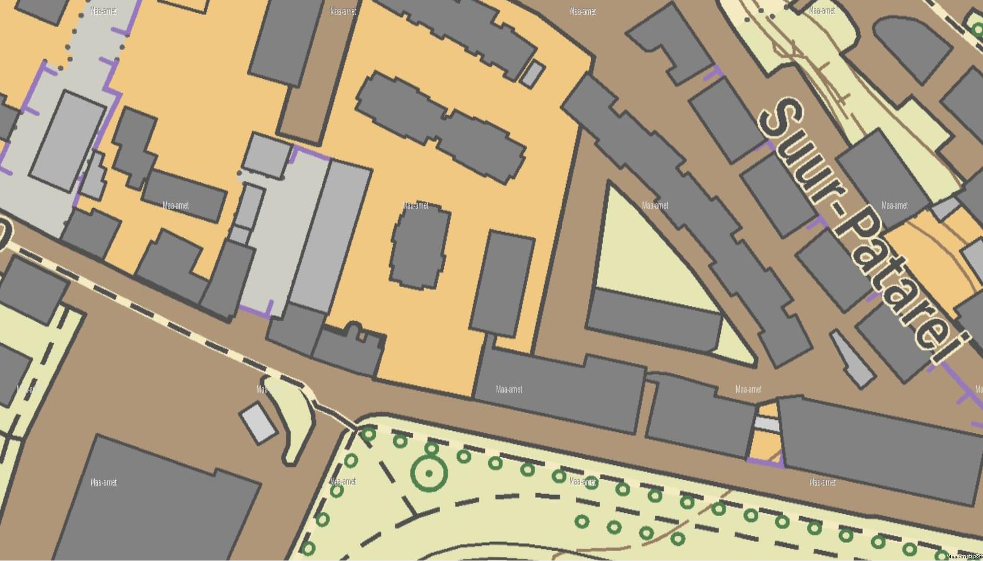
- Maa-amet Basic Map with
http://kaart.maaamet.ee/wms/alus-geo?FORMAT=image/png&TRANSPARENT=TRUE&VERSION=1.3.0&SERVICE=WMS&REQUEST=GetMap&Layers=CORINE,BAASKAART,KAART24,HALDUSPIIRID,TEED,KYLAD&STYLES=&CRS={proj}&WIDTH={width}&HEIGHT={height}&BBOX={bbox}
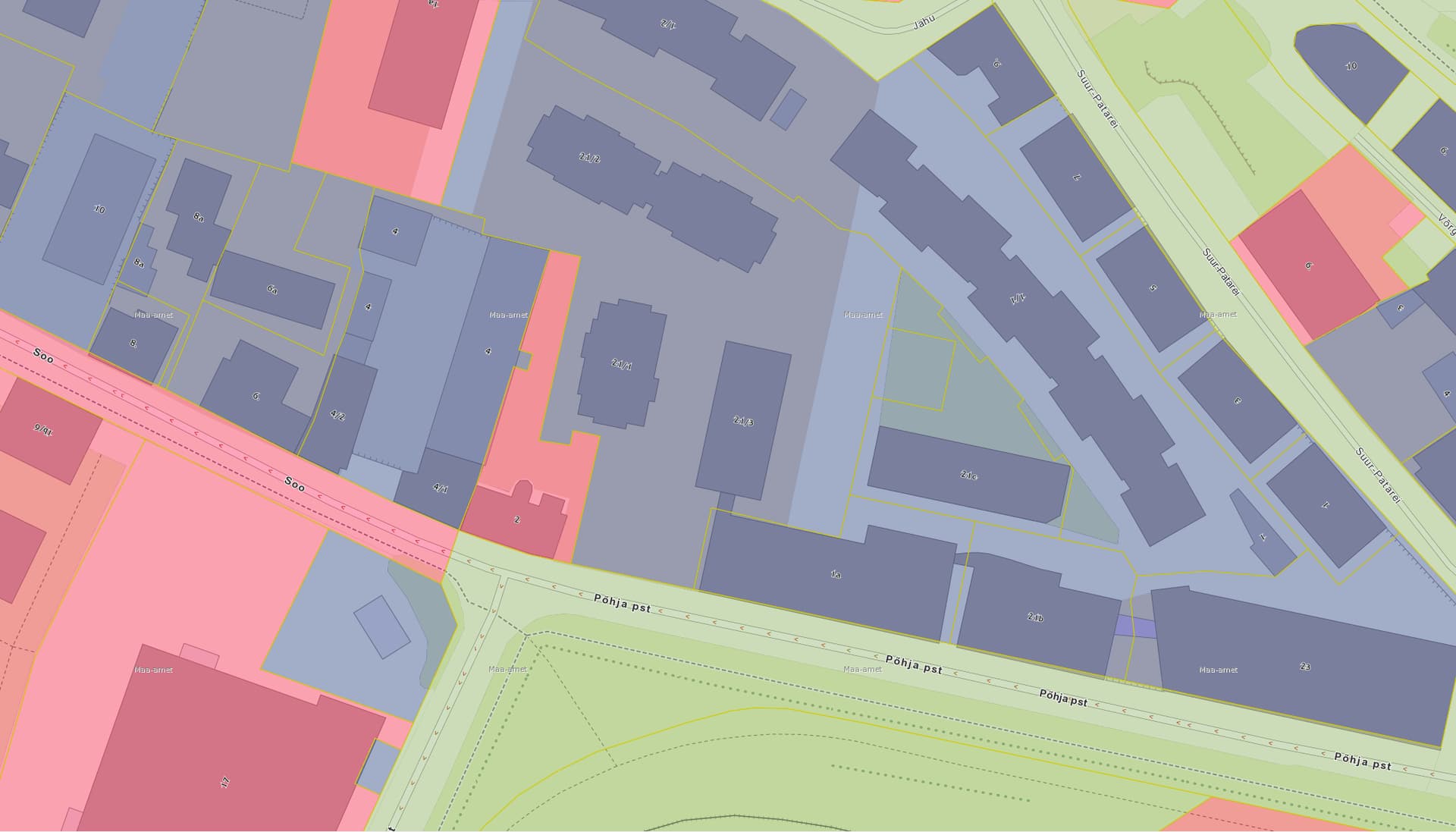
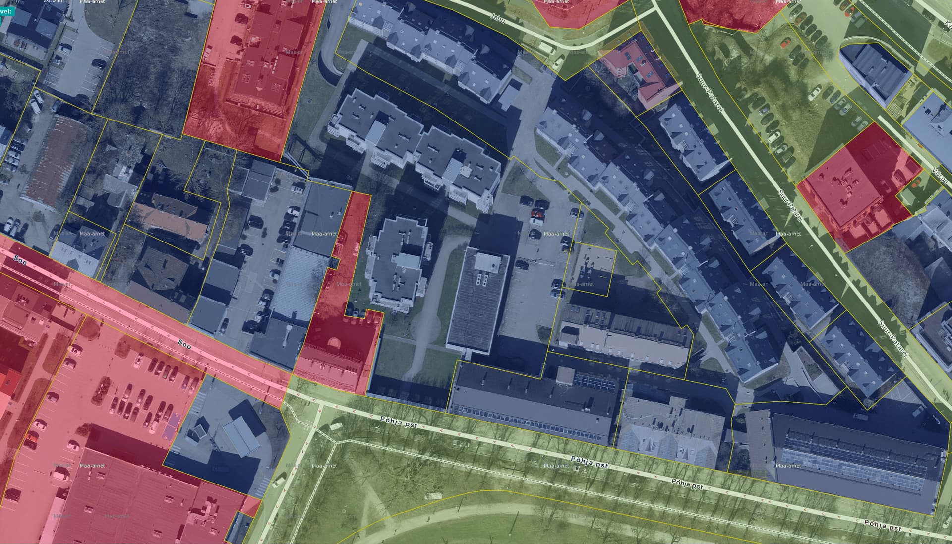
- Maa-amet Cadastral Map with a derivative of the above baaskaart, with the cadastre layers activated, without the aerial imagery:
https://kaart.maaamet.ee/wms/alus-geo?FORMAT=image/png&TRANSPARENT=TRUE&VERSION=1.3.0&SERVICE=WMS&REQUEST=GetMap&LAYERS=CORINE,BAASKAART,KAART24,HALDUSPIIRID,TEED,KYLAD,TOPOYKSUS_6569,TOPOYKSUS_6573&STYLES=&CRS={proj}&WIDTH={width}&HEIGHT={height}&BBOX={bbox}
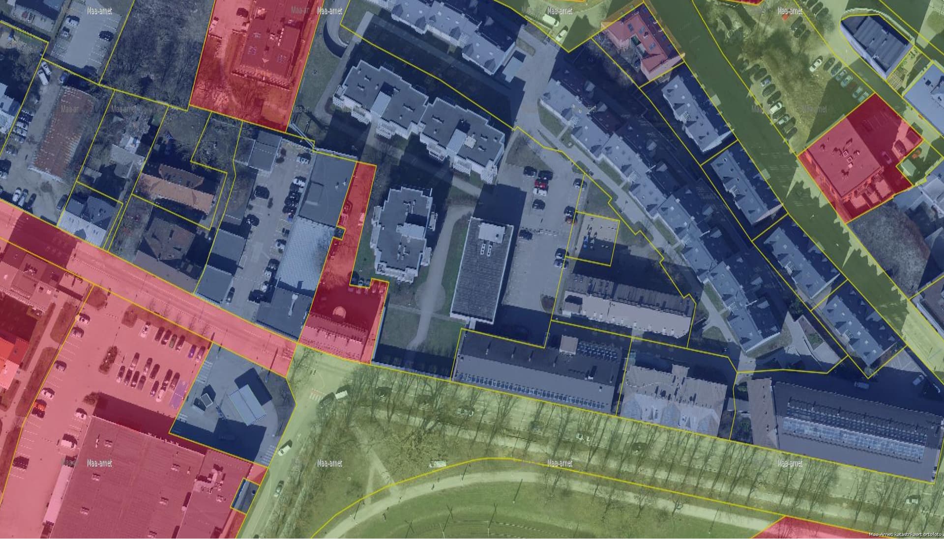
On the cadastral map, note that there is no ortofoto layer shown in the above image (which would be layer of10000 in the WMS request). We could still have it included by using this WMS request: https://kaart.maaamet.ee/wms/alus-geo?FORMAT=image/png&TRANSPARENT=TRUE&VERSION=1.3.0&SERVICE=WMS&REQUEST=GetMap&LAYERS=of10000,HALDUSPIIRID,TEED,KYLAD,TOPOYKSUS_6569,TOPOYKSUS_6573&STYLES=&CRS={proj}&WIDTH={width}&HEIGHT={height}&BBOX={bbox}
Which would give us this image:
I personally find it more noisy, having the aerial imagery, but would not oppose to use this instead of what I proposed above. (we also already have the unmarked aerial imagery layer available with the Maa-amet Ortho WMS and TMS layers).
Or maybe we want to just add these new layers and also keep the existing ones? Maybe add “raster” to the existing layer names, and “vector” to the new ones to be added? Or do something else entirely?
Any opinions or thoughts? ![]()
For reference, the layers which iD and other editors show exist here: editor-layer-index/sources/europe/ee at gh-pages · osmlab/editor-layer-index · GitHub, so any outcome of this discussion would eventually result in some kind of pull request against that repo, I’d reckon.
For JOSM, we’d have to modify the Trac wiki pages as I understand it: Maps/Estonia – JOSM
I could volunteer to edit those places I think, but we’d have to agree on something to do before that ![]()