Within the OSM iD-editor, you have the feature typesBus Platform and Bus Stop.
The additional information on both points to Tag:public_transport=platform - OpenStreetMap Wiki but the additional fields of information differ wildly. Bus Stop has fields like shelter/bench/waste bin, etc., whereas Bus Platform does not.
Interesting, the two tags are basically synonyms now iD always adds a public_transport=platform when you use Bus Stop. However, public_transport=platform is a generic tag applying to railway station platforms, ferry boarding areas, tram stops, taxi ranks and no doubt some other things. You need to add a transport mode such as bus=yes to make it the same as highway=bus_stop.
The public_transport tags were introduced to unify some aspects of different modes of public transport, but at the same time were perhaps too biased to certain types of data consumption and less so towards other uses. As a consequence their adoption was not universal and hence a degree of synonymy arose. The wiki is just inconsistent: all the tags are likely in use. A more useful starting point is to use taginfo and look at actual usage.
However in the EN-GB version of iD I’m using all these platform options offer departure indicator and shelter, and none offer waste basket or bench. I also don’t see ‘Bus Platform’, but do see ‘Transit Platform’.
Addendum: what @SekeRob describes is a public_transport=stop_position'. In the dim and distant past highway=bus_stop` was used in this way, but by 2009 when NaPTAN data were imported in the UK this was not the case. All that data refers to the marker (technically called a flag) at the road side where passengers wait.
Bus Stop is standard British idiom for where passengers wait for a bus, not where the bus stops (which at larger stops is not predictable). In Jilted John’s eponymous song :
I was so upset that I cried
All the way to the chip shop
When I came out there was Gordon
Standing at the bus stop
This shows the typical context of “bus stop” and certainly refers to the place with a sign on a pole with any ancillary equipment or facilities,
As such I would expect it to appear in other languages in editors as Haltestelle, Arrêt de bus, Parada de autobús, etc. Note the EN wikipedia article is no help at all as it conflates the passenger waiting place and the actual stop location on the road carriageway.
The bus stopping position is not something of general interest to mappers, and in locations served by several bus routes is meaningless if 2 or more buses are boarding or dropping off passengers at the same time. It is of interest to transport professionals, and possibly some wheelchair users and others with restricted mobility who require level access (e.g., though a raised kerb at a bus stop).
Hmmm, now the plot thickens as there is indeed another feature type in iD: Bus Stopping Location.
Now I can make sense of a platform where one can wait for transport (be it bus of whatever, including properties like shelter, bin etc.) and a stop location as a place where the transport will actually stop (including properties like timetable etc.).
But where does that leave the feature type Bus Stop?
What does it actually represent?
What raw tags do you see for the two feature types when first created, under “Tags” near the bottom of the edit feature panel)? (It is often helpful to look at these when mapping in ID, as the name of of the feature type is specific to ID, whereas the raw tags are what will actually be saved, and are used in the wiki and tools such as taginfo).
Like @SK53 my version of ID doesn’t seem to present exactly what you describe. For me, the initial tags for the feature “Bus Stop” are
public_transport=platform
bus=yes
highway=bus_stop
This works for the place by the side of the road where passengers wait. The need for 3 tags for this simple concept goes back to the way public transport tagging developed historically as SK53 said. But you don’t really need to worry about that, those 3 tags should be interpreted correctly by all applications, along with any you add such as shelter=yes.
In my ID version, the feature “Transit Platform” has only the tag public_transport=platform, so is more generic and does not specify that this is a bus stop.
As mentioned, it is possible to additionally map the stopping position on the road - this would be a node directly on a “highway=” object. This is seen as optional in many areas - I’d suggest you don’t dive into mapping those unless it is common practice where you live.
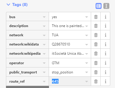
Also mentioned above is the tag route_ref. I’m not sure if many applications use this field (compared to using route relations to represent which bus stops belong to which routes).
My understanding, a platform (bus stop shelter e.g.) is to the side of the road and has to carry that public_transport=platform tag. A bus stop is the physical position on the road where the bus halts and gets the stop_position value. Most here in town have now a marked out stop area where no one else is allowed to park or obstruct (a pipe dream of course)…I rarely map them, only when the bus stop pole is completely AWOL like here
Otherwise I only make the platform a member of bus routes and denote that with the route_ref tags.