Has anyone written a guide yet - on the OSM Wiki, or on OSMUK’s pages - describing how to map the OpenStreetmap postal address concepts in addr:* to the Royal Mail’s concepts of addresses?
The RM ones are best documented by Frank’s guide, but there’s the RM’s own page too.
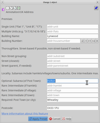
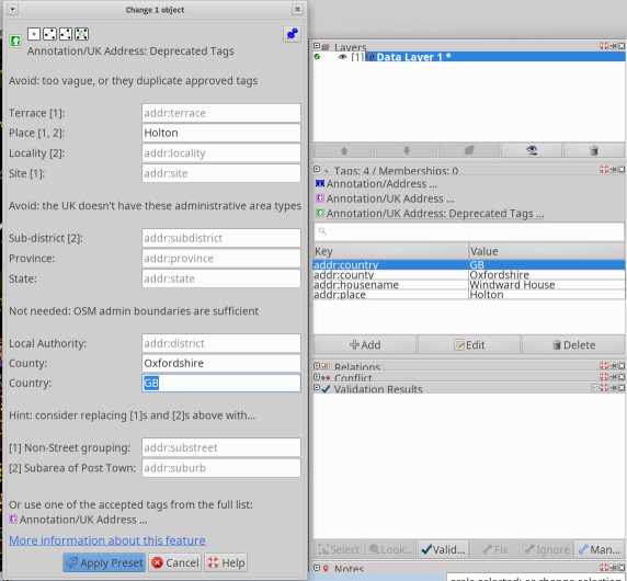
What I want: I’d appreciate something a clear and unambiguous table with entries like like “addr:city in OSM must always be the Royal Mail Post Town” or similar, down to the housenumber level.
And why: I come across villages near here which seem to require addr:housename and addr:place=<VillageName> because the streets are genuinely unnamed, as confirmed by locals.
There’s even a hamlet that’s really a suburb of a sprawly village which seems to use addr:housenumber and addr:place=<HamletName> still on its main street, but for now I’m fudging that into the road name based on confirming historical info and the way the former village pub used to write their address (just “38 Littleworth, Wheatley OX33 1TR”, not “38 Littleworth Road, […]” or anything. It’s TBD: I need to visit in person and see what people say and what’s written on the house numbers before coming up with a plan.
(This is also a call for you to post your weird local ways of doing addresses, or areas where the ascended Karlsruhe schema doesn’t really cut it in .uk. Give me corner cases!)