I’m trying to have a leaflet map based on the Pick-a-Peak example, but with a custom Nominatim instance, and a custom overlay (obviously not peaks) that includes nodes and ways.
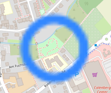
Getting the search and everything to work was no problem, but the overlay is giving me headaches, because it blurs at high zoom levels like this:

The object that’s blurred is a pretty standard rectangular:

For nodes, it looks even more weird:
I’m creating the vector files with
tippecanoe --no-tile-compression --no-feature-limit --no-tile-size-limit --no-tiny-polygon-reduction -f -ps --drop-densest-as-needed -e data/tiles data/boules.json
Everything else is the same as the example from ther talk. No matter what I try, my tiles are always blurred at higher zoom levels. What ideally like to have is
- just the contours, not filled
- same resolution as the map
- if it has to be filled, how to specify the colour?
Anyone has some experience with this?
ps. The tagging of these places is horrible, please don’t complain about these pitches having a name. The reason I’m doing this special map, is to convince certain people, that we don’t need names, but convert to proper tagging.