For a while, I started seeing edits from this challenge, but it seems to me rather useless and adds false detail on the map. I can understand when such water towers are redrawn:
I agree with you, but unfortunately the wiki is not very clear about it. https://wiki.openstreetmap.org/wiki/Tag:man_made%3Dwater_tower
and leaves it open to the contributor to decide.
Personally I would draw an area for the first picture and add building=water_tower to it. https://wiki.openstreetmap.org/wiki/Tag:building%3Dwater_tower
for the picture on the wiki page man_made=Water_tower I would probably draw an area as well, without building and for your second picture just a node.
But as the wiki does not give strict instructions everything is “not wrong” - making a map-roulette challenge out of it and change all of them? Well I do not think this is too clever…
Clearly the creation of this way (your example above) in this changeset by this user is just silly. As you say, the actual structure of the water tower can’t be seen (other than it is “very small”). Mapping it as a way of any shape is just guesswork.
It wouldn’t be fair to assign any blame to the actual mapper here. They’re trying to improve the data in OSM, and the Maproulette challenge - which is listed as “Easy” - simply states:
Be sure to copy every node tags to the area (the easiest way is to merge the node into the new area)
If possible, merge the node with the existing area
It no stage does it discuss which water towers it makes sense to map as ways and which it does not.
I would suggest contacting the author of the challenge and asking them to improve the description. The page lists it as “World Binnette’s Project”; that links to this page and the owner of that project is this OSM user. I’d suggest messaging them, or (if you can find a relevant one) commenting on one of their changesets asking them to either make the description of the Maproulette challenge much better or disable it altogether.
If either one of those contact methods don’t work after a week or so (obviously people may be busy with other things at this time of year) I’d suggest talking to OSM’s Data Working Group** about it so that we can bring the matter to their attention - send an email to data@openstreetmap.org .
It’s worth mentioning here that this particular challenge was four years old and there are 31 similar ones that may also need changing.
Trigger Warning, Strongly held personal believes that might be controversial below the fold (horizontal ruler):
Some people are at war with the PoI – they want to make this dimensionless entity vanish from openstreetmap. More dimensions (1 or 2 instead of 0), more nodes (20 instead of 1) will make the data inherently better, so the message. Mind you, the data resolution of openstreetmap coordinates is said to be 8mm in the worst case. Above tower could be mapped even more “precisely” – I do not subscribe to this school of thought. Never mind that on all the aerials JOSM has to offer, that tower is mapped in a wrong location, off by much more than 8mm.
I remember, lately emergency landing pads here were converted to areas by maproulette challenge: On the Ground these are just a letter H laid out by stones on a level mostly grassy field. There is no way to give the circumference. This is a repeating thing, up the dimensions, death to the PoI, it seems to me, personally, not wanting to offend anybody.
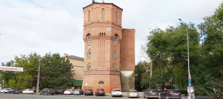
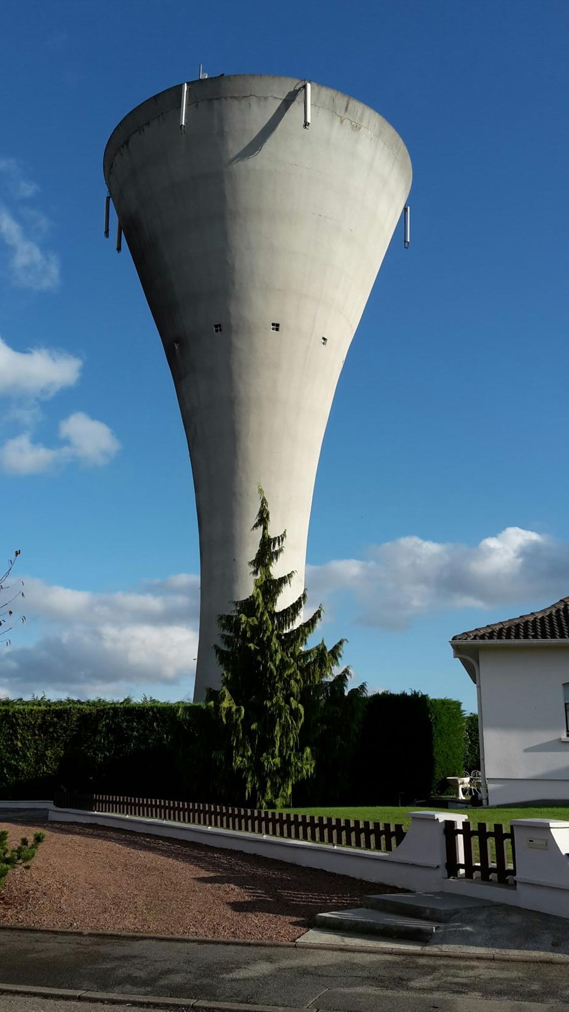
Interesting, are people expecting these man_made=water_tower areas to correspond to the footprint at the base or the maximum extent? The documentation doesn’t specify. Most water towers where I’m from are shaped like barrels or balls supported by pipestems, so there can be quite a difference:
Or is it like buildings, which should technically exclude any overhangs, but in practice often include overhangs because of limited information or attention? Personally, I normally don’t bother mapping water towers as areas, but I can understand the motivation since they cover more area than many buildings and other features that we usually map as areas.
Ironically, some of the lowest-quality imagery we have access to makes it much easier to map the footprint, if desired, due to obliqueness. Building imports can also introduce footprint-based areas. For example, this water tower’s footprint came from a building import apparently sourced from a LiDAR scan, but it would’ve been just as easy to map it by hand.
Fortunately, as with masts mapped as areas, renderers seem to be coping just fine with areas. Instead of preferring a node representation over an area representation or vice versa, we should just discourage guesswork: if you can’t visually determine the footprint, not even via a shadow, then either leave it as a node or map the maximum extent. Someone can come along later to transform it into a 3D building relation with building=roofs for the overhangs.
Of course, I understand the essence of Maproulette and that cartographers may not fully understand the danger of their actions.
Moreover, half a year ago I left a comment in Maproulette (Get in touch item) and a potential challenge problem, but apparently its author missed it. I admit, this problem is also not a priority for me, which is why I wrote on the forum only now.
And I should probably call the author @Binnette on this topic.
In general my suggestion boils down to limiting the suggested objects to something like the following:
node[man_made=water_tower][building];
out skel qt;
Since when does Maproulette appeal to cartographers? I thought it inciting mappers only. Or are you trying to make cartographers aware of mappers actions? A wholly different subject, IMO.
Alas, I suspect that you might be reading a little too much into the differences between those terms. Given what this discussion is about, I’m sure that you’re both talking about the same thing - “people editing OpenStreetMap to add more detail to it”.