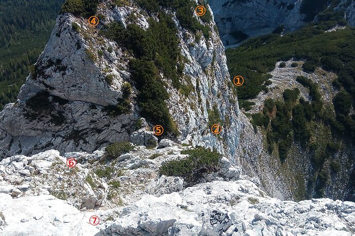
I have no problem with dimensionality in all pictures in the collage of mine, neither in those of @tekim s. There is vegetation in all of mine, should be good for size, shouldn’t it?
The trees in bottom of the collage are Pinus mugo (Latschen in German), as typical for where base rock limestone. I took measure in the administrative terrain model: The incline of the cliff is 60° in average and height around 60m to where the scree starts.
I like this picture, because the route is right in front of your eyes. It is only little more than 100m long. It is not a difficult scramble, hands for balance mostly, the only short part where hands for advance necessary hidden from sight though in the lower centre.
The openstreetmap path is tagged T6, a hikr.org user gives T5- and this section UIAA I. I’d say, surefootedness (including height for heights) all it takes. The footholds sometimes smaller than the boot, but plenty and solid rock. And that is good, the route quite exposed: Any tripping or slipping likely fatal. People died there, deliberately or by accident.
I showed the picture to people familiar with such surroundings, they had no problem with dimension. I wonder how many of those that did vote for path being appropriate to map UIAA III routes are? And the people that the wiki page will serve… That indeed might be a problem.
PS: Discourse should have a gallery of own uploads: Here for reference the route marked:
