Mostly I want to map the locations of rappel anchors and their access trails so that it’s easier for climbers to find the path down and stomp on fewer tree roots, etc. The tags on Climbing - OpenStreetMap Wiki are a little confusing:
climbing=bolt is for single bolts on a sport route? But could also be used for multiple bolts at an anchor?
climbing:bolt=abseil / anchor lets you differentiate between the bolts in the middle of a route and the bolts at the end that are used for rappelling? But it’s possible for bolts to be an anchor without abseiling, and it’s possible for bolts to be both an anchor and abseiling.
climbing:bolts=<number> is for a sport route climbing=route_bottom node or climbing=route way to say how many bolts the route has? And is not for “how many bolts are at the anchor”? Later the wiki says climbing:bolts=yes / no / <nr of bolts>, so it can also indicate whether a route has bolts at all.
climbing:bolted=yes / no / <average bolt distance in meters>: This is also for the route itself? The yes and no options are redundant with ``climbing:bolts=yes / no`?
If a tree is slung for anchoring/rappelling purposes, I don’t see how to tag it, since it’s an abseil point but not a bolt. There are Talk page suggestions for climbing:anchor=tree or climbing=abseil or climbing:abseil_point combined with natural=tree.
Not sure how to tag a point where you set up a trad gear anchor to reduce rope drag but can’t rappel off it, either. climbing:anchor=trad or something? There isn’t actually an object here, but it’s still a point of interest on the map with coordinates.
Climbing mostly vertical, no idea here how to recreate that in openstreetmap. PoI stacking one above the other via tags? (That when retreating in the middle?)
Is this still about climbing? Recently been watching climbers on the way down with binoculars and got me thinking, I could be of help in telling them: They looked like ants testing the surroundings. Took one of them a bit of lost height, eventually they found their way down. I guess that is part of the game GPS I suppose is not of much use, at least that is what I observed when in such terrain. What makes me wonder, why the “topo” or route description – they certainly used such going up – did not cover the way out?
Correct, being in the wrong location by less than a meter can be the difference between easy and almost impossible terrain - much less than the accuracy of a consumer GPS unit - not to mention that accuracy can be further degraded because ~half the sky is obscured by the rock.
The route looks quite different from above than from below and climbing topos are drawn from the climber’s perspective - not the perspective of someone reppeling the route. If there are fixed rappel (abseil) anchors they can sometimes be quite difficult to find when coming down, even if only an hour or so before you used them as belay anchors on the way up.
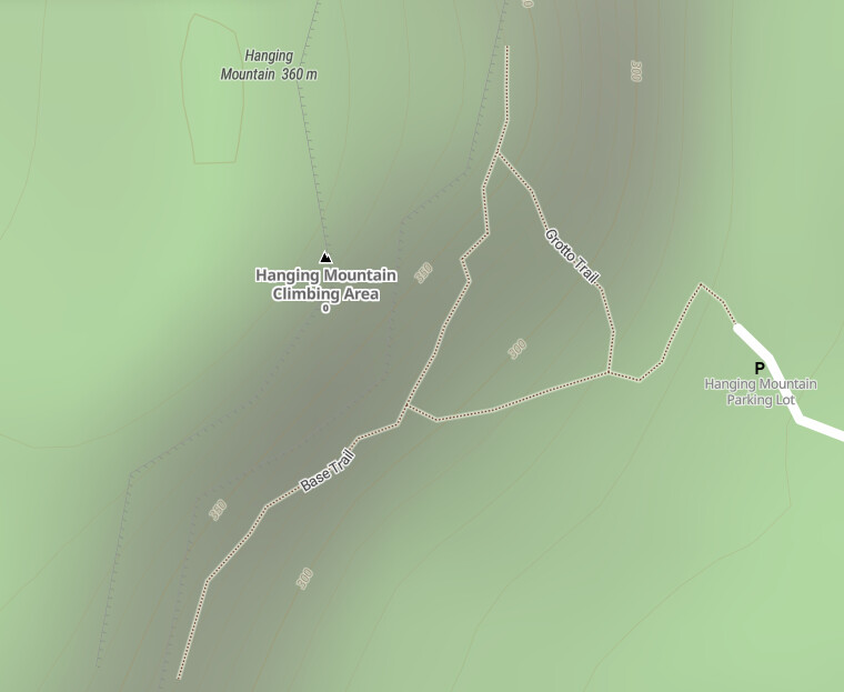
Most long/easy routes have some horizontal movement, too. I’ve mapped a few as experiments, but I’m not sure how useful it is to map the routes themselves:
Well it’s more like hiking to find the way down.
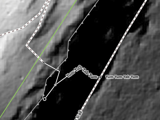
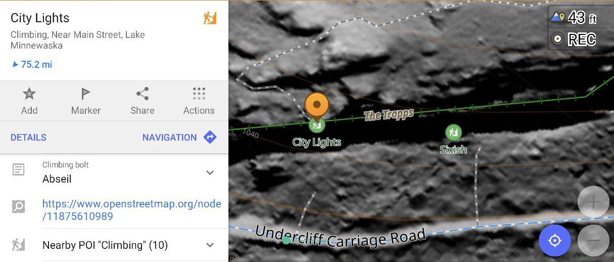
It does, but it can be confusing, which is why I want to map the rappel anchors in OSM. Real example from last weekend: I tried to do blue route and then walk to rappel, but I took red path by accident. I had a GPS point for the start of the green route, so I noticed I had walked past it, and went back.
Right now climbing:bolt=abseil only has 42 uses (TagInfo), whereas climbing:abseil_point=* has 64 (TagInfo). In my mind climbing:abseil_point=* would be preferred for actually marking abseil points.
One option would be documenting and expanding the values of climbing:abseil_point=* to add details in addition to yes. For example: bolts, fixed_sling, etc.
An alternative would be to use separate keys on the attachment to ground mechanism and the hardware in contact with the rope to give a better idea of what to expect. This could lead to combinations like:
For myself, the big distinction is how likely am I to need to bring replacement material or a new quick-link to back up/replace a faded old sling versus using the anchor as-is. While all anchors should be inspected, knowing that a route has newish stainless steel hardware versus slings of unknown age can be very useful.
Extending the above idea, maybe climbing:abseil_point:anchor:count=1?
Similarly, some points have a single ring/quick-link, etc while others have two. Something like this could be used: climbing:abseil_point:attachment:count=1
Is there any application that reads these tags?
Lately I’ve started mapping with openclimbing.org and adding the routes and anchor points there. They save the bolt locations and the lines in a text field, so they are drawn over the topo photo. I prefer that approach because it is visual. A bunch of letters and numbers is hard for me to remember.
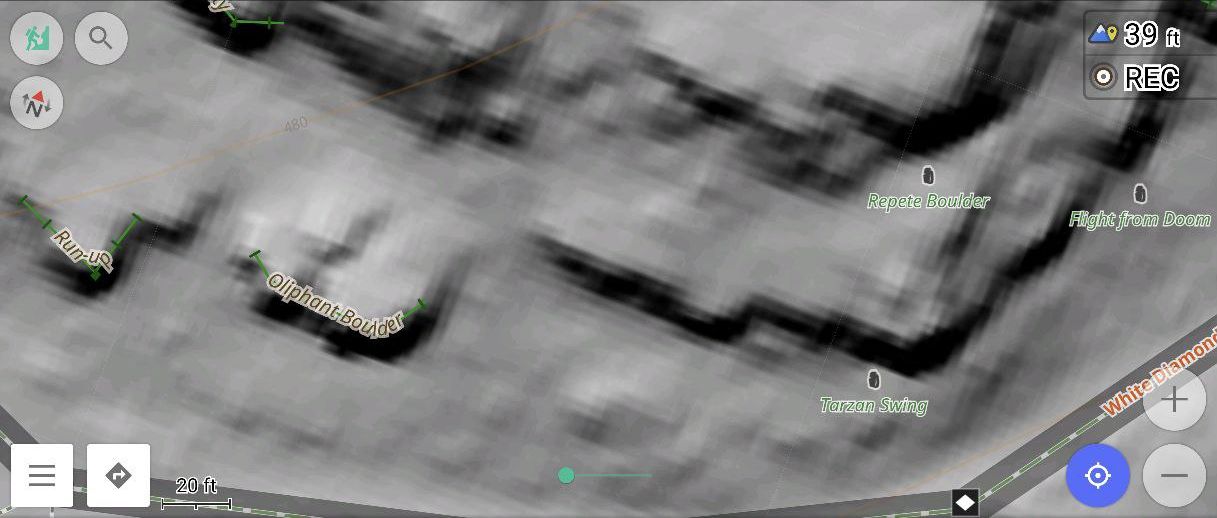
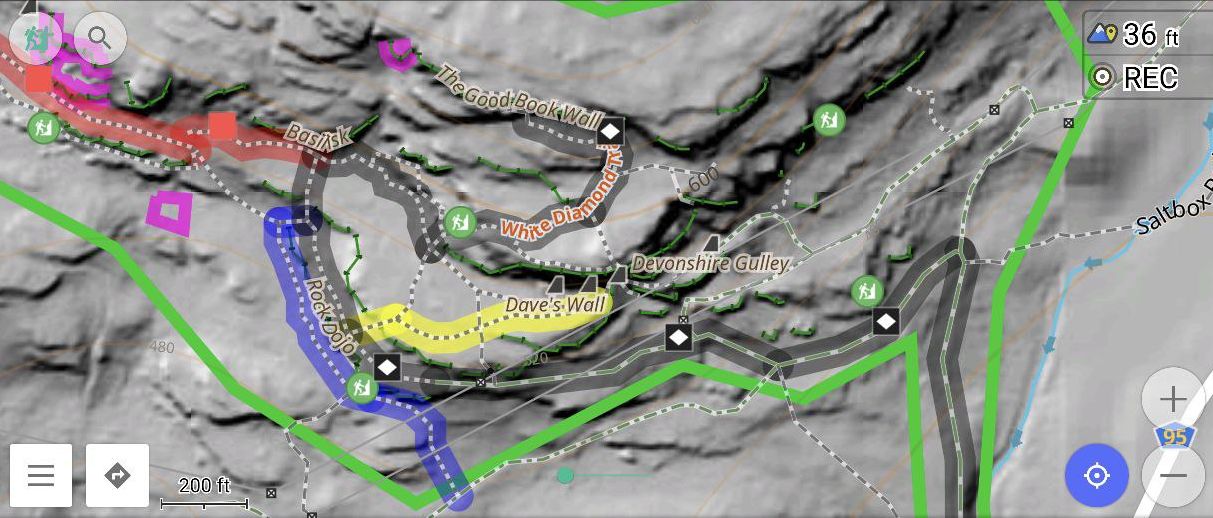
Osmand can show sport=climbing objects, but it doesn’t show too much detail about them. For example, named cliffs or boulders are shown by default (I think?):
Sure. Basically, look for coloured items - blue and red. They contain photos, as per legend. So far, since the guys are from Czech Republic, the crags there seem to be mapped well. I’ve mapped just a few locations so far. This will be a longer project, with crag photos. We have a drone so I’m looking forward to it. But, I digress.
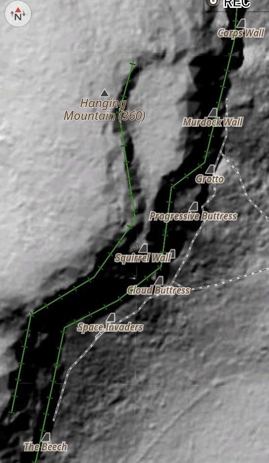
Take this area, for example, and look at the crag topos inside:
Yes! OsmAnd has improved display of the climbing tags significantly recently. I’ve requested a few items that have landed in that release and now the maps in hiking mode look much better! (with Climbing turned on, of course)
This scheme sounds reasonable. It doesn’t seem that we really came to any final conclusions though and these type of examples aren’t in the wiki. Is there appetite for figuring out this tagging scheme?
One thing I’d probably tweak is the climbing:lower_off key. My hunch based on the example values is that what you are trying to describe is open systems vs closed systems rather a distinction between being able to lower on a weighted rope without undue rope-twist vs an anchor that is best used only for rappelling and then pulling the unweighted rope. I could be misunderstanding though. Maybe this is a trying to indicate a community norm around lowering on the fixed hardware vs rappelling/abseiling?
I recently installed a few vertically-aligned "French" style anchors with a rap-ring (closed system) on the upper bolt since it is likely that some climbers may move above the anchor to top out if they have less than a 70m rope.
I went with the vertical orientation specifically to reduce rope twist when lowering a climber and would encourage lowering on the fixed hardware over rappelling for anyone for whom that feels more comfortable or efficient – the ring is cheap and easy to replace. climbing:lower_off=no would feel like an incorrect statement for such an anchor.
I might be overthinking this, but maybe climbing:open_lower_off=yes|no would be more clear. Naming things is hard…