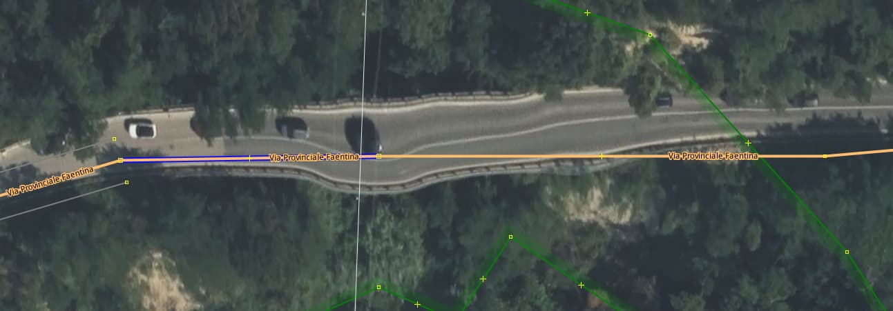
Some swear by Bing… not some landslide, but it did happen there in past, this is heavy man_made erosion territory. In ESRI this is a straight line in OLD Clarity it is too. See this often on long viaducts in Google sat imagery, a Six Flags rollercoaster. Just saying.
Satellite imagery is rarely shot exactly nadir, and even if it is, only the very center of a given image would be perfectly perpendicular.
Non-flat terrain will distort imagery when it’s corrected. So they use elevation models to correct for this, and project an angled photo into a relatively flat map.
Inaccuracies in the elevation models cause artifacts. In this case, the bridge goes over a dip of some kind. So the imagery was corrected as if the road followed the dip in the ground.
If you have photos from multiple differing angles, you can really start to put together an accurate picture of the actual shape of the ground. Then you can do some clever processing to fix artifacts like this, by creating a composite, rendered virtual “true” orthophoto.
Personally I find Bing imagery to be quite good, at least in the US where I primarily map.
Good explanation @Xvtn! I will add that the next update of Bing is unlikely to have the same off-nadir angle, so the bridge will likely appear differently then. Also, this same issue applies to tall buildings, and one should trace the top of the building and then move the shape to coincide with the bottom. We call this “building lean.”