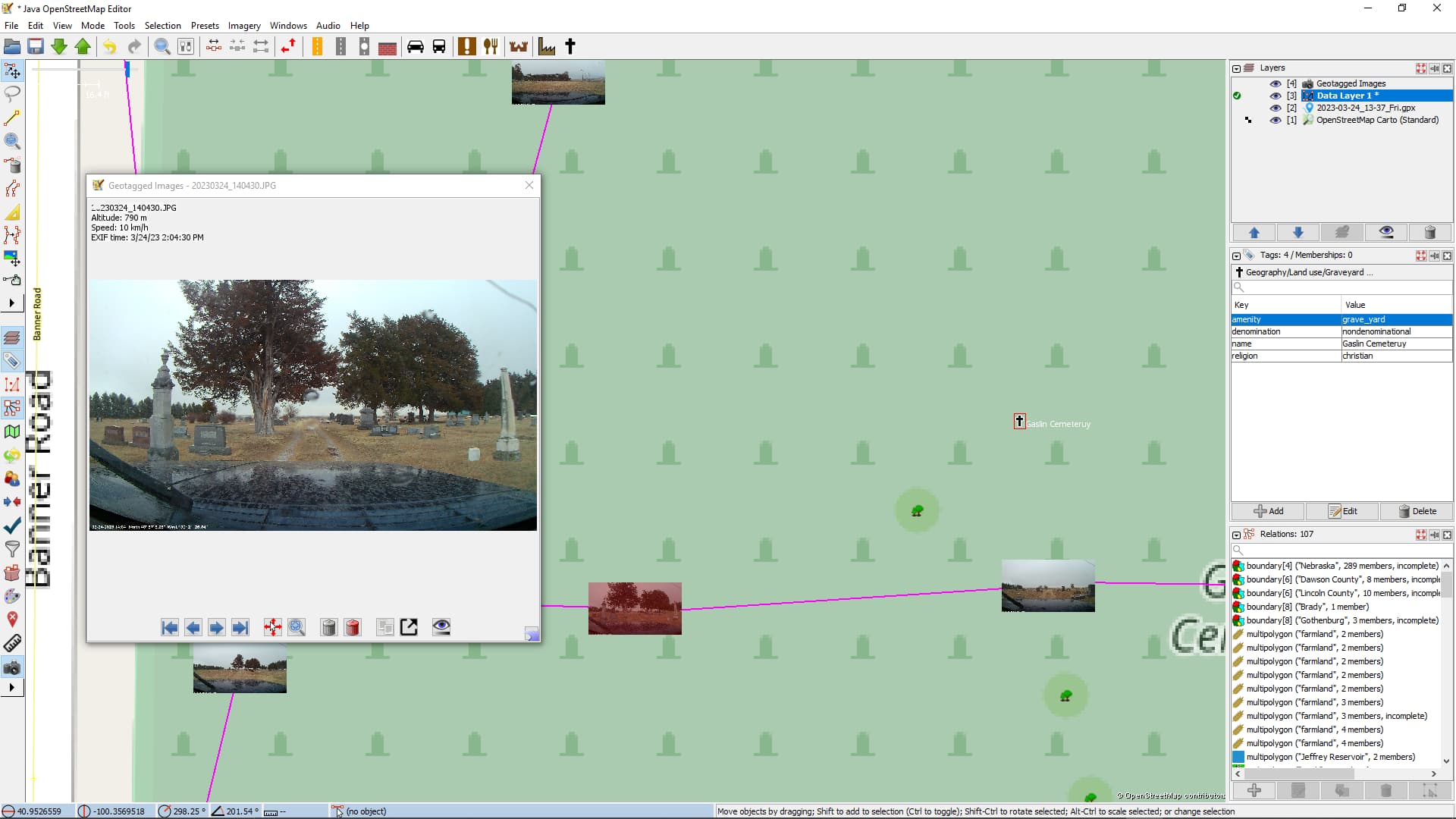
On March 24 I went for a drive to try some things. I set my “action camera” to take photos every 10 seconds. I set OsmAnd on my phone to make track points at the same interval, of course, the two devices are not synced time-wise except to the closest minute (it is a cheap action camera). On my trip, I stopped at two cemeteries and drove through them (another hobby of mine).
To my point This morning I loaded the photos, and the GPX track and loaded them into JOSM then downloaded the data layers of the area I drove in. I created a node in each of the cemeteries Geographic>landuse>cemetery and I got a pop-up that the cemetery tag is not suitable, so I added the graveyard tag and added the other data I wanted to add. Why is the cemetery tag unsuitable?
A semi-related note, is there a way to make the tag text larger?
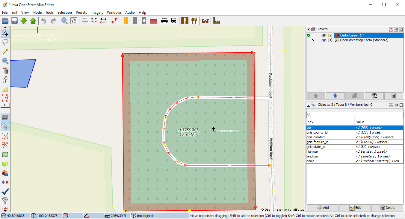
The cemetery is already mapped, and I presume that in general landuse=cemetery is expected to be on areas only, but it also may not like a cemetery mapped within a cemetery. You can add the additional tags to the existing element. Also worth adding the service roads given that you could drive on them, possibly with a tracktype tag too.
You say you map them as nodes. I’ve never done that, only as area. With area JOSM does offer 2 choices of cemetery, the second as cemetery sector which does not offer the religion/denomination choice. When I try mapping a cemetery as node it only offers the cemetery sector as choice, which generated the tag cemetery=sector.
That said, I’ve had some vexing issues with a pet-cemetery. The graveyard option closed the alert issue.
I’m still learning here, good info Thank you!
SK53 if the cemeteries were already mapped would there not be an Icon already, or only text? This makes me wonder who would have mapped them, both entities are out in the country, and one is about a half mile off the beaten bath.
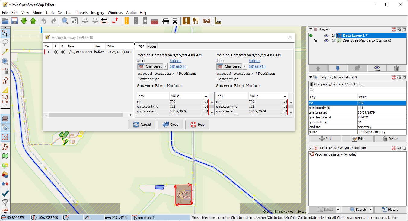
Many of the cemeteries here are well outside residential areas, well outside. Who mapped them? In JOSM select the object and in the selected tag pane at right hit the history button and JOSM will fetch the full history from V1 to Vn which gives the chance to see the change set commentaries
OSM elements can be located on points (nodes), lines (ways), or areas (usually also ways). Cemeteries are nearly always mapped as a closed way (an area) and in most editors will not show up as a single icon, but rather as the area, often shaded an appropriate colour (either for the entire area, or just at the edge). The area can only be grabbed at its edges ('cos anything else would make editing things in the area very tedious). Names may only show at particular zoom levels (for instance the on-line iD editor shows the cemetery outline with a small icon at the centre, but the name doesn’t appear until you zoom in). JOSM is a high-powered customisable editor, but the default style might not show things as you expect them.
No, 1979 is when recorded in the gnis system as created date record. The Selection pane is not in your screen shot. Go to the left side icon bar, hit the little right pointing arrow (there are 2 in my config, half way down and at bottom) and pick the relevant ‘selection’ labelled icon to add it to the panel list at right . It has 3 buttons, select, search and history at bottom of it’s frame.