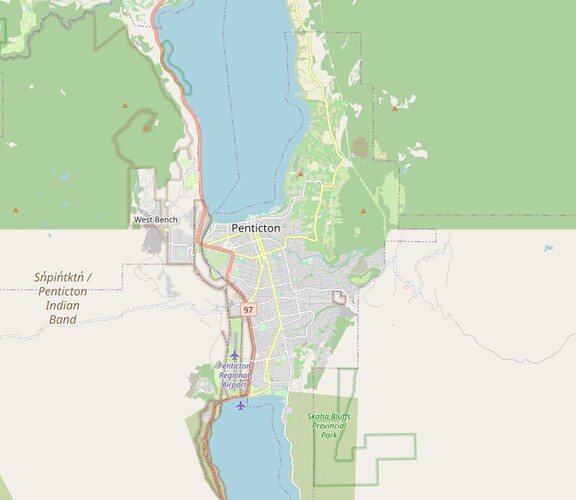
The kootney boundary map is not accessible via the map or the online map
Hi and welcome to OSM
OSM is primarily a huge database, so please tell us which app / website / program you are talking about.
The OsmAnd app and the website OpenStreetMap. Both have the southern most map in British Columbia Canada missing it’s details
I assume you mean Kootenay rather than Kootney?
We don’t have it because I’m not sure it really exists in any official sense these days - the wikipedia page redirects to Fisherville for example.
There are the districts of Kootenay Boundary and East Kootenay, and we do have those as relation 2218291 and relation 2218392.
We also have Kootenay National Park.
Yes Kootenay, the region called Kootenay boundary is the area surrounding the city Penticton. I am unable to view the mapping around this area. When I download the regions map it does not load into the map, similarly on the website it does not have the details. In both the app and website, the region is shown in white rather than the downloaded green color.
You mean the sharp change from green to grey around the middle of the city here?
That’s just because the land use is mapped differently, or rather the green areas are mapped as woods (for example 8478120) while the grey areas don’t have any sort of land use mapped.
Thank you kindly
