Does Overpass count as scripting? There are lots of overpass examples that allow you to select by various attributes, and that can be used to download data into JOSM.
Obviously using that to make a bunch of undiscussed changes to OSM is frowned upon - always discuss changes like this first if you’ve crossed that threshold.
Another option is to download a data extract and use something like “osmium tags-filter” or “osm-tags-transform” to filter the data and create a smaller .osm.pbf file. There are examples of both of those here.
to quickly display peaks that have no height good option, to compare values, like the one in the example, it does not seem to be possible, thanks anyway.
First you select the elements #1
Secondly, from the result set, deselect the elements #2 (using “select” again)
(Or select #2 from this result set - depending on the group you want)
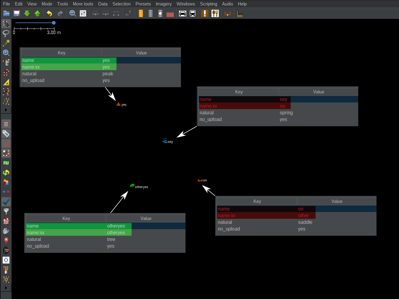
I’m testing your option and I didn’t understand it, I add example, graphically, something simple like open the search window and type (name_value==name:xx_value) and get selected the peak and the tree
Sorry if I have not expressed myself correctly
In a small region (single rural Municipality) the formatting and tagging of churchs, castles, farms (they traditionally have a name), etc. do vary a lot. I tried to harmonize a little by manual edit in the web editor, focusing on historical buildings.
While I have still to inform me and probably discuss here what format/s are the most appropriate, first I would like to know if serial (tabular) viewing and editing of certain places (in JOSM) is available?
P.S.: I do did not use JOSM so far.
I use a small part of the great potential that JOSM has, I probably won’t be of great help to you, but can you give a practical example of what you are looking for? to know if it is better to open a new specific thread.
Maybe you’re looking for something like the TagEditor plugin? https://wiki.openstreetmap.org/wiki/JOSM/Plugins/TagEditor