good day to all and thanks for your contribution Milton.
I generally write down all information I don’t want to keep in my mind, as in this case: in the changeset https://www.openstreetmap.org/changeset/74322090 I wrote as source the number of the gaceta oficial I used (28302).
in the page https://wiki.openstreetmap.org/wiki/ES:Panam%C3%A1/Proyectos/Parques_y_zonas_protegidas there’s a table listing all protected areas known to the people caring for updating the page (that’s Andrew Wiseman, SeraliaM and myself), and references to sites where to search for the documents.
you will find the pdf of the gaceta in question by following the instructions given in the above overview, or using this direct link: https://www.gacetaoficial.gob.pa/pdfTemp/28302/61790.pdf
I used the procedure described in the other page https://wiki.openstreetmap.org/wiki/ES:Panama/Protected_Areas, procedure based on tesseract, but you can also read and validate manually. since it was an automatic procedure I followed, doing it again will produce the same result as two years ago.
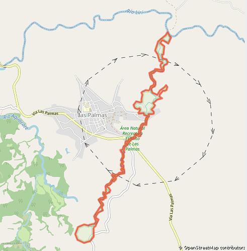
all nodes are numbered, and there might be discrepancies with their real position because I might have used the wrong projection. but the resulting shape nicely and tightly follows the waterway we have in OSM, what can’t be said of the polygon distributed by MiAmbiente.
I also checked the polygon for Parque Sarigua, and found less striking differences, still enough to make me weary of trusting the information.
yesterday I processed the document describing Parque Omar Torrijos, but I haven’t yet updated the wiki page*****. I had to copy the coordinates manually because the pdf was like gray50 on gray70 instead of black on white. here my interpretation of the decree leaves a very large chunk missing at the north-west of the park as compared to what’s distributed by MiAmbiente, but I can’t make anything else of what I read there. I’m sure that my polygon is wrong, because it encircles an area that does not reach the amount of hectares as detailed in the decree.
I could not check more objects because most decrees refer to objects that simply aren’t available as reference within OSM.
moreover, these polygons are distributed under a license that is incompatible with their inclusion into OSM. so my conclusion was why make the effort.
if I understand Milton’s point of view correctly, you suggest we could help MiAmbiente with validating the info they distribute, right? then it would be of huge help if you also managed to convince MiAmbiente to pressure the IGNTG into releasing their data so that we OSM mappers can lawfully import it into OSM, this would enable us to validate many more AP polygons.
best regards to all,
Mario Frasca
***** just updated the wiki page (2021-07-22 14:00-0500).


