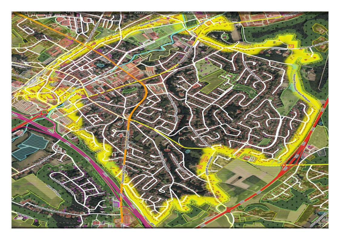
As a new contributor I started looking at possible improvements in my region and I would like to handle the fixme tag on the big residential area of Wavre that suggests to break it up along main roads and rivers.
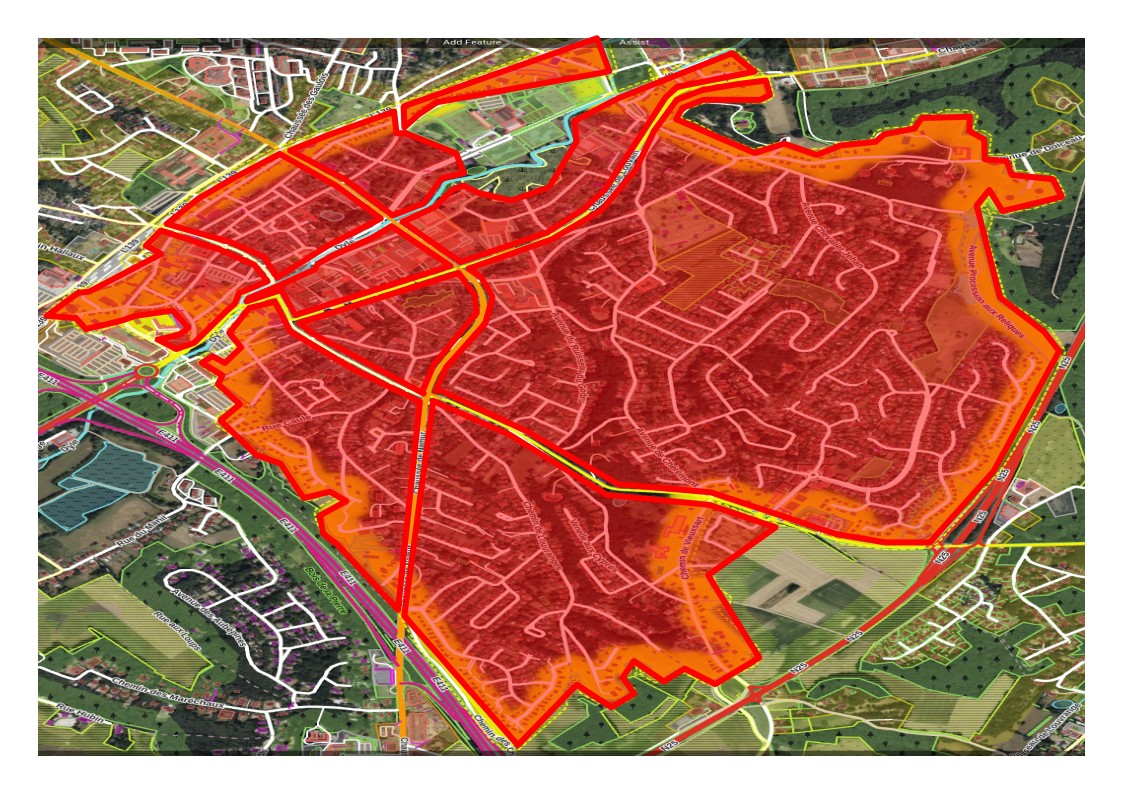
If those yellow highlighted ways inside the red area are meant to be the slicing lines and happen to be primary, secondary, tertiary ways, great, but don’t use the roads as part of the residential area outlines. Draw lines parallel to the roads (easy in JOSM with the Shift+P key to get perfect parallels). The next mapper will thank you.
There are definitely some areas that are named (for instance, the very imaginative “Les Quatre Sapins” and “Les Cinq Sapins”) but they will require further subdivision which I can do when I add the retail area in the center.
The wiki says " The extent of the area should mark the boundary of known residential use, not the extent of the whole town or village". It is clearly the latter here. Besides, as said above, there is an opportunity to capture some residential areas with names also. If anything, I will do it for learning’s sake.
No it’s the first. The latter would include forests, agricultural lands and everything until you get to the lands of the next town.
The area as it is now is clearly the area where people are living. But do as you like. There are many options. Some people exclude all roads.