I’ve noticed an error in Puntland’s boundries on your platform. The northern part of Mudug seems to have been excluded from Puntland. Could you please review and correct this error?
Link to UN OCHA’s latest map for reference:
I’ve noticed an error in Puntland’s boundries on your platform. The northern part of Mudug seems to have been excluded from Puntland. Could you please review and correct this error?
Link to UN OCHA’s latest map for reference:
I don’t understand - Mudug is a region in the state of Galmudug, and
Puntland is a state bordering Galmudug to the North; so obviously no
part of Mudug belongs in Puntland, or saying it differently, Mudug being
“excluded from Puntland” is exactly as it should be?
Thank you for your response. Allow me to provide further clarification:
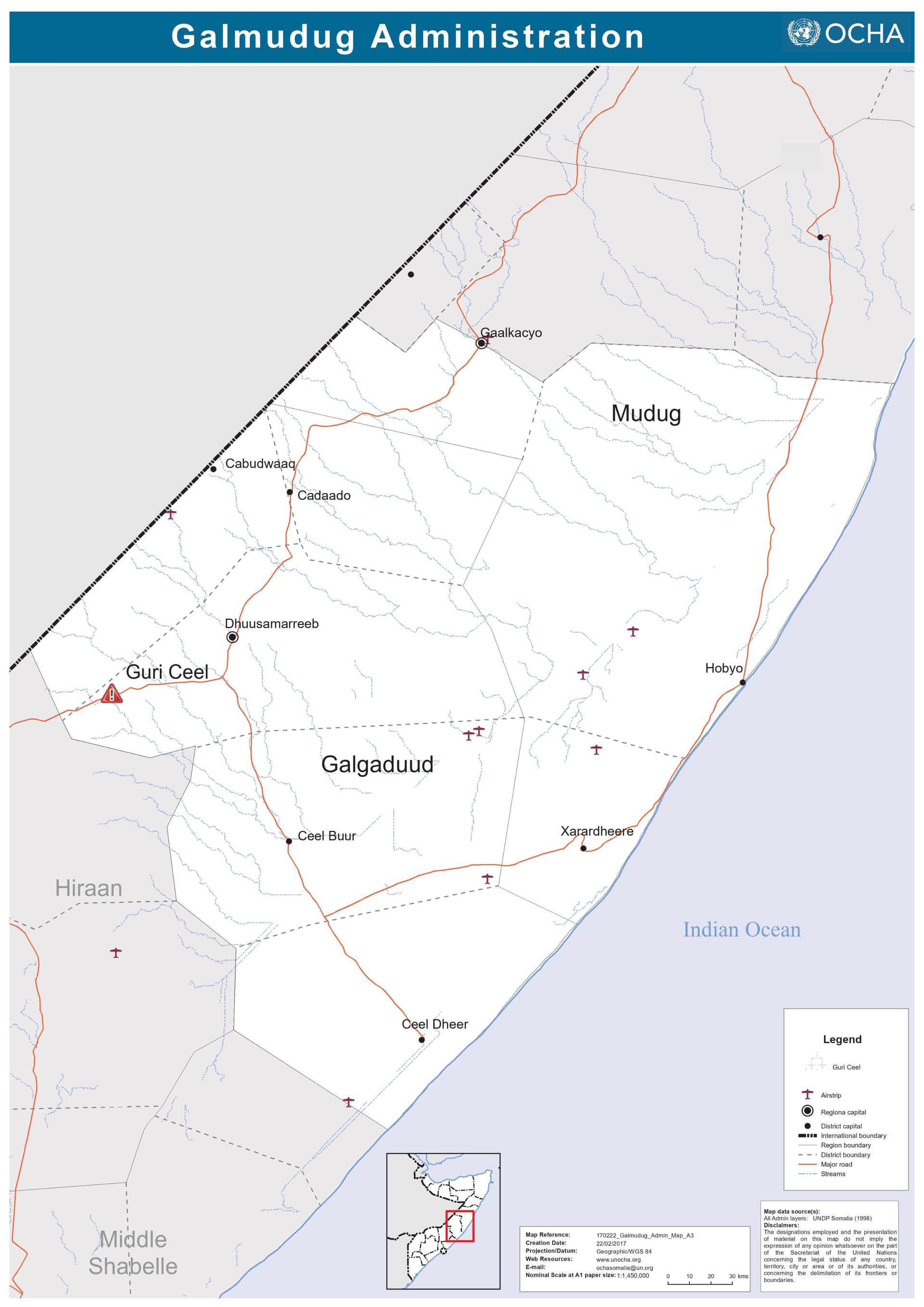
Mudug region is divided into two parts: the northern portion belonging to Puntland and the southern portion to Galmudug. However, it appears that in your map, Galmudug State has been inaccurately assigned the entire Mudug region.
I have attached a link to a map provided by UN OCHA for your reference, which illustrates the correct administrative boundaries in Somalia.
Reading the Wikipedia articles of Galmudug and Mudug, it seems that Mudug is a difficult case.
As a region it should be part of Somalia, but neither part of Galmudug nor part of Puntland as a whole. The districts Jariban, Galkayo and Galdogob seem to be part of Puntland, the districts Harardhere and Hobyo seem to be part of Galmudug.
Relations between Galmudug and Puntland do not always seem to be peaceful. I’m sure that’s no fun to map and maybe not possible to map so that everyone will be content.
I’m new here, do we have mappers who can correct this?