Hello, i am new to OSM so i apologize for any mistakes in tags or anything like that.
I have a question regarding Duhok Governorate and Nineveh Governorate’s borders with each other.
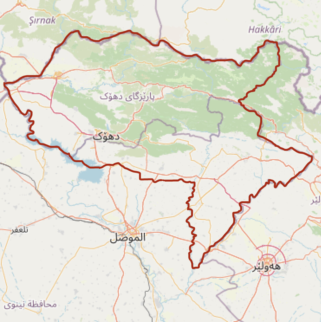
Apparently Nineveh Controls the southern part of what is Duhok’s (up to Mount Zawa) and also Duhok does not control the Nineveh plains (Duhok controls all of these, Southern Part and The Nineveh Plains)
It used to show these aforementioned territories as part of Duhok, but now. Not only did it change, it even takes more territory from Duhok.
I want to know, are these borders editable by me? (If so, how?) Or can i appeal to someone more experienced who can fix the border between these two governorates? I have attached a picture to clarify my question.
A picture of what it actually looks like and what it territorially controls.
Any answers are appreciated, and i am glad to be a new member of this dedicated community.
Thank you so much.