Blender is a free and open source 3D platform. It supports 3D modeling and rendering as well as many advanced features like animation, simulation, compositing, motion tracking, video editing and game creation.
This thread is to discuss the blender-osm for Blender. It provides one click download and import of OpenStreetMap and real world terrain data for Blender with global coverage. Two versions of the addon are available:
In addition to the features of the base version, the premium one provides:
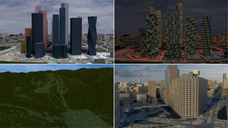
Import of buildings from OpenStreetMap with default materials, tileable building textures and UV-mapping applied
Default materials and textures to mimic lit windows for a late evening setting
Import of forests and single trees as 3D objects
Options to use custom tileable building textures (e.g. from textures.com)
Satellite imagery and web maps projected on a terrain
Buy the addon at gumroad.com! By purchasing the addon you support the addon development. All customers will get the addon source code under GPL license! All default textures and materials supplied with addon are released under the CC0 (public license)!
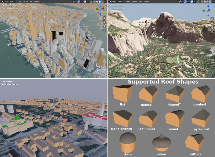
blender-osm imports buildings from OpenStreetMap without any texture applied. Building height and number of floors are used to create the final scene. Composition into 3D parts for a building with the complex structure is also processed. A large number of roof shapes is supported. If a terrain is provided, buildings are placed on the terrain automatically.
blender-osm downloads and imports real world terrain data with resolution about 30 meter.
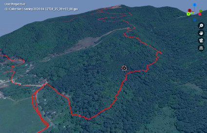
blender-osm imports GPX tracks.
River, lakes, forests, vegetation are imported as polygons. If a terrain is provided, they are projected on the terrain.
Imported roads, paths and railways have width. They are represented by Blender curves with a profile object. If a terrain is provided, roads are projected on the terrain.
Get the addon at gumroad.com! You might prefer to pay some price for the addon to support its development. However it is completely optional. The addon source code is available under GPL license!
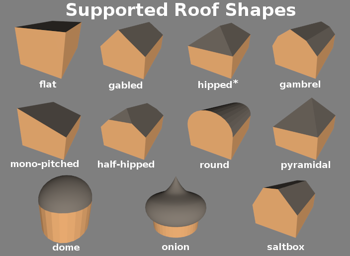
The new release of the OpenStreetMap importer for Blender is out with the support of a large number of roof shapes shown on the image below: flat, gabled, hipped (for a quadrangle outline only), mono-pitched, half-hipped, round, pyramidal, gambrel, dome, onion and saltbox.
Oh, well, I consider OSM go as open source anyway (because it is JavaScript).
But you are right, I have also to express my self about the copyright. And that is GPL. I will write it to the wiki page.
And about the roof algorithms I also mend, if you may give me some hints if I have questions.
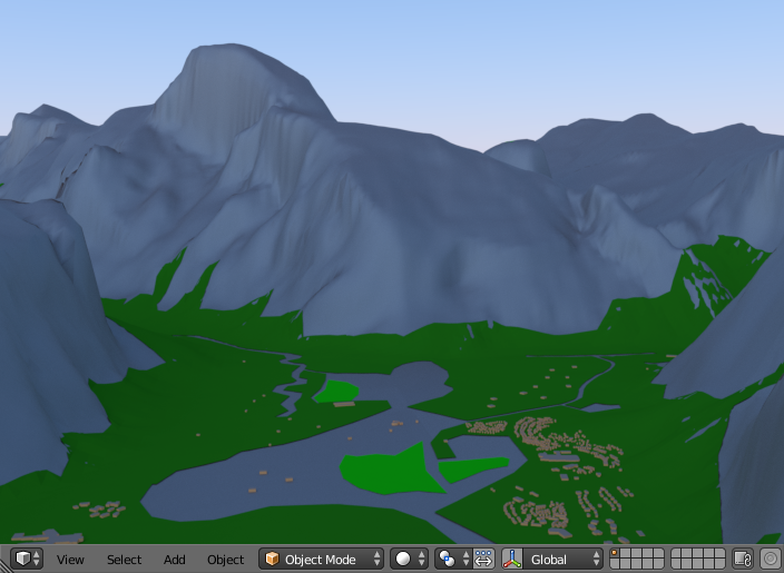
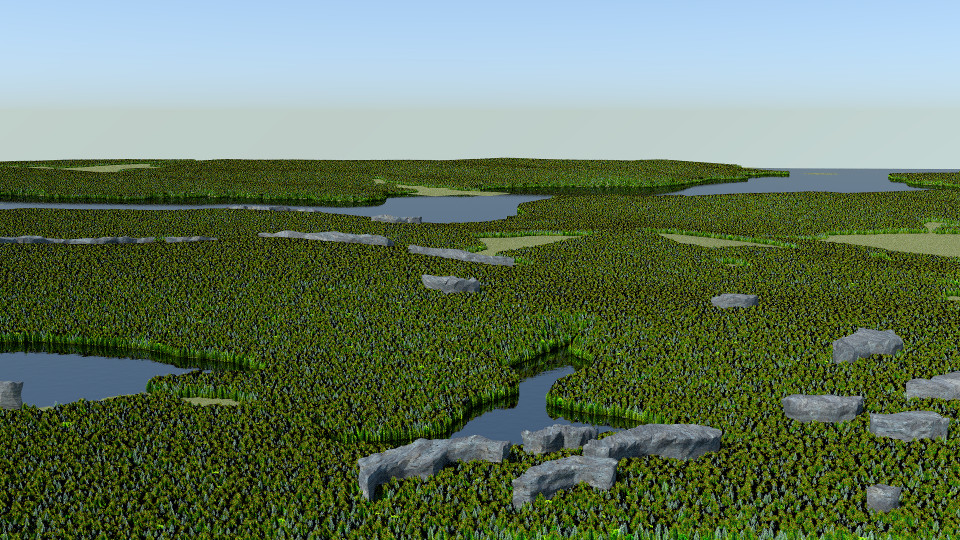
Time to reveal some features of the premium version of the blender-osm addon. A real world woody landscape with lakes has been generated by the premium addon to be released later. It’s based on OpenStreetMap data. See the location of the virtual camera on the 2D map. All customers of the base version will get a discount for the premium one.
Hey, just downloaded the premium version, and attempted to install in Blender version 2.83.3. It doesn’t seem to work though as it does not appear on the installed addons list, likewise absent osm tab n the main screen. Any suggestions?
great add-on you have written!
using it with blender 2.83
when loading GPX track…the track appears straight up out of the center in the z direction. does not matter whether I check/uncheck project onto terrain/georefencing
when loading OSM…I can only see 2D/3D maps when using the initial coordinates (Moscow!)
using any other coordinates, I cannot see anything (even after changing clip end, georeferencing, etc.)