Belgium - Fix Spiky Buildings

BEL- NL
Hallo Belgische OSM-gemeenschap,

Met trots kondig ik een nieuwe MapRoulette-uitdaging aan: Belgium - Fix Spiky Buildings (MapRoulette)! We hebben gebouwen op OpenStreetMap (OSM) geïdentificeerd met vreemde scherpe hoeken. De meeste hoeken van gebouwen zijn bijna 90 graden, maar deze uitdaging richt zich op gebouwen waar de hoeken minder dan 15 graden zijn. Hoewel sommige misschien echt zijn, zijn er waarschijnlijk veel met onjuiste gegevens.

De taak:
Help ons de gegevenskwaliteit van OSM te verbeteren door de geïdentificeerde gebouwen te beoordelen en te kijken of hun vorm een aanpassing behoeft.

Belangrijke overwegingen daarbij:

  • Sommige gebouwen, vooral historische gebouwen, kunnen unieke hoeken hebben.
  • Als u het niet zeker weet, raadpleeg dan het communityforum voor advies.
  • De taak leidt je naar het gebouw zelf, niet noodzakelijkerwijs naar het specifieke “scherpe hoek gedeelte” van het gebouw. Zoom zorgvuldig in en zoek naar het probleem.

Waarom het scherpe hoek gedeelte van gebouwen repareren?
Van nauwkeurige bouwvormen op OSM profiteert iedereen! Ze verbeteren:

  • Datakwaliteit voor diverse toepassingen
  • Navigatie diensten
  • Stadsplanning
  • Noodoproep reactie

Heeft u nog vragen?
Gewoon een reply sturen op dit bericht voor hulp, het wijzigen van instructies of suggesties voor bronnen.
Bedankt voor je bijdrage!

Met vriendelijke groet,
Salim

BEL- FR
Bonjour Communauté OSM Belgique,

Je suis ravi d’annoncer le lancement d’un nouveau défi MapRoulette : Belgium - Fix Spiky Buildings (MapRoulette) ! Nous avons identifié des bâtiments sur OpenStreetMap (OSM) avec des angles étrangement pointus. La plupart des angles des bâtiments sont proches de 90 degrés, mais ce défi se concentre sur les bâtiments dont les angles sont inférieurs à 15 degrés. Si certains peuvent être réels, beaucoup sont probablement des données incorrectes.

Notre mission:

Améliorer la qualité des données OSM en examinant les bâtiments identifiés et en déterminant si leur forme doit être corrigée.

Considérations importantes:

  • Certains bâtiments, en particulier les bâtiments historiques, peuvent avoir des angles particuliers.
  • En cas de doute, consultez le forum de la communauté pour obtenir des conseils.
  • La tâche vous mènera au bâtiment lui-même, et pas nécessairement au nœud “pointu” spécifique. Zoomez avec précaution et recherchez le problème.

Pourquoi corriger les bâtiments à angles saillants?

La précision des formes des bâtiments sur OSM est bénéfique pour tout le monde ! Elles améliorent

  • La qualité des données pour diverses applications
  • Les services de navigation
  • La planification urbaine
  • Les interventions d’urgence

Vous avez des questions?
N’hésitez pas à répondre à ce message pour obtenir de l’aide, modifier des instructions ou d’autres suggestions.

Merci de votre précieuse contribution à nos côtés !

Cordialement,
Salim
Unless proven otherwise, the reference for building outlines in Belgium is numerical imagery. Our country is made of 3 Regions, each providing an accurate overview of buildings:

  • Brussels (UrbisAdm)
  • Flanders (Digitaal Vlaanderen GRB)
  • Wallonia (PICC numerical imagery)

Every day, we see new users moving or redrawing buildings after tracing them directly on aerial imagery, which is the default option in the iD editor.

Could you please make sure that this MapRoulette challenge will encourage people to check against numerical imagery and not aerial imagery?

To illustrate my point, here is a “spiky building” I drew today: Way: 1275225416 | OpenStreetMap It has a sharp dent, yet this is the official outline of the building. A user who traces on aerial imagery will only see the roof and might want to “fix” it.

2 Likes

Sure @bxl-forever . thank you for the input. I will add this to the project description

In addition to this, if the building has a source:geometry:ref tag, it was imported from official sources. Only if a human touched it after, does it make sense to review it. So it probably makes sense to exclude them, perhaps put them in another task, or give them lower priority.

There has been a high number of changesets produced in the last hours from this quest, also on buildings with no obvious spike, like this one which is only slightly curved and does not match the “less than 15 degrees” criteria.

Many old buildings in European city centres are not rectangles anyway. More than 50% of changesets I reviewed are plainly incorrect and damaged buildings that were correctly mapped (with or without the source:geometry:ref tag referred by Joost). One user uploaded about 300 changesets in a single day.

Shall we consider turning off this quest? Or maybe change the code to make sure it only selects buildings with a real spike?

1 Like

Good morning @bxl-forever : what do you recommend? shall I go back and have a look at all the tasks and remove the doubtful ones? or give instructions that only few will pick up this task?

Honestly, I don’t know what current practices are in use for MapRoulette.

I read your instructions on the page and you did a great job at providing very clear guidelines.

I got in touch with one mapper who made mistakes, and who seemed to understand the problem, but other users like ‘googlenaut’ seem to act like if they are playing a video game where the main objective is to solve as many challenges as possible to get high rankings. Once in a while, their edits are good, though, so I don’t believe reverting everything is appropriate.

What is mostly puzzling me is that the task asks to fix non-spiky buildings, as in the link I provided in the previous message. If that can be removed, that might reduce the risk of false positives.

Hello @bxl-forever ,

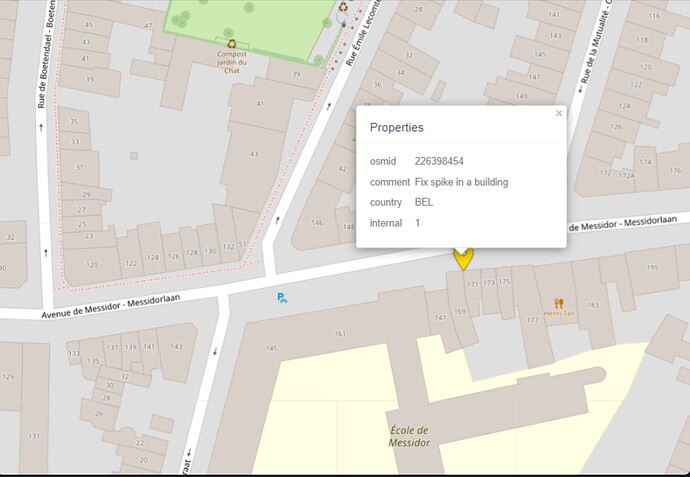
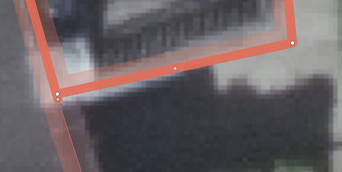
thank you for indicating this link this one but apparently there was someone who edited the 169 building but did not check the 171 sharp corner on the left end bottom side.

The Building ID that has the sharp corner is: w226398454