Argument about an underground drain in Vienna

Hello, Andy from the DWG here.
A mapper in Vienna is adamant that an underground drain in Vienna should not have a “tunnel” tag on it. Other people think that it should. A very long changeset discussion is here.

A picture of the exit into the stream to the north is:

I have tried several times to persuade the proponent of the “non-tunnel” argument to ask the community more widely. They have unfortunately failed to do that, so I’m creating this thread. Currently on the changeset discussion one mapper is on one side of the argument and everyone else is on the other, but I’m asking here to make sure that we’re not missing anything obvious.

So - does it look like the feature in that picture should have a tunnel=yes tag?

6 Likes

This is documented as tunnel=culvert.

5 Likes

Would have to see a pic in the opposite direction to be sure this is a culvert outlet into the waterway below.

2 Likes

Disclaimer: I’m involved in the discussion and made the first revert (back to tunnel=culvert) so everything i write might be biased

I created the note Note: 3775272 | OpenStreetMap and user @mihaifl was so kind to go there and take some pictures. These can be found Liesingbach - Album on Imgur there (also in the Note linked). @Luzandro was there and made some pictures as well (thanks to both of you for driving there!)

I’ll try to recap to my best ability (it is a lenghty changeset-comment-section, i apologize if misinterpreted something!):
The user is basically saying that to be a tunnel it should have a entrance and a end. And this cannot be a tunnel because he was not able to get to the end and therefore no end exist therefore it cannot be a tunnel. As far as i got it, he basically read the Description in Key:tunnel - OpenStreetMap Wiki that reads

A tunnel is an underground passageway built for a road or similar.

and chose to ignore the rest of the article where it explicitly states

tunnel=* is used for roads, railway line, canals, etc. that run in a tunnel.

and

Where the water from a smaller stream, drain or even cattle crossing passes under a way structure or a building consider using tunnel=culvert in place of the tunnel=yes used for accessible and larger tunnels for roads, railways, etc.

When the waterway=* runs underground for a considerable distance, you can use tunnel=flooded especially when the duct isn’t designed to be safely accessible in operation or man_made=pipeline for sections built with tube assemblies.

He is mentioning to be an expert in that field and to know a lot of experts that would agree with him in that matter but it was explained to him that it might be true in their field - but in order to be correct tagged in OSM it would need a tunnel=* tag as well (and not the layer=-1 that has no meaning other than to tell the renderer “render this below everything else”).

I would even say its best to tag it as tunnnel=flooded also because of that sentence

tunnel=* only represent a man made infrastructure and doesn’t presume of the flowing regime. You should use waterway=canal, waterway=drain, or waterway=pressurised to give such details.

Still, please paint your own picture in the changeset-comment in case i missed something. (Happy to receive criticism or a hint if i missed something crucial).

4 Likes

Thanks for reaching out.

What exactly speaks against a tunnel tag? According to the definition in the wiki, and already since the first version of the wiki page on 1 June 2015, tunnel is also used for “canals”, which are underground. Furthermore, it has been defined there since the first version that a tunnel=culvert is used for water to pass “things” under ground, regardless of size.
The wiki page for tunnel=culvert already exists since 1 September 2010 and already here it is defined that this tagging is used for a man-made installation that channels water underground.
Nowhere in the wiki is it insisted that a tunnel needs two ends.

If an old road tunnel collapses in the middle due to an accident and fills up completely with soil in the middle, it is also no longer possible to pass through. Is the “rest” of the tunnel then no longer a tunnel just because one can no longer get through from one side to the other?
Another one: If I am standing in front of the wall of a dam and the valve for the outlet is closed, then I can walk through the canal of the dam to the valve, but I cannot get out at the other end. Obviously, I would then be standing in the middle of the reservoir anyway. Is the entire canal, which is underground, not a canal?

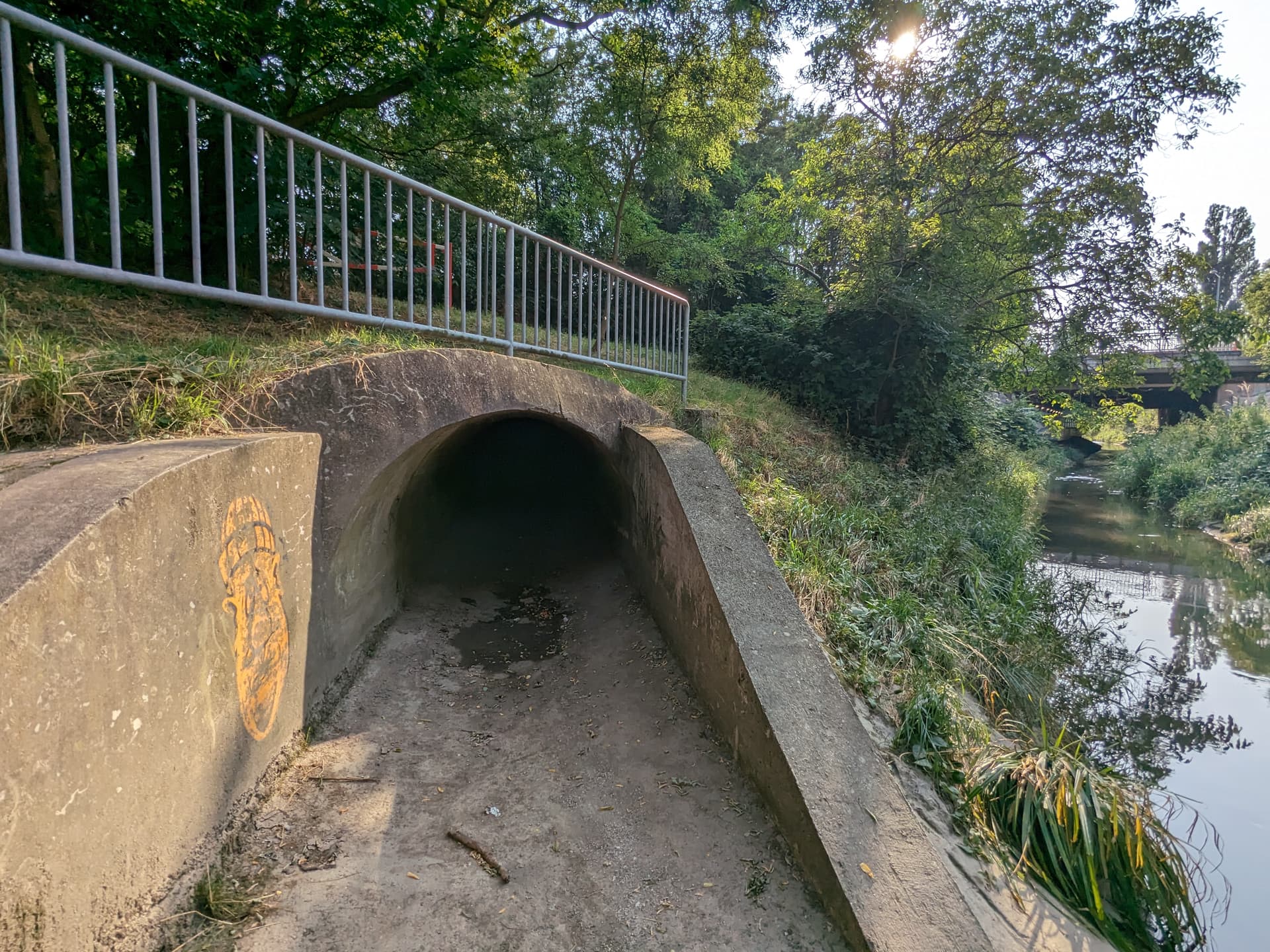
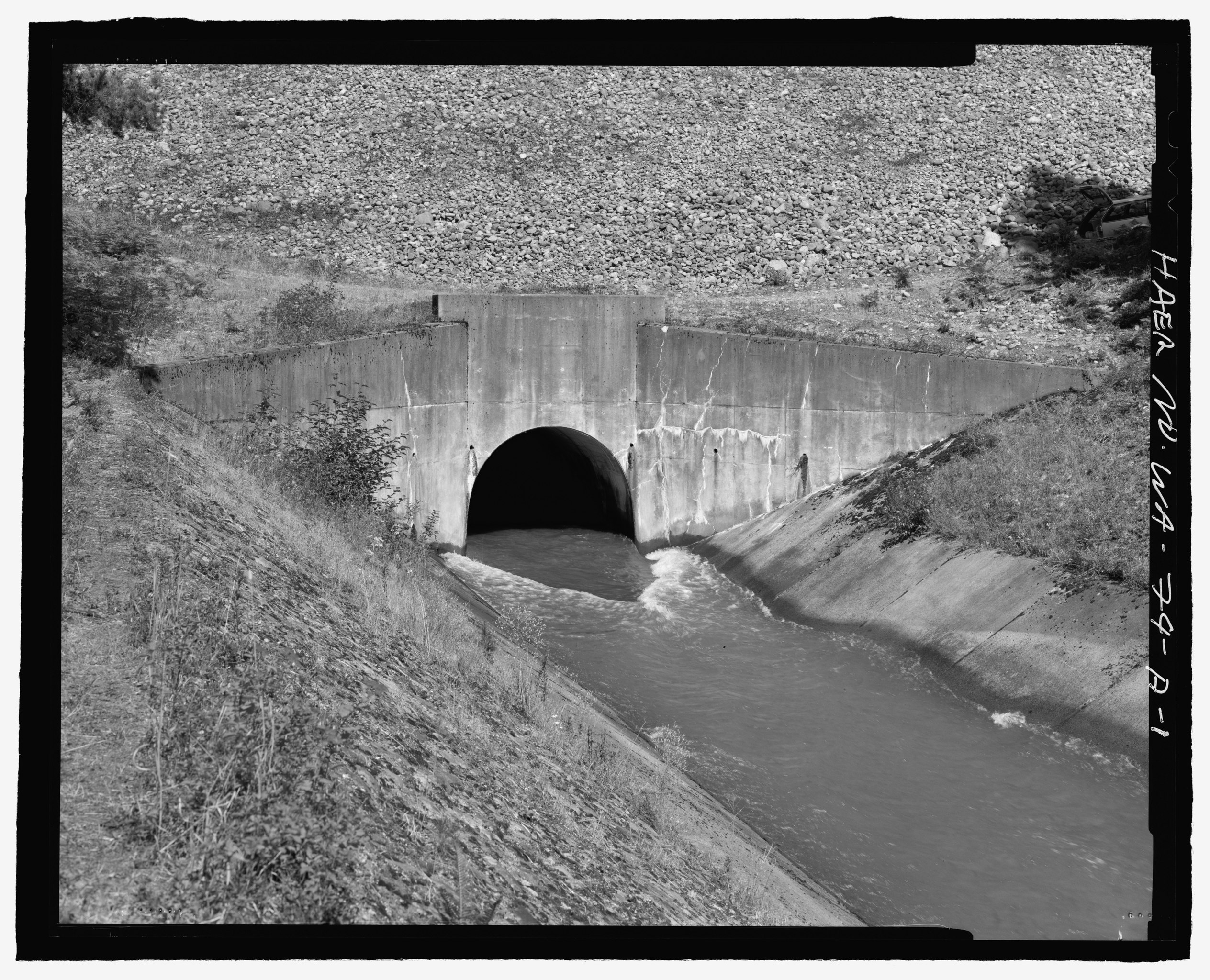
With fishing trousers and rubber boots and a headlamp, I would walk in here, but would I get to the end?

Same here, and in this photo the floodgate was actually opened, what is it like when it is closed?

There are also diversion outlets that can be entered, but also these have no end. You then stand in the middle of the rock or concrete and can only turn around.


Aren’t all these tunnels?

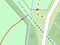
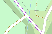
In the end, you should ask yourself what effects the respective tagging has on a map display. From the usual Carto view, the current impression is that in some places there is a ford which is not tagged because a flowing water intersects with a path:
image

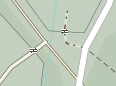
With a familiar dashed rendering, this information would again be given and it would be clear that one would not get wet feet when using the path.
image

I would also like to turn the question around: What exactly is disadvantageous about entering a tunnel=culvert here? Don’t we want to create added value together?

2 Likes

Sometimes map a ford as a line (tag on wider water crossing section of way rather than a node and if there are ford=stepping_stones or intermittent as many of our streams and ditches dry pretty much up in summer, but not this year. Quite a few have a concrete surface to make driving/wading across easy.

/OT

Actually, I’ve deliberately not asked that here because I don’t think that one particular map rendering (especially one that has been criticized quite as much as OSM Carto has) should dictate how we map things.

5 Likes

Only recently a long time mapper told me, he thought that only stuff that renders has blessing. While OSM Carto is just a consumer of the data, it is quite influential. They are in a tough position, no envy from my side. Not as much as The Beatles, who sought spiritual advice in India to cope with their influence :wink:

Just mapped a tunnel=flooded Way: ‪Ehnbach‬ (‪686499577‬) | OpenStreetMap - no indication of it being a tunnel in standard view, but several Issues · gravitystorm/openstreetmap-carto · GitHub - Now going to read up on those to learn what I did do wrong? I think it is too long for a culvert.

UPDATE: Seems QA worked out; What I got: flooding is only specified for human intervention, not just thunderstorms.

PS: The tunnel in Vienna is a tunnel in OSM sense, IMO. Wonder what the quoted expert form the speleology club means: Perhaps, a tunnel needs boring or explosives in creation?

I see no problem with this. These will also be rendered accordingly. See Way: 315219370 | OpenStreetMap

You are correct, but this map style is now the ubiquitous “standard” on osm.org
But you can compare many other map styles and you will notice the same effect. A waterway that visually crosses a path/street unobstructed, looks like a level connection of both paths, no matter what map style.
imageimageimageimageimage

It seems not be a problem with tunnel=flooded. Here is one which renders correctly as dashed line: Way: ‪Bachüberleitung Fasulbach und Rosanna‬ (‪1183699176‬) | OpenStreetMap
Or this one: Way: ‪Hochkopfstollen, part of Rißbachstollen‬ (‪343939314‬) | OpenStreetMap
I only guess that it’s because of waterway=canal instead of waterway=stream.

I stand by what I have already written in the changeset discussion: This clearly needs a tunnel tag in my view. In fact, the photo pretty much looks like the textbook example of a tunnel.

I also find it funny that fkv first complains that we are “armchair mappers” and have not been there, then when 2 people actually go there and take pictures, he claims that that was not necessary, huh?

10 Likes

As @SomeoneElse already said, it’s first about how we want to view this as properly tagged, but actually I’ve already removed several bridges that were created on suspicion, one exactly at this spot (seems like iD Editor makes it a bit too easy to “fix” this with one click without much consideration…)

2 Likes

Yup, cut it up, often way too long, bridge it and layer it. JOSM is not so ‘crossing ways’ validatirish. Done many country tracks crossing streams and bridge and never a squeal.

Few days ago came acrossing 2 tunnels, layer=0 and layer=1 tagged. Well that old rail tunnel is still not at the surface, the ceiling has not caved. Came across a town where the various went as low as -5 and -6. Think ID in general is good at 'who’s higher, lower and suddenly the driveway is in a tunnel, but back on OT, this is as tunnel=culvert as tunnel=culvert can be, with an incline it appears.

1 Like

I’ve re-added the tunnel tag. See here and here.

5 Likes

I’d phrase it differently: You added the culvert tag: An analogue to what culvert is on waterways is missing in highway and railway?

I’ve marked this as “solved” because the data’s been changed and discussion has dried up.

Now who’s going to get the Harry Lime Theme out of my head? :slight_smile:

Bei solchen Bauwerken spricht man in der Topographie von Durchlässen bei kurzen Unterführungen und von Verrohrungen bei längeren Unterführungen.
In diesem Fall sicher von einer Verrohrung

1 Like