I agree and I usually do not set buildung= to those shelters. But from the wiki, that should be ok: just add amenity=shelter and shelter_type=public_transport as well and you’re done.
Yeah, well… building=roof feels even more wrong too, yet there it is
taginfo says there are building=shelter, building=bus_shelter, building=bus_station etc. so you can at least modify that detail if someone has already micromapped it as building=yes polygon.
But when mapping myself where nothing is mapped, I probably wouldn’t bother with such polygons and would just tag the bus stop as a highway=bus_stopnode with shelter=yes and call it a day (also note there is newer public_transport=platform). Of course, those would need to be added anyway regardless is shelter itself is mapped as a “building” or not.
Hmm, are you proposing here different way to tag them or …?
Yes, renderers are primary data consumer of buildings, but there are others too. (for example, city planing, various statistics, finding how walkable some neighbourhood is etc. also depend on parsing such building data)
Note that everything we map in OSM is for the renderer, or router, or some other type of data consumer.
The (in)famous and over(ab)used phrase “do not map for the renderer” does not really mean what it might seem to mean to casual passerby who have not bothered to read that wiki page.
IOW: of course one should map for the renderer (and the router! and the the other data consumers!)
But such wording was chosen, and unfortunately it stuck… But what that phrase was intended to say (in less words) was “do not intentionally lie to OSM in order to get nice picture in your preferred renderer” (which is of course not at all what would happen in this particular case with e.g. building=shelter or similar truthful statement).
How about amenity=shelter;shelter_type=public_transport ?
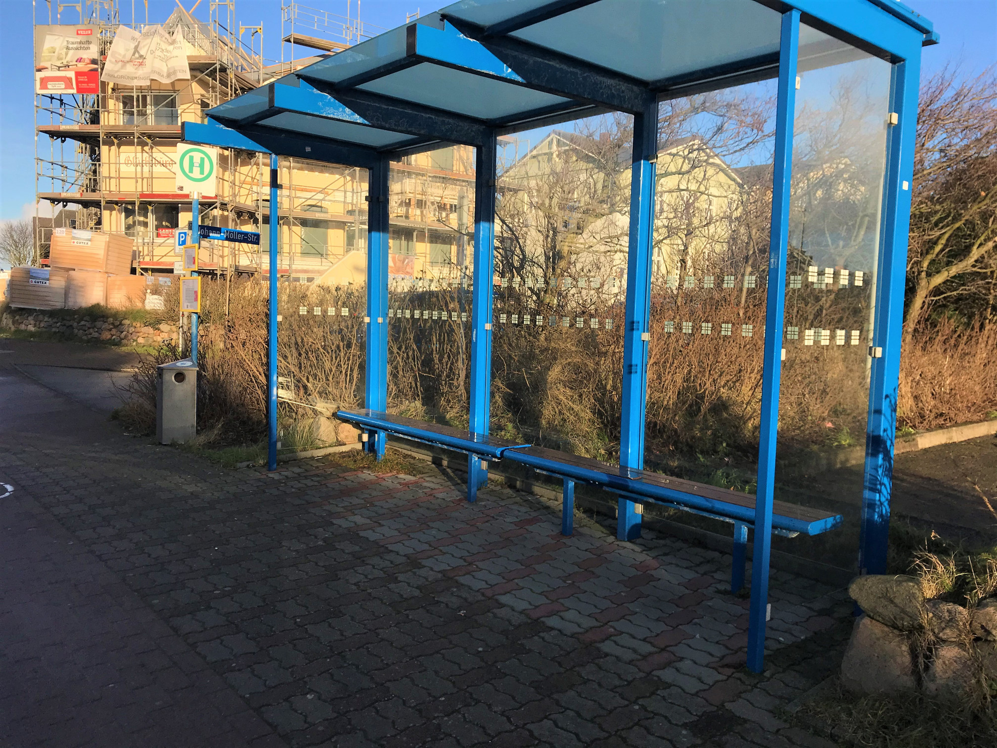
They most often are not buildings. The building=roof tag only serves to get the area rendered. Most of highway=platform belong to the same. This was invented for rail where it makes sense and gets used for stretches of sidewalk.
That is exactly my point. building=* tag in OSM is used for tagging not only objects which you’d find in English dictionary under “building” (i.e. places intended for human occupancy), but quite a few somewhat related things.
Many shelters would not called “buildings” in English, yet they are tagged with building=* tag, in the same way as many things which are nothighways (not even close!) are tagged with highway=* tag (like highway=via_ferrata or highway=street_lamp or elevator).
So yeah: building=* tag does not really mean “building” (as in English dictionary). Never has.
Neither is vast majority of other OSM tags pure enough so there is 1:1 match with OSM tag and English dictionary.
Thus voting “how many buildings on this picture” is somewhat disingenuous. Should’ve asked how many of those might be tagged with building=* tag in OSM instead (as this thread is about OSM tagging, not about English language etymology; that class is two doors to the left! )
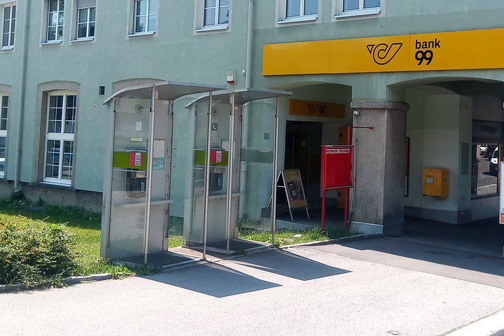
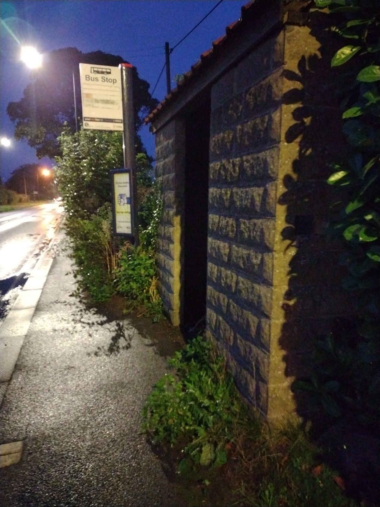
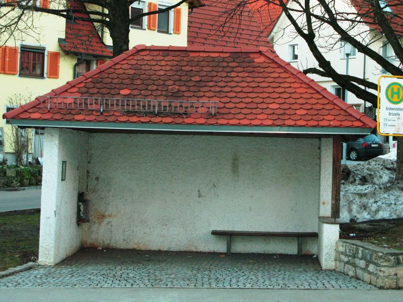
There’s no door or windows here, but otherwise you might think of it as a very solid building. I’ve not mapped it as one (just as a bus stop with a shelter), but I could understand why someone might map it as a building.
If you ask me: The building tag solely serves to make OSM-Carto render the area. It betrays on everything else: Where do you enter the building? Does it have an inside/outside? Can you cross it at will in any direction? The PT mappers are painters.
PS: Only one in nine talkers voters in the improvised poll above did consider a phone booth a building, I guess I know who