Hello All. ![]()
I think everyone has heard about OpenAerialMap.org. For various reasons, it is not very convenient to use. I know, that many OSM contributors still use it, though.
There are good news. Using of OpenAerialMap should become more convenient now.
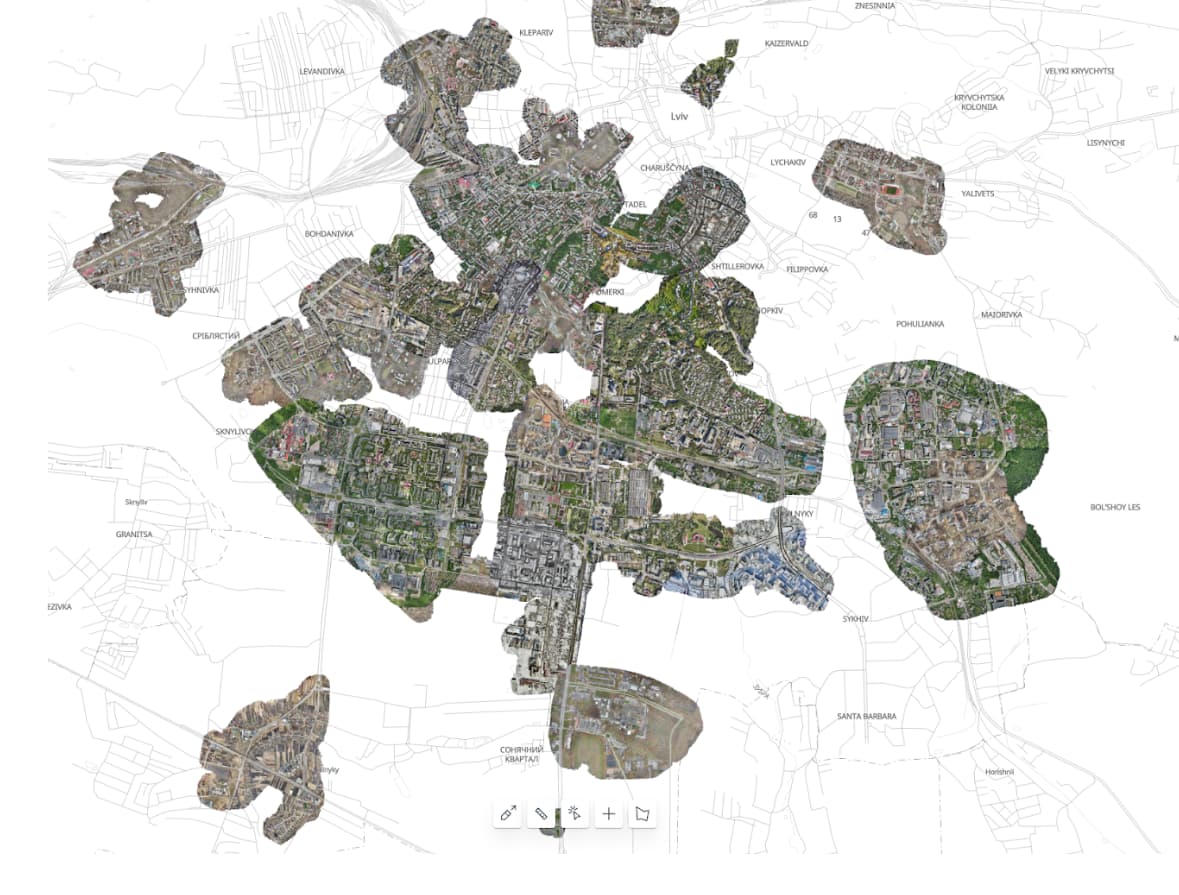
We have created a mosaic TMS layer with all available individual images visible at once (all-in-one, yes ![]() ). If those images do not overlap, of course
). If those images do not overlap, of course ![]()
The OAM mosaic layer should be most useful in areas where OAM already has some coverage, and individual images actually form a mosaic. However, even if there are just two or three images side by side, it should also be useful.
Here is TMS link:
https://apps.kontur.io/raster-tiler/oam/mosaic/{zoom}/{x}/{y}.png
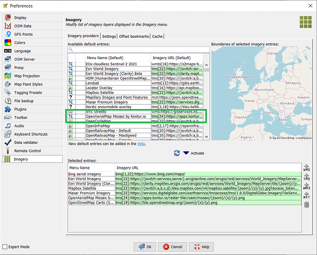
The layer is already available in JOSM, in the list of available global satellite images.
This layer is not yet available in iD, because Editor Layer Index (i.e. the base from which the ID takes a list of satellite layers) maintainers are still considering whether to accept my pull request or not.
(I will not post a link to the pull request, whoever needs it will find it himself ![]() )
)
There are also layer with marker clusters on Disaster Ninja, to find available imagery in a bit more easy way.
Comments, suggestions, bug reports are welcome.
There are some known issues, mostly linked to the quality of source OAM images (black borders), mixture of different image types (photo and DEM). We are working on that ![]()