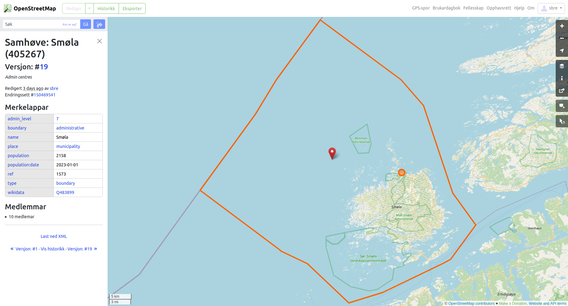
In Norway, maritime areas are included in municipality boundaries. This sometimes causes the centroid of the boundary to be considerably off from where people consider the municipality to be located. Example: Smøla municipality r405267
Centroid in red, boundary and admin_centre in orange.
To capture the fuzziness of human understanding, one would add a role:label member of the relation, or as the wiki puts it “When placing the node, consider where you would map the place as a point feature if the boundary were unknown or ill-defined.”.
I would put the node approximately where the black label (which is the name for the main island, shared with the municipality) is in the image, but how should it be tagged? I see quite a lot of variation in use, with a fair amount of tag duplication.
Like the idea in concept were but it needs selling to the ones who render the maps, our house reference Carto Standard e.g. Case in point, got a 500 square km national park the ‘centre’ so happens to fall practically direct on the municipality admin node. Not any zoom is the name ever shown. Even when adding the ‘admin centre’ of the park, just few hundred meters away, it had no effect. Just a coincidental render conflict. That all said, the park name does show up in small print along park boundary sections, so if one wants to know, zoom in.
T’is though you like it in one place and next mapper likes it in the natural centre of the bordered area so it needs hard agreed guidance of where is proper.
one could check for land inside the boundary and put the label on the centroid of the landpolygon that has the biggest settlement inside, and if there is more than one, choose the biggest polygon.