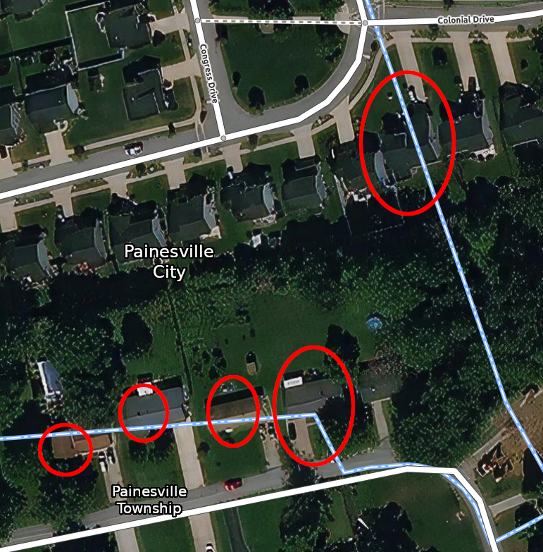
I went surveying yesterday, and there are a couple of addresses/lots/buildings that straddle a particular administrative boundary. I’m not sure what the proper value to assign to “addr:city”
I don’t think that’s really a qualifying “thing” as people here rarely differentiate between “township” and “city” for any other reason than status (some view living in the township as being higher “class” than living in the city proper)
Regardless…either could claim “Painesville” (without the township/city specification) and still, for example, receive their mail or have guests find their home just as easily
Yes, the Royal Mail (UK postal delivery system) codes individual addresses as “delivery points” which are the actual geolocation of the letter box (or equivalent). In the US where most deliveries will be kerb-side mailboxes I wouldn’t be surprised if something similar doesn’t hold. But, also, as I’ve said on IRC I would not be surprised here if “Painesville” is not used for all properties.