I’ve rerun the stats and regenerated the “static” data files to omit GWR entries with no house numbers and further as a follow up to Address and Street Data Updates - #6 by SimonPoole I’ve added GWR “class” 1252 to the list of criteria for ancillary buildings that are not expected to have a real address. The net result is that we gained ~3% of coverage.
1 Like
Thank you!
There are still addresses without house numbers in the dataset, as seen in this example.
Gebäudestatus 1004 bestehend Gebäudekategorie 1060 Ohne Wohnnutzung Gebäudeklasse 1274 Sonstiger Hochbau
Need to check that. Note that I only use the category and class to filter out entries that have proper house numbers (aka without a dot in them) but are not actually “real”, so anything that doesn’t have a number shouldn’t turn up to start with.
Ah the issue is simply that I currently don’t remove these from the files with complete data (fsvo) but only from the stats and the daily generated files.
Apologies if I misunderstood, but the example mentioned above is included in the daily generated file (O).
-
Primarily in Graubünden and Valais, numerous/all addresses in specific municipalities have been incorrectly flagged as “not in GWR” in the warnings file since approximately December 19.
-
The map displays older municipal boundaries, which are not congruent with the table, a fact you are likely already aware of.
The only relevant change on that date was that I started ignoring addresses with the official address flag set to false (this is in line with the original stats prior to the change of the data source). This likely needs closer inspection.
Borders the stats use a static set of boundary polygons to avoid breaking if someone changes something in the ‘live’ data, the map on the other hand does use the regular data and might be picking up some historic boundaries depending on how they were retagged.
I checked a random example and yes the relevant flag is false even though the address is clearly valid, see Federal Register of Buildings and Dwellings: building status If this is limited to GR and VS I’ll simply change the queries to allow non-official addresses in those cantons (which creates an issue the other way around but that is probably preferable).
The map issue should be fixed now, as suspected there was a handful of old boundary polygons that matched the query and could cause a visual issue.
1 Like
In some municipalities, where I conflated from GWR, the table shows indeed a lot of “non GWR” errors (Troistorrents for instance).
Yes this seems to be, as mentioned above, an issue in VS and GR. It is a bit of a pain as the relevant flag is supposed to be mandatory and an easy way to check for proper addresses, but I’ll disable the check for Valais and Graubünden for now (just needed to get home, so that I can work on it in my regular dev environment).
I’ve addressed the issue now by simply determining on a municipality by municipality base if there are any validated addresses (aka ones with doffadr set to true) present, and if there are none, not removing such addresses from the count.
This seems to work reasonably well and will as more municipalities get around to automatically correct itself. The canton Berne has a lot of addresses in this category too, which however is more likely simply a consequence of the how we did the import there and nothing that needs fixing.
Further I’ve separated out the count of such addresses when I find a matching address in OSM.
I would note that these are named “warnings” on purpose, they many be indicative of a real issue or not.
PS> I haven-t updated the “full” extracts yet.
1 Like
Thanks a lot. You are right, the nuance is important and your tool so useful.
Just a heads up: Michael and myself have just finished updating the municipality borders, these changes wont be reflected in the data till I reimport from the BfS (and the BfS has actually changed their data to reflect the mergers).
1 Like
Seems as if the BfS has already changed the references in the database, I might get around to updating the data over the weekend.
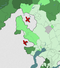
Bad news: the Ticino issue is still not fixed in the GWR it seems, even though it should have supposedly been done by the end of 24.
Thanks for the updates!
I believe you’re referring to the address node positioned at the centroid of a building, rather than the absence of municipalities on your map. Is that correct?
Municipal mergers are not yet reflected in the list (e.g., Ponthaux, La Tène, Tschiertschen-Praden, …).
I haven’t updated the data yet so it isn’t a surprise that the mergers are not reflected yet.
The issue with Lavizzara and Onsernone is purely a visual one, the GWR doesn’t contain any valid addresses for those municipalities (one would hope that is fixed together with the other issues in TI) and that causes nothing to be rendered, which, because they are on the border, simply looks a bit weird.
1 Like
I updated the data yesterday. There are still some glitches with the new municipalities that I need to investigate, but they are likely really just the data not being updated for the relevant areas in the GWR (aka the address data likely still references the old BfS municipality number).
Ticino still seems to have the same issues as before, I’ll look at a fix for that asap.
1 Like