I’ve encountered a sign on a path in England that I don’ think I’ve encountered before and I’m not sure of the access implications for the way.
Main text:
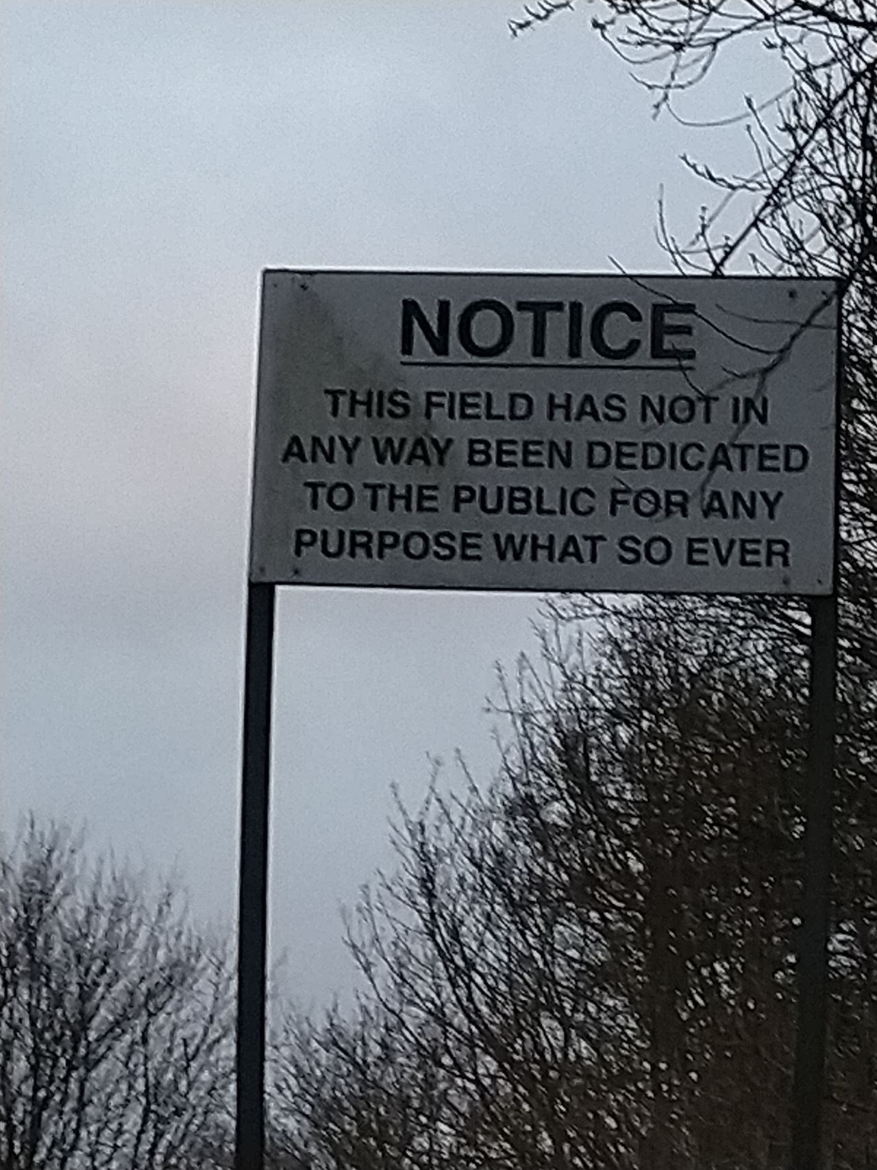
Section 31 (3) Highways Act 1980
I hereby give notice that this way has not been dedicated as a footpath or other highway nor is there any intention to dedicate it.
I’m no lawyer (I think they call them barristers there, right?) but the second paragraph about the 20 year right of way making it effectively public seems like this would be de facto public. Curious what other British locals would say. @SomeoneElse can you or any locals provide some insight on how these signs should be mapped?
I’d suggest using the Public Rights of Way tiles in your editor of choice to verify PRoW status as and when there’s no on-the-ground signage indicating a PRoW.
The short answer is no, the way should be tagged to suit its current use. The real reason for these notices is to place an end date on the 20-year rule for claiming a Public Right of Way. You can claim a path to be a PRoW by showing evidence of its public over a 20-year period, (it does not have to be 20 consecutive years of use). The not-for-dedication notice is in order for the landowner to cap the end date of the 20 years as the date of the notice being erected.
The notice does not mean that the way is not a public way, merely that the landowner only, does not recognize the way is public as of the date of erection of the notice. PRoWs have been successfully claimed on ways where the notice has been placed, with the 20 years of use being before the notice erection date.
Here is one I made earlier. That corresponds to this location.
What I suspect the story is here is that Rowntree’s (since bought by Nestle) used to own this land. It had sports pitches on part of it, and was used by the public as a recreation ground. The signs date from that period. Since then, most (or all?) of this land is now part of St John’s University, but the signs remain. I suspect that the purpose is exactly as @BCNorwich says - to prevent an “inadvertent” right of way being established. If some was able to prove it was in fact a legal right of way (perhaps they could demonstrate usage before the signs were put up) then yes, it might be possible to be designated as a legal right of way, and if that was to happen, “foot=yes” would be appropriate. However, in the absence of that, and based on on the evidence of the sign only, as @Richard said, “foot=permissive” is the correct choice.
Edit: This sort of shenanigans applies to England and Wales only; Scotland has different rules. Northern Ireland’s rules I believe are similar to England’s (see here), but I’ve no idea if they have legislation that would prompt similar signs.
From what I can tell on the Council’s website the conversion of the old railway into a cycle path happened in '84, but that predates the online system so no documents are online to indicate whether this ‘sliproad’ was part of the original conversion or what signs were meant to be put up where when that happened. (Not that their copyrighted maps would be permissible for OSM even if they were online.)
I’ve updated the access path to permissive for foot and cycle access. I haven’t expanded these tags to the overall route as it seems odd that they’d reserve the right to close this given all the publicity unless they think they might want to revert to it having some sort of public transport on it at some point.