Came across a double digit layer value, at near 13 million uses there were bound to get stranger values in and they did. Seeking one out, there’s quite a few parts that have odd double digit layer values, let’s say ‘deviating from the normal’, in whole and even with decimals values.
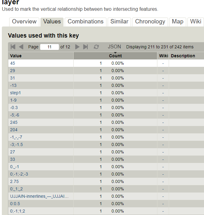
Visiting TagInfo a snapshot produced the below clearly explaining the function.
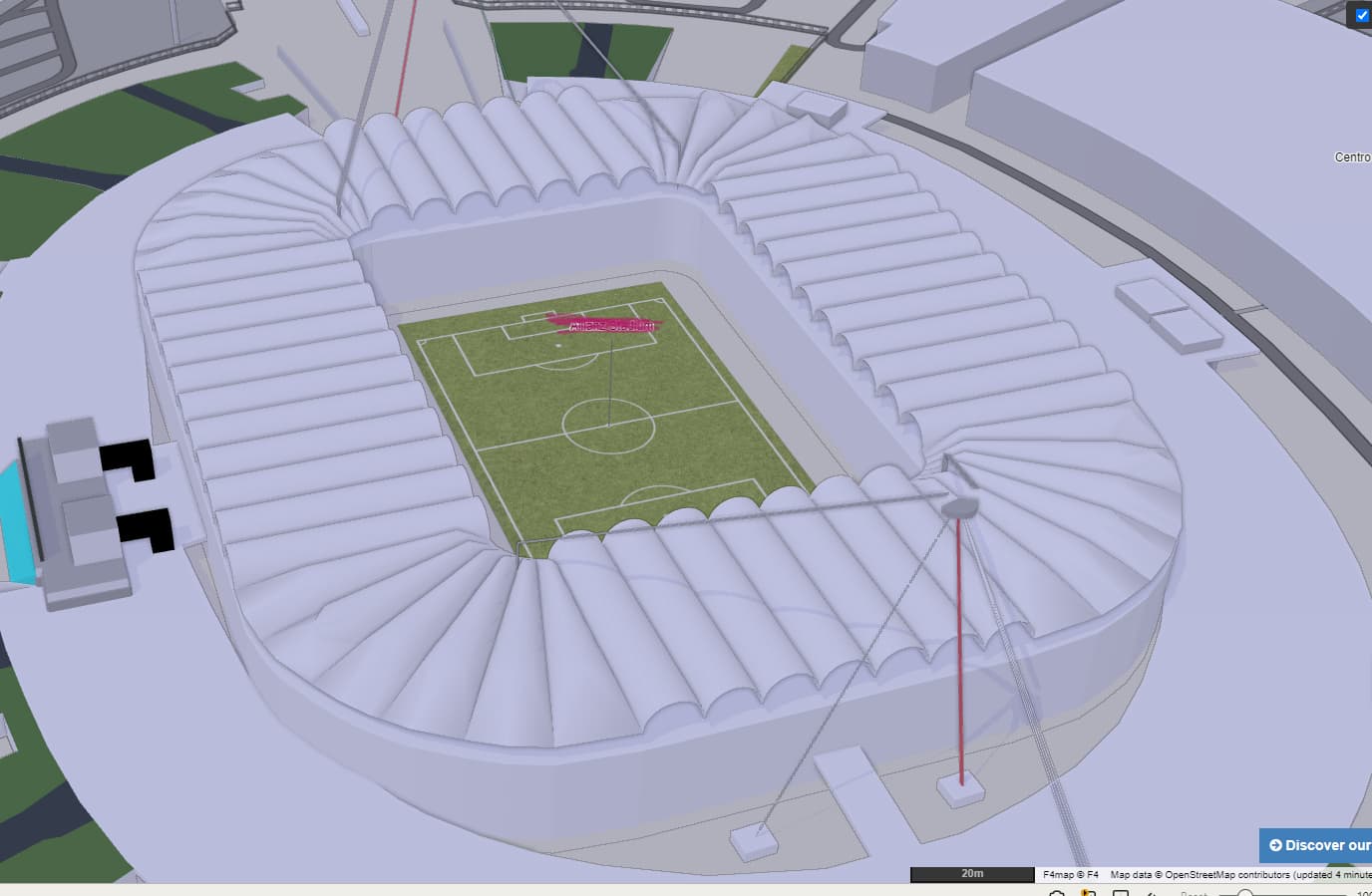
The question is, is this some workaround maybe to serve a particular renderer? One building using a bunch of these looks exceptionally well mapped, possibly program/import assisted, some parts tagged as building to somehow (I suspect) convince 1 or more 3D renderers that suspension cables and trusses are to be shown too, but am only a beginner in this discipline.
A F4Demo snap shot of the stadium where a bunch of these high valued layer tags were used. How high up the ski boxes in there are, don’t know, but whatever the tags do, it looks great but for the absent space below the roofs. Note the support pylon and suspension depiction.
It seems like they are just repeating the height=* value in the layer=* value. The stadium is now full of buildings, imho they should be at least building:part=*.
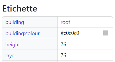
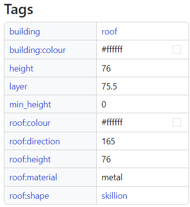
As the saying goes, the exception proves the rule, with layer 75.5 v height of 76, suspecting the layer value could be used as a min_height kind of value, but then there’s also min_height=0.
Think I’ll write the gentleman since on one stadium he does (replicate object tagging method maybe?) and on the other doesn’t.